- Usage in publication:
-
- Carpenter Ridge Tuff*
- Modifications:
-
- Named
- Dominant lithology:
-
- Tuff
- AAPG geologic province:
-
- Paradox basin
- Piceance basin
Summary:
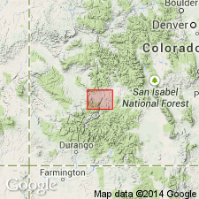
Named for exposures on Carpenter Ridge, its type area, in Cebolla quad, Gunnison Co, CO in Piceance basin. Formerly called Piedra Rhyolite (Larsen and Cross, 1956). Is preserved locally. Mapped at west edge of area into Montrose Co in Paradox basin, as well as east and south of its type area. Consists of two ash flows, some water-laid tuff, and tuffaceous gravel. Devitrified tuff which makes up most of Carpenter Ridge is reddish-brown to light gray. The groundmass is welded ash and pumice. Is 240 ft thick in its type area, but ranges from 170 ft to 200 ft thick in southern part of area, from 200 ft to 230 ft thick in central part of area, and 200 ft to 280 ft thick in north part of area. Overlies Fish Canyon Tuff (new unit); underlies Hinsdale Formation. Assigned a late Oligocene age.
Source: GNU records (USGS DDS-6; Denver GNULEX).
- Usage in publication:
-
- Carpenter Ridge Tuff*
- Modifications:
-
- Revised
- Geochronologic dating
- AAPG geologic province:
-
- San Juan Mountains province
Summary:
Is a crystal-poor rhyolite less than 26.7 m.y. (K-Ar) or late Oligocene age, with reverse magnetic polarity, an estimated initial volume of 1,200-1,500 cubic km that was derived from the Bachelor caldera. Is younger than Crystal Lake Tuff (new). Known in the San Juan Mountain province.
Source: GNU records (USGS DDS-6; Denver GNULEX).
- Usage in publication:
-
- Carpenter Ridge Tuff*
- Modifications:
-
- Revised
- AAPG geologic province:
-
- San Juan Mountains province
Summary:
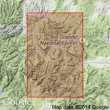
Pg. A8-A9, A78-A79. Carpenter Ridge Tuff. Spread over about the same area as Fish Canyon Tuff (about 15,000 sq km), but is less than half as voluminous. Derived from the Bachelor caldera in the central part of the San Juan volcanic field (San Juan province). Nearly all rocks assigned to this unit are crystal-poor rhyolites. Includes (in ascending order) unnamed outflow member and Bachelor Mountain Member (revised). Bachelor Mountain includes (in ascending order) Willow Creek, Campbell Mountain, and Windy Gulch Beds (all 3 revised). Overlies Fish Canyon Tuff; underlies Mammoth Mountain Tuff. Age is intermediate between 27.8 m.y., determined for the older Fish Canyon Tuff, and 26.7 m.y., for the younger Mammoth Mountain Tuff (citing Lipman and others, 1970, GSA Bull., v. 81, no. 8, p. 2340).
Source: Publication.
- Usage in publication:
-
- Carpenter Ridge Tuff*
- Modifications:
-
- Areal extent
- Overview
- AAPG geologic province:
-
- San Juan basin
- San Luis basin
- San Juan Mountains province
- Paradox basin
- Piceance basin
Summary:
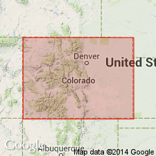
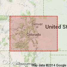
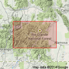
Areal extent of Carpenter Ridge Tuff in southwestern Colorado shown on distribution map; present in Archuleta County (San Juan basin), Conejos, Rio Grande, and Saguache Counties (San Luis basin), Mineral and Hinsdale Counties (San Juan Mountain province), Montrose County (Paradox basin), and Gunnison County (Piceance basin).
Source: Modified from GNU records (USGS DDS-6; Denver GNULEX).
- Usage in publication:
-
- Carpenter Ridge Tuff*
- Modifications:
-
- Geochronologic dating
- Overview
- AAPG geologic province:
-
- San Juan Mountains province
Summary:
Is ash-flow sheet associated with Bachelor caldera in central San Juan Mountains of Colorado (San Juan Mountain province). High-resolution 40/39 Ar geochronology (unpublished data, M. Lanphere, USGS) yields age of 27.35 Ma [late Oligocene].
Source: GNU records (USGS DDS-6; Denver GNULEX).
- Usage in publication:
-
- Carpenter Ridge Tuff*
- Modifications:
-
- Revised
- AAPG geologic province:
-
- San Juan Mountains province
Summary:
Revised to include Mammoth Mountain unit (revised to informal status) in upper part; in lower part, Bachelor Mountain Member is revised in that, in ascending order, Willow Creek, Campbell Mountain and Windy Gulch are relegated to informal zones within Bachelor Mountain. Restudy of Creede area, Mineral Co, CO, San Juan Mountain province, has shown that previously mapped boundary between Mammoth Mountain and Bachelor Mountain Member of Carpenter Ridge is an alteration boundary that lacks evidence for major cooling break. Willow Creek, Campbell Mountain and Windy Gulch represent upward sequence of progressively less welded zones within thick rhyolitic fill of Bachelor caldera. Carpenter Ridge further revised in that Outlet Tunnel, Phoenix Park and Shallow Creek are assigned to Carpenter Ridge as informal units; these are now interpreted to be three generally equivalent local breccias derived from wall of Bachelor caldera during its subsidence. Outlet Tunnel is landslide and talus breccia composed of Fish Canyon Tuff; Phoenix Park was derived from northeast wall of caldera; and Shallow Creek was derived from southwest wall of caldera. Younger than Fish Canyon Tuff; older than Wason Park Tuff. Carpenter Ridge was derived from Bachelor caldera and has been dated at 27.35 Ma (Oligocene).
Source: GNU records (USGS DDS-6; Denver GNULEX).
For more information, please contact Nancy Stamm, Geologic Names Committee Secretary.
Asterisk (*) indicates published by U.S. Geological Survey authors.
"No current usage" (†) implies that a name has been abandoned or has fallen into disuse. Former usage and, if known, replacement name given in parentheses ( ).
Slash (/) indicates name conflicts with nomenclatural guidelines (CSN, 1933; ACSN, 1961, 1970; NACSN, 1983, 2005, 2021). May be explained within brackets ([ ]).

