

- Usage in publication:
-
- "Canyon Creek" Member
- Modifications:
-
- Original reference
- Dominant lithology:
-
- Sandstone
- AAPG geologic province:
-
- Green River basin
Summary:
Pg. 105, pl. 2; 1965, Wyoming Geol. Assoc. Gdbk., no. 19, p. 18. "Canyon Creek" Member of Ericson (Iles) Formation. Name suggested for upper part of Ericson (Iles) Formation. Overlies "Rusty Zone" of Ericson (Iles) Formation. Name has been in common use by oil company geologists and others that have interests in Vermillion basin. Age is Late Cretaceous.
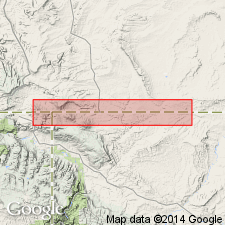
Occurs in Mountain Fuel Supply Company's Canyon Creek Field, [in T. 12 N., R. 101 W., Scrivner Butte 7.5-min quadrangle, Sweetwater Co., southernmost WY].
[Smith's 1961 paper (cited in GNU records, USGS DDS-6, Denver GNULEX) is nearly identical to Smith's 1965 paper (cited in USGS Bull. 1350). Misprint (USGS Bull. 1350, p. 118): Canyon Creek Field is in Sweetwater Co., southern WY, not Moffat Co., northwestern CO.]
Source: Publication; US geologic names lexicon (USGS Bull. 1350, p. 118).
- Usage in publication:
-
- /Canyon Creek Zone
- Modifications:
-
- Revised
- AAPG geologic province:
-
- Green River basin
Summary:
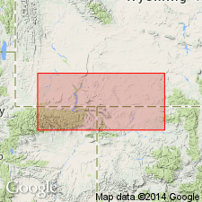
Is unranked upper fluviatile unit in the Ericson Formation of Mesaverde Group in the Rock Springs uplift area in the Greater Green River basin, southwestern WY. Rank changed from member to zone. [No explanation given for redefinition. Deemed inappropriate (GNU records, USGS DDS-6).] Overlies middle unit (Rusty Zone) of Ericson. Underlies Almond Formation. Age is Late Cretaceous. [The term "zone" as misapplied to this lithostratigraphic unit has proliferated in subsequent published reports by Roehler and others, usually citing Smith (1961) as the source. However, Smith actually ranked the unit as a member (GNU records, USGS DDS-6).]
Source: GNU records (USGS DDS-6; Denver GNULEX).
- Usage in publication:
-
- Canyon Creek Member*
- Modifications:
-
- Areal extent
- AAPG geologic province:
-
- Green River basin
Summary:
Is upper member of Ericson Sandstone of Mesaverde Group in Washakie basin, Sweetwater Co, WY and northwest part of Sand Wash basin, Moffat Co, CO (both basins part of Greater Green River basin). Coastal-plain fluvial deposits correlated from outcrop near Rock Springs, WY and southeast into subsurface of Washakie and Sand Wash basins on basis of electric-log correlations. Areally extended in subsurface as far as gas well (station 5, sec. 33, T. 12 N., R. 97 W.) in Moffat Co, CO. Unconformably overlies delta-plain deposits of Rusty zone (Roehler, 1965) [middle member] of Ericson. Underlies Almond Formation of Mesaverde. Is shown locally equivalent to Pine Ridge Sandstone of Mesaverde and correlative with lower part of Williams Fork Formation of Mesaverde. Late Cretaceous age.
Source: GNU records (USGS DDS-6; Denver GNULEX).
For more information, please contact Nancy Stamm, Geologic Names Committee Secretary.
Asterisk (*) indicates published by U.S. Geological Survey authors.
"No current usage" (†) implies that a name has been abandoned or has fallen into disuse. Former usage and, if known, replacement name given in parentheses ( ).
Slash (/) indicates name conflicts with nomenclatural guidelines (CSN, 1933; ACSN, 1961, 1970; NACSN, 1983, 2005, 2021). May be explained within brackets ([ ]).