The National Geologic Map Database is migrating to a new infrastructure. We apologize for any service disruptions during this process.
|
|---|


- Usage in publication:
-
- Campito sandstone*
- Modifications:
-
- Original reference
- Dominant lithology:
-
- Sandstone
- AAPG geologic province:
-
- Great Basin province
Summary:
Campito sandstone. Chiefly sandstone, which on fresh fracture is dense fine-grained grayish rock with conspicuous fine dark lines that indicate highly complex cross bedding. Weathers reddish brown to dark purplish red. Associated with this sandstone are some bands of very dense lighter colored quartzitic sandstone separated by thin layers of siliceous slate, which occur as partings in the dense sandstone. Upper third of formation is somewhat more slaty and includes zones curiously speckled by ferric oxide. Remarkable cross-bedding at several horizons. Rests unconformably on Deep Spring formation and appears to grade into overlying closely related Silver Peak group, the upper limit of the Campito being placed at lowest horizon at which fissile calcareous shales and fairly pure masses of limestone appear. Thickness of formation 3,200 feet. Age is Early Cambrian.
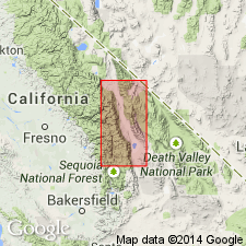
Named from prominent exposures on Campito Mountain, [Inyo Mountains], eastern CA.
Source: US geologic names lexicon (USGS Bull. 896, p. 327).
- Usage in publication:
-
- Campito Formation
- Modifications:
-
- Revised
- Redefined
- Age modified
- AAPG geologic province:
-
- Great Basin province
Summary:
Pg. 140 (fig. 2), 141, 143. Campito Formation. The Campito Sandstone of Kirk (IN Adolph Knopf, 1918, USGS Prof. Paper 110) is redefined and confined to detrital rocks. Not clear from Kirk's discussion where he considered top of the Campito to be. Some beds of what are called here the upper member [Montenegro] of the Campito may have been included in Kirk's overlying †Silver Peak Group (abandoned). Campito Formation subdivided into (descending): Montenegro Member (new), gray shale and interbedded fine-grained quartzitic siltstone and sandstone, [about 1,000 feet thick]; and Andrews Mountain Member (new), massive dark-gray to black quartzitic sandstone and interbedded gray siltstone and shale, about 2,500 to 2,800 feet thick. Contact between members drawn at horizon above which no thick beds of quartzitic sandstone occur. Total thickness about 3,500 feet. Fossils. Carries olenellids and archaeocyathids in middle and upper parts. Overlies Deep Spring Formation; underlies Poleta Formation (new). Age is considered Precambrian(?) to Early Cambrian.
[GNC remark (US Geologic Names Committee unpub. changes to geologic nomenclature, January 1, 1962-June 30, 1962, p. 23): This definition of Campito Formation adopted by the USGS.]
[See also C.A. Nelson, 1966a, Geol. map Waucoba Mountain quadrangle, CA, USGS Geol. Quad. Map GQ-528, 1 sheet, scale 1:62,500; C.A. Nelson, 1966b, Geol. map Blanco Mountain quadrangle, CA, USGS Geol. Quad. Map GQ-529, 1 sheet, scale 1:62,500.]
Source: Publication; GNU records (USGS DDS-6; Menlo GNULEX); GNC changes in geologic nomenclature, unpub., Jan. 1, 1962-June 30, 1962, p. 23.
- Usage in publication:
-
- Campito Formation*
- Modifications:
-
- Age modified
- AAPG geologic province:
-
- Great Basin province
Summary:
Campito Formation is Precambrian(?) and Early Cambrian.
Source: GNU records (USGS DDS-6; Menlo GNULEX).
- Usage in publication:
-
- Campito Formation*
- Modifications:
-
- Age modified
- AAPG geologic province:
-
- Great Basin province
Summary:
Age of the Campito Formation is Early Cambrian.
Source: GNU records (USGS DDS-6; Menlo GNULEX).
For more information, please contact Nancy Stamm, Geologic Names Committee Secretary.
Asterisk (*) indicates published by U.S. Geological Survey authors.
"No current usage" (†) implies that a name has been abandoned or has fallen into disuse. Former usage and, if known, replacement name given in parentheses ( ).
Slash (/) indicates name conflicts with nomenclatural guidelines (CSN, 1933; ACSN, 1961, 1970; NACSN, 1983, 2005, 2021). May be explained within brackets ([ ]).