The National Geologic Map Database is migrating to a new infrastructure. We apologize for any service disruptions during this process.
|
|---|


- Usage in publication:
-
- Campbell Creek limestone*
- Modifications:
-
- Original reference
- Dominant lithology:
-
- Limestone
- AAPG geologic province:
-
- Appalachian basin
Summary:
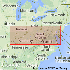
Campbell Creek limestone. Layer of impure limestone with cone-in-cone structure. Thickness 1 foot. Makes its first appearance along Campbell Creek [Kanawha? County], West Virginia. May represent Johnstown cement bed of Pennsylvania, since according to my identification of the coals it occurs at the right geological horizon for that bed. Lies 50 feet below Middle Kittanning (Cedar Grove) coal and 20 to 40 feet above Lower Kittanning (Campbell Creek) coal. Age is Pennsylvanian (Lower Coal Measures). [Later studies showed that Cedar Grove coal is much older than Middle Kittanning coal, and that Campbell Creek limestone is a member of Kanawha formation, lying 0 to 20 above Campbell Creek coal and 0 to 5 feet below Lower Monitor sandstone of West Virginia Geol. Survey.]
Source: Publication; US geologic names lexicon (USGS Bull. 896, p. 325).
- Usage in publication:
-
- Campbell Creek Limestone
- Modifications:
-
- Revised
- AAPG geologic province:
-
- Appalachian basin
Summary:
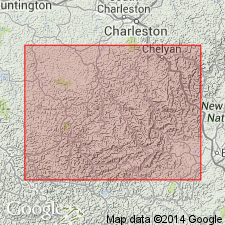
Campbell Creek Limestone of White (1885) was named for exposures along Campbell Creek near its confluence with Kanawha River, Kanawha Co., about 4 mi southeast of Charleston, WV. Reconnaissance mapping indicates that Campbell Creek Limestone underlies Williamson coal bed (zone) and is equivalent to fossiliferous beds named Seth Limestone by Krebs and Teets (1915) for exposures near Seth, Boone Co., WV. Authors have identified this unit from scattered localities in southern WV. Fossil data is sporadic. U.S. Geological Survey Geologic Quadrangle Maps indicate that shales containing limestone concretions and local marine or brackish-water fossils occur at same horizon as Campbell Creek Limestone of White (1885). This unit is identified as Elkins Fork Shale of Morse (1931) in KY. Although Campbell Creek Limestone of White (1885) contains some fossils, it is not considered regionally mappable because it is discontinuous. Therefore, the unit is given informal status as a member of Kanawha Formation in WV.
Source: GNU records (USGS DDS-6; Reston GNULEX).
- Usage in publication:
-
- Campbell Creek Limestone
- Modifications:
-
- Areal extent
- AAPG geologic province:
-
- Appalachian basin
Summary:
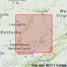
Interval in eastern KY, incorrectly correlated with the Campbell Creek Limestone of White (1885) by various workers is here named the Crummies Member of the Breathitt Formation.
Source: GNU records (USGS DDS-6; Reston GNULEX).

- Usage in publication:
-
- Campbell Creek limestone
- Modifications:
-
- Overview
- Areal extent
- AAPG geologic province:
-
- Appalachian basin
Summary:
Used informally in WV. Described as a slightly fossiliferous calcareous dark shale having limestone concretions and lenses, 30 to 40 ft (9 to 12 m) above Campbell Creek coal in the Kanawha Formation. Unit is between Williamson (above) and Peerless coals in WV but is stratigraphically misplaced as a marine unit above Eagle, Pond Creek, or Lower Elkhorn coals in many geologic reports concerning southern WV and adjacent parts of KY and VA . Probably equivalent to Elkins Fork shale of Morse (1931) in KY.
Source: GNU records (USGS DDS-6; Reston GNULEX).
For more information, please contact Nancy Stamm, Geologic Names Committee Secretary.
Asterisk (*) indicates published by U.S. Geological Survey authors.
"No current usage" (†) implies that a name has been abandoned or has fallen into disuse. Former usage and, if known, replacement name given in parentheses ( ).
Slash (/) indicates name conflicts with nomenclatural guidelines (CSN, 1933; ACSN, 1961, 1970; NACSN, 1983, 2005, 2021). May be explained within brackets ([ ]).