

- Usage in publication:
-
- Caddy Canyon Quartzite*
- Modifications:
-
- Original reference
- Dominant lithology:
-
- Quartzite
- AAPG geologic province:
-
- Northern Rocky Mountain region
- Snake River basin
Summary:
Pg. 585-586, 591. Caddy Canyon Quartzite. Consists of: (1) lower part, white- to tan-weathering vitreous orthoquartzite with some interbedded greenish argillite and siltite; (2) middle part, dolomite or limestone; and (3) upper part, pinkish, purple or maroon quartzite and argillite. Total thickness at type section 910 m [approx. 3,000 feet]. Conformably overlies Papoose Creek Formation (new). Underlies greenish phyllite of Inkom Formation (new). Age is late Precambrian (Precambrian Z). (Caddy Canyon Quartzite adopted by the USGS.)
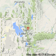
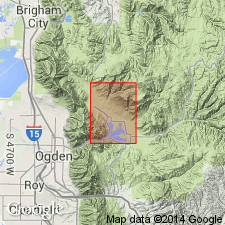
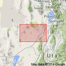
Type section: in Caddy Canyon, north of Portneuf River, about 8 mi (13 km) southeast of Pocatello, in sec. 13, T. 7 S., R. 35 E., and sec. 18, T. 7 S., R. 36 E., Bannock Co., ID. (Possibly extends into Huntsville area, Weber Co., northern UT.)
Source: GNU records (USGS DDS-6; Denver GNULEX, Menlo GNULEX); US geologic names lexicon (USGS Bull. 1520, p. 45-46); Changes in stratigraphic nomenclature, 1971 (USGS Bull. 1372-A, p. A4-A5).
- Usage in publication:
-
- Caddy Canyon Quartzite*
- Modifications:
-
- Revised
- Areal extent
- AAPG geologic province:
-
- Wasatch uplift
Summary:
In report area, Caddy Canyon Quartzite is assigned to the Brigham Group.
Source: GNU records (USGS DDS-6; Menlo GNULEX).
- Usage in publication:
-
- Caddy Canyon Quartzite
- Modifications:
-
- Areal extent
- Revised
- AAPG geologic province:
-
- Great Basin region
Summary:
Caddy Canyon Quartzite. Extended into the Sheeprock Mountains of north-central Utah (Great Basin region) as the basal formation (of 4) of the Brigham Group. Consists of white, gray, brown, fine- to medium-grained quartzite that has some olive-drab to liver-colored siltstone and very fine-grained quartzite beds. At one locality, includes several hundred meters of purple-brown intraformational conglomerate near base. Thickness 700 to 2,000 m. Much of outcrop area mapped as Caddy Canyon (this report) = Mutual Formation mapped by Cohenour (1959). Disconformably to transitionally overlies Kelley Canyon Formation, newly assigned to the Sheeprock Group (rank raised); conformably underlies Inkom Formation of the Brigham Group. Age is Late Proterozoic. Report includes geologic map, stratigraphic sections.
Source: Modified from GNU records (USGS DDS-6; Denver GNULEX).
- Usage in publication:
-
- Caddy Canyon Quartzite*
- Modifications:
-
- Age modified
- Areal extent
- AAPG geologic province:
-
- Great Basin province
Summary:
Caddy Canyon Quartzite present in Pine Grove-Blawn Mountain area, Beaver County, Utah. Age is Proterozoic Z.
Source: GNU records (USGS DDS-6; Menlo GNULEX).
- Usage in publication:
-
- Caddy Canyon Quartzite
- Modifications:
-
- Revised
- AAPG geologic province:
-
- Northern Rocky Mountain region
Summary:
Assigned as 1 of 6 formations to the Brigham Group (extended as group rank in ID) in the northern Bannock and Portneuf Ranges, and as 1 of 7 formations in the southern Portneuf and Bear River Ranges, Bannock and Bear Lake Cos, ID in the Northern Rocky Mountain region. Gradationally overlies Papoose Creek Formation, newly assigned as the basal formation of the Brigham of ID. Thickness of formation reported for type section was 6,560 ft; authors believe type includes a fault and thickness of formation is 4,020 ft. Divided into 4 members--lower, carbonate, middle, upper. Lower 3 members are part of depositional sequence 1--the tidal flat and subtidal deposits. The upper member is part of depositional sequence 2--an offshore deposit. Upper contact gradational with Inkom Formation of Brigham Group. Of Late Proterozoic age. Cross section.
Source: GNU records (USGS DDS-6; Denver GNULEX).
- Usage in publication:
-
- Caddy Canyon Quartzite*
- Modifications:
-
- Age modified
- Areal extent
- AAPG geologic province:
-
- Great Basin province
Summary:
Caddy Canyon Quartzite present in Lynndyl 30' x 60' quadrangle, west-central Utah. Age is Late Proterozoic.
Source: GNU records (USGS DDS-6; Menlo GNULEX).
For more information, please contact Nancy Stamm, Geologic Names Committee Secretary.
Asterisk (*) indicates published by U.S. Geological Survey authors.
"No current usage" (†) implies that a name has been abandoned or has fallen into disuse. Former usage and, if known, replacement name given in parentheses ( ).
Slash (/) indicates name conflicts with nomenclatural guidelines (CSN, 1933; ACSN, 1961, 1970; NACSN, 1983, 2005, 2021). May be explained within brackets ([ ]).