

- Usage in publication:
-
- Busby quartzite*
- Modifications:
-
- Original reference
- Dominant lithology:
-
- Quartzite
- Shale
- AAPG geologic province:
-
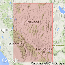
- Great Basin province
Summary:
Pg. 421-432. Busby quartzite. Basal 50 to 75 feet is coarse-grained quartzite, containing in places tiny rock fragments in addition to quartz. Thin beds of dark quartzite and green sandy shale in varying proportions compose remainder of formations, the shales becoming increasingly abundant upward. Mud cracks and fucoid markings present in many of beds. Thickness 450+/- feet. Top arbitrarily placed at base of lowest limestone bed, although quartzites and shales similar to those in the Busby are present above this line. No fossils, but gradational contact with overlying Abercrombie formation, which contains Middle Cambrian fossils, indicates Middle Cambrian age of Busby. Grades into underlying Cabin shale.
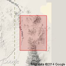
Named from exposures in Busby Canyon, on northeastern slope of Dutch Mountain, [in T. 7 S. (unsurveyed), R. 18 W.], Gold Hill district, Gold Hill 15-min quadrangle [1955 ed.], Tooele Co., western UT.
[See also Nolan's USGS Prof. Paper 177, 1935.]
Source: US geologic names lexicon (USGS Bull. 896, p. 303).
- Usage in publication:
-
- Busby quartzite
- Modifications:
-
- Revised
- AAPG geologic province:
-
- Great Basin province
Summary:
Pg. 28-32, fig. 5. Busby quartzite. Geographically extended into House Range area [central western Utah] where it includes Tatow limestone (Deiss, 1938); in Wah Wah Range [southern western Utah] includes uppermost 70 feet of beds assigned to Pioche shale by Wheeler (1943, GSA Bull., v. 54, no. 12, pt. 1). Thickness 165 feet in House Range; 450 feet in Deep Creek Range [along Utah-Nevada State boundary]. Overlies Pioche shale; underlies Millard limestone (new). Busby may be tongue extending southward from Prospect Mountain quartzite. Age is considered Middle Cambrian.
Source: US geologic names lexicon (USGS Bull. 1200, p. 553-554).
- Usage in publication:
-
- Busby quartzite*
- Modifications:
-
- Age modified
- AAPG geologic province:
-
- Great Basin province
Summary:
Age changed from Middle Cambrian to Early Cambrian. Fossil OLENELLUS, an Early Cambrian fossil found near top of Busby in Deep Creek Range, Juab and Tooele Cos, UT in the Great Basin province.
Source: GNU records (USGS DDS-6; Denver GNULEX).
- Usage in publication:
-
- Busby quartzite
- Busby formation
- Modifications:
-
- Revised
- AAPG geologic province:
-
- Great Basin province
Summary:
Pg. 12 (table 1), 35, 39-41, pl. 1, measured sections. Busby quartzite of Ophir group; Busby formation of Ophir group. In Sheeprock Mountains, Busby quartzite or formation included in Ophir group. Comprises 146 feet of beds, mainly quartzites, sandstones, and sandy limestones. Lies above Pioche shale and below Millard formation (all in Ophir group). Age is [early] Middle Cambrian with strong indications that it was deposited only slightly after Early Cambrian time. [GNC remark (ca. 1960, US geologic names lexicon, USGS Bull. 1200, p. 554): The USGS currently considers the Busby Quartzite to be Early Cambrian in age. This designation is based on the discovery of trilobite OLENELLUS near top of quartzite in Deep Creek Range.]
[Mapped undifferentiated with Millard Formation in area south of Lookout Peak (now Red Pine Mountain), in T. 9 S., R. 6 and 7 W., Lookout Pass 7.5-min quadrangle, Wasatch National Forest, Tooele Co., western UT.]
Source: Publication; US geologic names lexicon (USGS Bull. 1200, p. 553-554).
- Usage in publication:
-
- Busby quartzite*
- Modifications:
-
- Areal extent
- AAPG geologic province:
-
- Great Basin province
Summary:
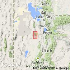
Geographically extended east from the Gold Hill district (Nolan, 1935) and Drum Mountains (Crittenden, Straczek, Roberts, 1961) to exposures on east side of Dugway Range, Tooele Co, Great Basin province. Section 160 ft thick measured on ridge 0.7 mi north of Trailer Wash where formation overlies Cabin shale and underlies Shadscale formation (new). Lower contact placed at base of brown- or red-weathering quartzite above siltstone of Cabin. Top placed at base of orange-weathering dolomite at base of Shadscale. Composed of gray, green, to white, medium- to fine-grained, massive quartzite and green-gray to dark green, micaceous siltstone. No fossils found. Assigned to Early Cambrian. Geologic map. Stratigraphic sections.
Source: GNU records (USGS DDS-6; Denver GNULEX).
- Usage in publication:
-
- Busby Quartzite Member
- Modifications:
-
- [Revised]
- [Age modified]
- AAPG geologic province:
-
- Great Basin province
Summary:
Pg. 8 (fig. 5, Deep Creek Mountains, Utah, column). Majority of information below gleaned from L.B. McCollum and M.B. McCollum, 1984, IN Kerns, G.J., and Kerns, R.L., Jr., eds., Geology of northwest Utah, southern Idaho, and northeast Nevada, Field Conf. Gdbk., Utah Geol. Assoc. Pub., no. 13, p. 38.
Busby Quartzite Member of Pioche Formation. In Deep Creek Mountains of western Utah, Busby Quartzite reduced in rank to upper member of Pioche Formation. Consists of alternating thick- to thin-bedded quartz arenites and subarkoses. [Thickness not given.] Gradationally overlies Cabin Shale Member of Pioche Formation. Underlies beds assigned to Howell Limestone. [Authors replace Nolan's Middle Cambrian Abercrombie Formation and Young Peak Dolomite with House Range terminology of Hintze and Robison (1975); see also entries under Abercrombie and Young Peak. Age not given by McCollum and McCollum (1984); interpreted to be late Early to early Middle Cambrian, based on ages given for underlying and overlying beds; BONNIA-OLENELLUS to ALBERTELLA trilobite assemblage zones.]
[GNC remark (ca. 2010): In the Deep Creek Mountains, the Busby Quartzite Member of Pioche Formation is considered latest Early Cambrian. Underlies Abercrombie Formation and overlies Cabin Shale Member of Pioche Formation. See entry under Hintze and Kowalis (2009).]
Source: Publication.
- Usage in publication:
-
- Busby Quartzite Member
- Modifications:
-
- Overview
- AAPG geologic province:
-
- Great Basin province
Summary:
Pg. 20-21 (fig. 25); charts 41, 45. Busby Quartzite Member of Pioche Formation. Recognized in Deep Creek Mountains, central western Utah, where it is 410 to 500 feet thick. Lies above Cabin Shale Member of Pioche Formation and below Abercrombie Formation. Considered age equivalent of: part of unnamed lower member of Pioche Formation in Fish Springs, House, and Wah Wah Ranges; lower part of Tintic Quartzite in East Tintic mining district; and middle part of Geertsen Canyon Quartzite in Bear River Range. Age is latest Early Cambrian (Dyeran); OLENELLUS trilobite assemblage zone.
See also L.F. Hintze, 1988, Geol. History of Utah, Brigham Young Univ. Geol. Studies, Spec. Pub., no. 7, p. 16 (fig. 19), chart 45.
Source: Publication.
For more information, please contact Nancy Stamm, Geologic Names Committee Secretary.
Asterisk (*) indicates published by U.S. Geological Survey authors.
"No current usage" (†) implies that a name has been abandoned or has fallen into disuse. Former usage and, if known, replacement name given in parentheses ( ).
Slash (/) indicates name conflicts with nomenclatural guidelines (CSN, 1933; ACSN, 1961, 1970; NACSN, 1983, 2005, 2021). May be explained within brackets ([ ]).