


- Usage in publication:
-
- Bridge Creek limestone member*
- Modifications:
-
- Original reference
- Dominant lithology:
-
- Shale
- Limestone
- AAPG geologic province:
-
- Anadarko basin
Summary:
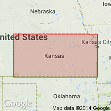
Pg. 67. Bridge Creek limestone member of Greenhorn limestone. Alternating limy shale and thin chalky limestone. Four-fifths of member is limy shale, but the limestone beds are the conspicuous feature. Thickness 74 feet. Top member of Greenhorn limestone in Hamilton and Kearny Counties, western Kansas. Top 25 feet is = Pfeifer shale member of counties to east, and rest of member corresponds to Jetmore chalk member of areas to east. Rests on Hartland shale member of Greenhorn limestone and is overlain by Fairport chalky member of Carlile shale. Age is Late Cretaceous. Report includes stratigraphic chart.
Named from exposures in Bridge Creek northwest of Medway, Hamilton Co., western KS.
Source: US geologic names lexicon (USGS Bull. 896, p. 262); supplemental information from GNU records (USGS DDS-6; Denver GNULEX).
- Usage in publication:
-
- Bridge Creek limestone member*
- Modifications:
-
- Revised
- AAPG geologic province:
-
- Anadarko basin
Summary:
Pg. 153. Bridge Creek limestone member of Greenhorn limestone. In Hamilton County, Kansas, Pfeifer shale member and underlying Jetmore chalk member are thicker than farther east; they cannot be distinguished and have been together designated the Bridge Creek limestone member, having a total thickness of 74 feet. Age is Late Cretaceous.
Source: US geologic names lexicon (USGS Bull. 1200, p. 473-474).
- Usage in publication:
-
- Bridge Creek limestone member*
- Modifications:
-
- Areal extent
- AAPG geologic province:
-
- Anadarko basin
- Las Vegas-Raton basin
Summary:
Bridge Creek limestone member of Greenhorn limestone. In Baca County, southeastern Colorado, member contains alternating beds of chalky limestone and limy shale with a few thin layers of bentonite; limestone beds are 3 to 12 inches thick and are separated by 6 inches to 6 feet of shale. Thickness 62 feet along Two Butte Creek; thickens eastward to 74 feet in Hamilton County, western Kansas; thins westward to 35 feet in Model anticline in Las Animas County. Overlies Hartland shale member. Age is Late Cretaceous.
Source: US geologic names lexicon (USGS Bull. 1200, p. 473-474).
- Usage in publication:
-
- Bridge Creek Limestone Member*
- Modifications:
-
- Principal reference
- Dominant lithology:
-
- Limestone
- Shale
- Bentonite
- AAPG geologic province:
-
- Denver basin
Summary:
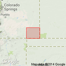
Is the upper member of Greenhorn Limestone, overlying Hartland Shale Member of Greenhorn and underlying Fairport Chalky Shale Member of Carlile Shale. Type locality in sec 14, 22, and 23, T23S, R42W, Hamilton Co, KS in the Anadarko basin measured (75 ft thick) where member is composed of interbedded, chalky, hard to massive, fossiliferous limestone. Some beds at type have pyrite nodules, very calcareous, chalky gray shale, and white, limonitic-stained bentonite (9 beds). Principal reference section designated in NW1/4 NE1/4 sec 31, and SW1/4 and NW1/4 NW1/4 sec 30, T20S, R65W, Pueblo Co, CO in Denver basin where 57 ft measured. Composed of gray, hard, massive, fossiliferous (ammonite) nodular limestone, gray, calcareous shale, and limonitic bentonite. Is 130 ft at Littleton, Arapahoe Co, CO in Denver basin; 16.5 ft thick at Gold Creek, Colfax Co, NM in Las Vegas-Raton basin; 43 ft thick in Cimarron Co, OK in Palo Duro basin; to 74 ft thick in Hamilton Co, KS in Anadarko basin. Of late Cenomanian and Turonian, Late Cretaceous age. Correlation chart. Measured sections. Faunal lists. Columnar sections.
Source: GNU records (USGS DDS-6; Denver GNULEX).
- Usage in publication:
-
- Bridge Creek Limestone Member*
- Modifications:
-
- Areal extent
- AAPG geologic province:
-
- Las Vegas-Raton basin
Summary:
Bridge Creek, upper member of Greenhorn Formation, extended areally to the Gold Creek exposure in sec 4, T31N, R17E, Colfax Co, NM in the Las Vegas-Raton basin. Is 16.6 ft thick in measured section. Composed of interbedded, fossiliferous ammonites, planktonic forams, petroliferous, and granular limestone that weathers gray to gray-yellow and orange occurring in beds about 1 ft thick interbedded with bentonite and limy shale. Overlies Hartland Member of Greenhorn. Underlies Fairport Member of Carlile Shale. Age is Late Cretaceous.
Source: GNU records (USGS DDS-6; Denver GNULEX).
- Usage in publication:
-
- Bridge Creek Limestone Beds*
- Modifications:
-
- Revised
- Areal extent
- AAPG geologic province:
-
- Orogrande basin
Summary:
A calcarenite or calcareous shale in the lower part of the newly named Rio Salado Tongue of Mancos Shale that has been referred to as Greenhorn Limestone or Greenhorn Limestone Member of Mancos is the lithologic equivalent of only the Bridge Creek Limestone Member, uppermost member of the Greenhorn. Assigned to Rio Salado (at type) as Bridge Creek Limestone Beds. This calcareous interval is the lithologic or time equivalent of only the lower part of Bridge Creek at its type locality. Is 47 ft thick at type section of Rio Salado. Ranges from 30 to 60 ft thick in west-central NM, Orogrande basin. Consists of gray, fossiliferous, shaly, nodular limestone, light-olive-gray, fossiliferous shale, and olive-gray fossiliferous calcarenite at Rio Salado type, where beds overlie and underlie light-olive-gray shale of Rio Salado. Is of Late Cretaceous age. Its base in west-central NM is always within the late Cenomanian. Its top can be as low as latest Cenomanian or as high as late early Turonian.
Source: GNU records (USGS DDS-6; Denver GNULEX).
- Usage in publication:
-
- Bridge Creek Member*
- Modifications:
-
- Age modified
- Biostratigraphic dating
- AAPG geologic province:
-
- Las Animas arch
- Denver basin
- Salina basin
- Sierra Grande uplift
Summary:
Is [uppermost] member of Greenhorn Limestone. Age (of part) is refined to early Turonian (Late Cretaceous) on basis of ammonites identified from numerous localities including Pueblo and Boulder Cos, CO, Denver basin; Otero Co, CO, Las Animas arch; Hamilton Co, KS, Salina basin; and Harding Co, NM, Sierra Grande uplift. WATINOCERAS REESIDEI, W. COLORADOENSE, W. THOMPSONENSE, and W. DEVONENSE FLEXUOSUM place the middle part of member in middle zone of tripartite ammonite zonation of early Turonian. W. cf. W. PRAECURSOR places lower (but not basal) part of member in lower zone of early Turonian.
Source: GNU records (USGS DDS-6; Denver GNULEX).
- Usage in publication:
-
- Bridge Creek Limestone Member*
- Modifications:
-
- Biostratigraphic dating
- AAPG geologic province:
-
- Las Vegas-Raton basin
- Las Animas arch
- Denver basin
- Basin-and-Range province
Summary:
Is locally a member of either Greenhorn Limestone or Colorado Formation. Is a member of Greenhorn Limestone in southeast CO. Is assigned a late Cenomanian (Late Cretaceous) age based on presence of ammonites. EUCALYCOCERAS PENTAGONUM, PSEUDOCALYCOCERAS ANGOLAENSE, SUMITOCERAS BENTONIANUM, and S. CONLINI recorded from localities in Las Animas Co, CO in Las Vegas-Raton basin indicate basal part of member is assignable to middle late SCIPONOCERAS GRACILE zone. NEOCARDIOCERAS JUDDII recorded from localities in Pueblo Co, CO in Denver basin and Otero Co, CO in Las Animas arch indicate lower part of member is assignable to latest Cenomanian N. JUDDII zone. S. CONLINI also noted from single locality in Pueblo Co, CO. [Term "limestone" considered redundant, and locally dropped from formal name.] Is a member of Colorado Formation in southwest NM. Is assigned a middle late Cenomanian (Late Cretaceous) age based on presence of ammonites PSEUDOCALYCOCERAS ANGOLAENSE, SUMITOCERAS BENTONIANUM, and S. CONLINI from USGS Mesozoic locality D10196, and EUCALYCOCERAS PENTAGONUM from locality D11483, Luna Co, NM in Basin-and-Range province. Fauna places unit in the SCIPONOCERAS GRACILE zone.
Source: GNU records (USGS DDS-6; Denver GNULEX).
- Usage in publication:
-
- Bridge Creek Limestone Member*
- Modifications:
-
- Revised
- Areal extent
- AAPG geologic province:
-
- San Juan basin
Summary:
Member rank assigned to Upper Cretaceous Bridge Creek Limestone Member of Mancos Shale in the subsurface of the southwest part of the San Juan basin, NM. Is a distinctive unit that lies within the main body of the Mancos Shale. Was used as the datum to plot correlations shown on the cross sections.
Source: GNU records (USGS DDS-6; Denver GNULEX).
- Usage in publication:
-
- Bridge Creek Limestone Beds*
- Modifications:
-
- Biostratigraphic dating
- AAPG geologic province:
-
- San Juan basin
Summary:
Recognized in lower part of Rio Salado Tongue of Mancos Shale and equivalent unnamed shale member of the Mancos in the San Juan basin in west-central NM. Consists of thin limestone beds (interbedded with calcareous shale) near the base of the Rio Salado and equivalent shale. Are equivalent to part of Bridge Creek Member of Greenhorn Limestone of central Great Plains. Basal beds assignable to ammonite zone of SCIPONOCERAS GRACILE of middle late Cenomanian age. Fossils include ammonites, bivalves, gastropods, echinoids, and corals. Figure 2 is stratigraphic nomenclature and correlation chart of middle Cenomanian to lower Coniacian rocks in west-central NM, spanning 20 ammonite zones.
Source: GNU records (USGS DDS-6; Denver GNULEX).
- Usage in publication:
-
- Bridge Creek Limestone Member*
- Modifications:
-
- Areal extent
- AAPG geologic province:
-
- San Juan basin
Summary:
Mapped as a member of the Upper Cretaceous Mancos Shale on five cross sections of the subsurface of southern La Plata Co, CO and northern San Juan Co, NM in the San Juan basin. Overlies Graneros Member of Mancos. Underlies a shale member of Mancos. Is about 60 ft thick.
Source: GNU records (USGS DDS-6; Denver GNULEX).
- Usage in publication:
-
- Bridge Creek Limestone Member*
- Modifications:
-
- Revised
- Areal extent
- AAPG geologic province:
-
- San Juan basin
- Orogrande basin
GNU Staff, 1996, Draft copy of Ridgley, J.L., Geologic map of the Rio Chama Wilderness Study Area, Rio Arriba County, New Mexico, USGS Misc. Field Studies Map MF-2046 (unpublished): U.S. Geological Survey Digital Data Series, DDS-6, 1 CD-ROM., release 3
Summary:
Raised in rank to member of Mancos Shale and extended from Orogrande basin (southern part of author's San Juan basin) into Rio Arriba Co, NM in San Juan basin (author's Chama basin). Replaces Greenhorn Limestone Member of Mancos as previously mapped in area by Landis and Dane (1967). Thickness is about 35-60 ft. Overlies Hartland Shale Member of Mancos; underlies unnamed part of Mancos. Late Cretaceous age.
[See also Ridgeley and others, USGS Bull. 1733-C, 1988.]
Source: GNU records (USGS DDS-6; Denver GNULEX).
For more information, please contact Nancy Stamm, Geologic Names Committee Secretary.
Asterisk (*) indicates published by U.S. Geological Survey authors.
"No current usage" (†) implies that a name has been abandoned or has fallen into disuse. Former usage and, if known, replacement name given in parentheses ( ).
Slash (/) indicates name conflicts with nomenclatural guidelines (CSN, 1933; ACSN, 1961, 1970; NACSN, 1983, 2005, 2021). May be explained within brackets ([ ]).