The National Geologic Map Database is migrating to a new infrastructure. We apologize for any service disruptions during this process.
|
|---|


- Usage in publication:
-
- Brazos River sandstone and conglomerate member
- Modifications:
-
- Original reference
- Dominant lithology:
-
- Sandstone
- Conglomerate
- AAPG geologic province:
-
- Bend arch
Summary:
Pg. 25, 31; Univ. Texas Bull., no. 2132, p. 75, 76, and charts. Brazos River sandstone and conglomerate member of Mineral Wells formation. The lowest of the thick sandstones, which are most prominent feature of Mineral Wells formation. Occurs about 300 feet above base of that formation. Is a very prominent ledge of massive, coarse-grained sandstone that produces a striking escarpment. In places contains lenticular masses of conglomerate. Thickness 25 to 50 feet. = Brazos sandstone (preempted) of Strawn division of Plummer (1919). Underlies East Mountain shale member and overlies Mingus shale member; all included in Mineral Wells formation. Age is Pennsylvanian. Report includes correlation chart.
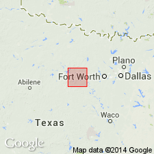
Named from widely distributed exposures along Brazos River, especially the high cliff at Inspiration Point, 8 mi due south of Mineral Wells, [Brazos River Valley area, Palo Pinto Co., north-central TX].
"Typical exposures": near town of Garner, 8 mi east of Mineral Wells and along Mineral Wells-Fort Worth road; on big hill 7 mi southeast of Mineral Wells on road to Millsap; prominent escarpment may be seen for miles north of Texas & Pacific RR between Gordon and Santo.
"Typical section" 2.5 mi northwest of Millsap, Palo Pinto Co., north-central TX.
Source: US geologic names lexicon (USGS Bull. 896, p. 257); supplemental information from GNU records (USGS DDS-6; Denver GNULEX).

- Usage in publication:
-
- Brazos River sandstone and conglomerate member
- Modifications:
-
- Revised
- AAPG geologic province:
-
- Bend arch
Summary:
Pg. 106, 108. Brazos River sandstone and conglomerate member of Garner formation. G. Scott and J.M. Armstrong (unpublished report on geology of Parker County [north-central Texas]) restrict Mineral Wells formation to beds above Brazos sandstone and conglomerate and introduce Garner formation for lower part of original Mineral Wells formation, extending from top of Brazos sandstone and conglomerate down to base of Thurber coal. Age is Pennsylvanian.
Source: US geologic names lexicon (USGS Bull. 896, p. 257).

- Usage in publication:
-
- Brazos River conglomerate member*
- Modifications:
-
- Overview
- AAPG geologic province:
-
- Bend arch
Summary:
The name Brazos being preoccupied, the USGS designates this member, which is chiefly conglomerate, as Brazos River conglomerate member of Garner formation. F.B. Plummer and J. Hornberger, Jr., 1936 (Univ. Texas Bull. 3534, p. 23+), call this member Brazos River sandstone. The state that, as pointed out by H.X. Ray (Univ. Texas Bull. 3201, 1933, p. 165-166), it is part at least of fluviatile origin and that it grades to west into beach and marine deposits.
Source: US geologic names lexicon (USGS Bull. 896, p. 157).
- Usage in publication:
-
- [Brazos River sandstone and conglomerate]
- Modifications:
-
- Biostratigraphic dating
- AAPG geologic province:
-
- Bend arch
Summary:
Fig. 2. Faunal break occurs in Brazos River sandstone and conglomerate. Part of unit is assigned to East Mountain shale and part retained in Garner formation. Age is Middle Pennsylvanian.
Source: US geologic names lexicon (USGS Bull. 1200, p. 463).

- Usage in publication:
-
- Brazos River sandstone member
- Modifications:
-
- Overview
- AAPG geologic province:
-
- Bend arch
Summary:
Pg. 21-22, fig. 3, pl. 1. Brazos River sandstone member of Garner formation. Referred to as sandstone member of Garner in report on Parker County [north-central Texas]. Essentially massive and cross-bedded with lenses and beds of coarse conglomerate and minor shale beds; in some areas, conglomerate is missing. Thickness uniformly 25 to 30 feet. Overlies Mingus shale member; underlies East Mountain formation. Age is Middle Pennsylvanian.
Source: US geologic names lexicon (USGS Bull. 1200, p. 463).

- Usage in publication:
-
- Brazos River Formation
- Modifications:
-
- Mapped 1:250k
- Dominant lithology:
-
- Sandstone
- Conglomerate
- Mudstone
- AAPG geologic province:
-
- Fort Worth syncline
Summary:
Brazos River Formation of Strawn Group. Sandstone, conglomerate, and mudstone; sandstone, coarse-grained, ferruginous, cross-bedded, thick-bedded to massive, reddish brown; mudstone, silty, gray, local lenses; conglomerate, angular pebbles of chert up to 1.5 inches in size, some clay ironstone, variegated, ferruginous cement common. Thickness 100 feet. Lies above Mingus Formation and below Mineral Wells Formation, both of Strawn Group. Age is Middle Pennsylvanian (Desmoinesian).
[Small, isolated outcrop along western edge of map sheet, west of Weatherford, in Parker Co., eastern TX. See also adjacent Geol. Atlas Texas, Abilene sheet, 1972.]
Source: Publication.
For more information, please contact Nancy Stamm, Geologic Names Committee Secretary.
Asterisk (*) indicates published by U.S. Geological Survey authors.
"No current usage" (†) implies that a name has been abandoned or has fallen into disuse. Former usage and, if known, replacement name given in parentheses ( ).
Slash (/) indicates name conflicts with nomenclatural guidelines (CSN, 1933; ACSN, 1961, 1970; NACSN, 1983, 2005, 2021). May be explained within brackets ([ ]).