


- Usage in publication:
-
- Branch River Member
- Modifications:
-
- Principal reference
- Dominant lithology:
-
- Till
- AAPG geologic province:
-
- Wisconsin arch
Summary:
Pg. 4 (table 1); App., p. A10-11 to A10-13. Branch River Member of Kewaunee Formation. Follows the informal usage of David M. Mickelson (McCartney and Mickelson, 1982, GSA Bull., v. 93, p. 297-302). Consists of brown till. Average thickness 2 m. Is the lowest of three members of Kewaunee Formation (new) in the Green Bay Lobe, east of an arbitrary vertical cutoff at the Fox River. Overlies dolomite bedrock, or till and gravel of the Horicon Formation (new). Underlies Chilton Member (new) of Kewaunee or is the surface unit. Distinguished from Horicon by redder color and less abundant sand, and from Chilton by more abundant sand. Is equivalent to Silver Cliff Member (new) of Kewaunee in the Green Bay Lobe, west of the arbitrary vertical cutoff at the Fox River, and to Ozaukee Member (new) of Kewaunee in the Lake Michigan Lobe. Age is late Pleistocene (late Wisconsinan).
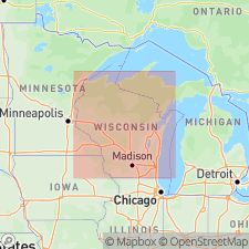
Type section: Greenleaf quarry, on north side of WI Highway 96, 0.4 mi (0.7 km) east of Greenleaf, in SE/4 SW/4 sec. 4, T. 21 N., R. 20 E., [approx. Lat. 44 deg. 18 min. 48 sec. N., Long. 88 deg. 04 min. 54 sec. W.], Greenleaf 7.5-min quadrangle, Brown Co., eastern WI.
Named from the Branch River in Morrison Twp., Denmark 15-min quadrangle; name credited to David M. Mickelson.
Reference sections: (1) roadcut on east side of Campbell Road, 0.25 mi (0.4 km) south of Collins Road, in NW/4 NW/4 sec. 24, T. 21 N., R. 20 E., [approx. Lat. 44 deg. 16 min. 50 sec. N., Long. 88 deg. 01 min. 48 sec. W.], Greenleaf 7.5-min quadrangle, Brown Co., eastern WI; (2) small borrow pit on southwest corner of intersection of County Trunk Highways Z and PP, in northeast corner sec. 28, T. 21 N., R. 20 E., [approx. Lat. 44 deg. 16 min. 09 sec. N., Long. 88 deg. 04 min. 16 sec. W.], Greenleaf 7.5-min quadrangle, Brown Co., eastern WI.
[Additional locality information from Syverson and others, 2011, Wisconsin lexicon of Pleistocene units, Wisconsin Geol. Nat. Hist. Survey Tech. Rpt., no. 1; supplemented from USGS historical topographic map collection TopoView and Wisconsin Highways www.wisconsinhighways.org, accessed on June 9, 2018.]
Source: Publication; US geologic names lexicon (USGS Bull. 1565, p. 43).
- Usage in publication:
-
- Branch River Member
- Modifications:
-
- Overview
- AAPG geologic province:
-
- Wisconsin arch
Summary:
[Not synopsized to date. Lithology, thickness, distinguishing characteristics, contacts, sections, areal extent, age, correlations discussed.]
Pg. 4 (fig. 2), 7 (fig. 3), 8, 132-133. Branch River Member of Kewaunee Formation.
Source: NA
For more information, please contact Nancy Stamm, Geologic Names Committee Secretary.
Asterisk (*) indicates published by U.S. Geological Survey authors.
"No current usage" (†) implies that a name has been abandoned or has fallen into disuse. Former usage and, if known, replacement name given in parentheses ( ).
Slash (/) indicates name conflicts with nomenclatural guidelines (CSN, 1933; ACSN, 1961, 1970; NACSN, 1983, 2005, 2021). May be explained within brackets ([ ]).