

- Usage in publication:
-
- Boulder River sandstone member*
- Modifications:
-
- Original reference
- Dominant lithology:
-
- Sandstone
- AAPG geologic province:
-
- Central Montana uplift
- Montana folded belt
Summary:
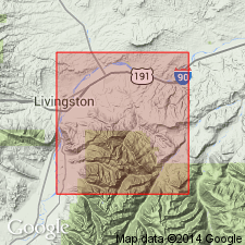
Pg. 415-416, pl. 34. Boulder River sandstone member of Colorado shale. Discussion of area east and southeast of Livingston, Montana. Here Colorado shale is divided into 10 units, and these are compared, where possible, with Black Hills and central Montana or Bighorn basin formations. Unit 7, a thick-bedded or massive sandstone about 100 feet thick, is herein named Boulder River sandstone member. Forms cliffs and ridges between less resistant shale sequence below and thin-bedded sandstone above. On south slope of a hill (altitude 6,763 feet) west of West Boulder River in NE/4 (unsurveyed) sec. 26, T. 3 S., R. 11 E., Mount Rae 7.5-min quadrangle, Park County, southwestern Montana, member is about 65 feet thick and consists of gray to yellowish-brown mostly fine-grained sandstone. Above it, and below crest of hill, are 145 feet of thin-bedded, in part shaly, sandstone. Age is Early Cretaceous.
[Named from] exposures along west side of Boulder River valley, in SE/4 sec. 11, T. 3 S., R. 12 E., McLeod Basin quadrangle, [Sweet Grass Co.], southwestern MT. Member forms almost continuous ridge from Boulder River westward to Yellowstone River south of Livingston.
Source: Publication; US geologic names lexicon (USGS Bull. 1200, p. 439).
- Usage in publication:
-
- Boulder River Sandstone Member
- Modifications:
-
- Revised
- AAPG geologic province:
-
- Central Montana uplift
Summary:
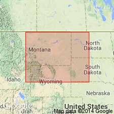
Formerly a member of Colorado Shale. Assigned in this report to Mowry Shale in Livingston area, Sweet Grass Co, MT on the Central Montana uplift. Overlies and underlies unnamed parts of the Mowry. Consists of gray to brown, medium-grained, subangular to subround, poorly sorted, quartz dominant sandstone. Matrix of silt and clay. Thin layers of black bentonitic shale interbedded with the sandstone. Of continental and marine origin. Similar in character to the Big Elk Sandstone Member, top member of Mowry in Livingston area. Averages 125 ft thick. Nomenclature chart. Cross sections. Of late Albian, Early Cretaceous age.
Source: GNU records (USGS DDS-6; Denver GNULEX).
- Usage in publication:
-
- Boulder River Sandstone Member*
- Modifications:
-
- Revised
- AAPG geologic province:
-
- Montana folded belt
Summary:
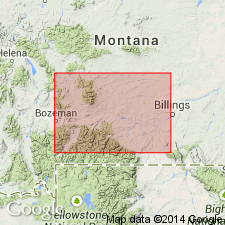
Boundary between Mowry Shale and Frontier Formation placed at base of Boulder Creek Sandstone Member. This usage represents removal of the Boulder River from Colorado Shale, a term not used in the Livingston area, Park Co, MT, Montana folded belt province, and its reassignment to the Frontier Formation as the basal member. The topmost bed of Boulder Creek is mottled. Assigned to the early Cenomanian, Late Cretaceous age.
Source: GNU records (USGS DDS-6; Denver GNULEX).
- Usage in publication:
-
- Boulder River Sandstone Member*
- Modifications:
-
- Overview
- AAPG geologic province:
-
- Montana folded belt
Summary:
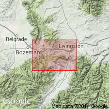
Pg. C6-C7, C24-C27, C67-C68, pl. 2. Boulder River Sandstone Member, basal member of Frontier Formation. A light- to dark-gray to grayish-green, poorly sorted, very fine-grained to conglomeratic, thin-bedded to massive sandstone that contains abundant heavy minerals, chert, glauconite; commonly cemented by calcareous silt or clay; locally cross-bedded and ripple-marked. Described in detail from measured reference section of Frontier Formation; thickness 119 feet. Overlies Mowry Shale, contact placed at lowest well-defined sandstone of the Boulder River; underlies unnamed upper sandstone, shale, and siltstone unit of Frontier Formation. Contains fossils; casts of OPHIOMORPHA (HALYMITES) are common in the fine-grained beds. Age is Late Cretaceous (Cenomanian). Report includes geologic map, correlation chart.
Reference section (of Frontier Formation): on north side of Canyon Mountain, [just southwest of Livingston], in secs. 26 and 27, T. 2 S., R. 9 E., [in vicinity of Lat. 45 deg. 37 min. 37 sec. N., Long. 110 deg. 35 min. 30 sec. W., Livingston 7.5-min quadrangle], Park Co., MT (Central Montana uplift).
Source: Publication.
For more information, please contact Nancy Stamm, Geologic Names Committee Secretary.
Asterisk (*) indicates published by U.S. Geological Survey authors.
"No current usage" (†) implies that a name has been abandoned or has fallen into disuse. Former usage and, if known, replacement name given in parentheses ( ).
Slash (/) indicates name conflicts with nomenclatural guidelines (CSN, 1933; ACSN, 1961, 1970; NACSN, 1983, 2005, 2021). May be explained within brackets ([ ]).