

- Usage in publication:
-
- Boulder Creek granite gneiss
- Modifications:
-
- Original reference
- Dominant lithology:
-
- Granite
- AAPG geologic province:
-
- Southern Rocky Mountain region
Summary:
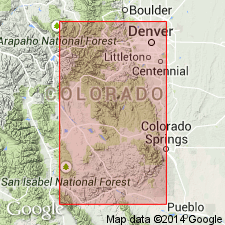
Pg. 305-306. Boulder Creek granite gneiss. Oldest observed intrusive pre-Cambrian rock in Front Range is gray granite and gneissoid granite that crops out widely on Boulder Creek, on east flank of Front Range, west and southwest of Boulder, [Boulder County], central northern Colorado, and is known as Boulder Creek granite gneiss. It intrudes Coal Creek quartzite, Ralston formation, and the schist. Is = Archean quartz monzonite of Georgetown region. Report includes geologic map.
Source: US geologic names lexicon (USGS Bull. 896, p. 241).
- Usage in publication:
-
- Boulder Creek granite
- Modifications:
-
- Revised
- AAPG geologic province:
-
- Southern Rocky Mountain region
Summary:
Boulder Creek granite. In this report [Jamestown area, Boulder County, central northern Colorado], Pikes Peak group includes (ascending) Boulder Creek granite and Overland Mountain granite (new). Younger than Swandyke hornblende gneiss. [Age is Precambrian.]
Source: US geologic names lexicon (USGS Bull. 1200, p. 438-439).
- Usage in publication:
-
- Boulder Creek Granodiorite*
- Modifications:
-
- Mapped 1:24k (Tungsten quad, Boulder, Gilpin, and Jefferson Cos, CO)
- Dominant lithology:
-
- Granodiorite
- AAPG geologic province:
-
- Southern Rocky Mountain region
Summary:
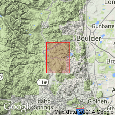
Is older Precambrian formation mapped in south-central Boulder, northeast Gilpin, and northwest Jefferson Cos, CO (Southern Rocky Mountain region). Map unit described as gray fine- to medium-grained intrusive rocks. Consists mainly of quartz, potassium feldspar, plagioclase, and biotite, and locally of hornblende. Contains abundant pegmatite. Nearly massive, but somewhat foliated adjacent to quartz monzonite and to many of the faults. Boulder Creek batholith occupies the eastern two-thirds of the quadrangle; metasedimentary rocks occupy the western one-third. Two principal rock types make up the batholith. Boulder Creek Granodiorite is the dominant type, which in most places is a biotite- or biotite-hornblende-bearing granodiorite but locally varies from quartz monzonite to quartz diorite. Peterman, Hedge, and Braddock (1968), by means of whole-rock Rb-Sr methods, have assigned a 1.7-b.y. age to this rock. The subordinate, but important part of the batholith is fine- to medium-grained biotite-muscovite-quartz monzonite; it is only slightly younger than the granodiorite, though it cuts the granodiorite with sharp contacts.
Source: GNU records (USGS DDS-6; Denver GNULEX).
- Usage in publication:
-
- Boulder Creek Granodiorite*
- Modifications:
-
- Mapped 1:24k (Grand Co, CO)
- Dominant lithology:
-
- Granodiorite
- AAPG geologic province:
-
- Southern Rocky Mountain region
Summary:
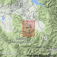
Is Precambrian X [Early Proterozoic] formation mapped as two map units in quadrangle in Grand Co., CO (Southern Rocky Mountain region). Predominant phase in quadrangle is granodiorite--medium-to coarse-grained gray to pinkish-gray biotite and biotite-hornblende granodiorite; scattered feldspar phenocrysts as much as 3 cm in length; massive to gneissic; locally intrudes quartz diorite but at other places grades into quartz diorite. Forms dikes, irregular masses, and large plutons, generally tending to be subconcordant to structure of enclosing gneiss but is locally discordant to structure of enclosing gneiss but is locally discordant. Minor phase mapped only in southwest corner of quad is quartz diorite--medium- to coarse-grained gray to dark-gray hornblende-biotite and hornblende quartz diorite; massive to foliated. Seems to represent an early phase of large plutons.
Source: GNU records (USGS DDS-6; Denver GNULEX).
- Usage in publication:
-
- Boulder Creek Granite*
- Boulder Creek Granodiorite*
- Boulder Creek Granite Gneiss
- Modifications:
-
- Areal extent
- AAPG geologic province:
-
- Southern Rocky Mountain region
Summary:
Pg. D2 (fig. 1), D6 (table 1), D12. Boulder Creek Granite (also called Boulder Creek Granodiorite and Boulder Creek Granite Gneiss). Type body is batholith west of Boulder, Colorado. Name has been extended beyond type batholith and its satellites to plutons scattered through the 200-mile (320-km) length of the Front Range (see Lovering and Goddard, 1950, pl. 1). Informal term "Boulder Creek complex" has been applied to cluster of plutons similar to Boulder Creek in central Front Range (see Hickling and others, 1970, GSA Bull., v. 81, no. 7, p. 1973-1994). Considering uncertainties inherent in long-distance correlation of igneous rocks, recent practice of referring to rocks far removed from the type batholith as "of Boulder Creek type" or "of Boulder Creek age" is preferable. Age is Precambrian X; dated at about 1,720 Ma by both Rb-Sr and U-Pb (zircon) methods (see Peterman and others, 1968, Jour. Geophys. Research, v. 73, no. 6, p. 2277-2296; Stern and others, 1971, GSA Bull., v. 82, no. 6, p. 1615-1634; Phair and others, 1971, GSA Bull., v. 82, no. 6, p. 1635-1656). Rock of this body is leading example of granitic rocks of about 1,700 Ma age group.
Source: Publication.
- Usage in publication:
-
- Boulder Creek Granodiorite*
- Modifications:
-
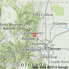
- Mapped 1:24k (Gold Hill quad, Boulder Co, CO)
- Dominant lithology:
-
- Granodiorite
- AAPG geologic province:
-
- Southern Rocky Mountain region
Summary:
Is Precambrian X unit mapped in central Boulder Co, CO (Southern Rocky Mountain region). Map unit described as gray, pinkish-gray to black and white, medium-grained to very coarse grained, locally porphyritic rock with feldspar crystals several centimeters in length and well aligned. Composed of microcline, plagioclase, and quartz, and lesser amounts of biotite and hornblende. The accessories include ores (chiefly magnetite, ilmenite, hematite, pyrite), allanite, and sphene. Granodiorite in border area of the Boulder Creek batholith and lenses of granodiorite in metasediments are well foliated and gneissic. Granodiorites in the interior of the batholith and larger plutons are gneissic to massive. Locally profuse mafic clots and lenses occur in the granodiorite of the batholith, especially east and south of Gold Hill. Rubidium-strontium dates place the Boulder Creek Granodiorite on the same 1,700-m.y. isochron as associated Precambrian X quartz monzonite (Xqm) (Peterman, Hedge, and Braddock, 1968).
Source: GNU records (USGS DDS-6; Denver GNULEX).
- Usage in publication:
-
- Boulder Creek Granodiorite*
- Modifications:
-
- Revised
- AAPG geologic province:
-
- Southern Rocky Mountain region
Summary:
Is one of nine formally named lithodemic units in the Early Proterozoic Routt Plutonic Suite (a new name). Is known in the Southern Rocky Mountain region. Is part of the Boulder Creek batholith (with Twin Spruce Quartz Monzonite), which occupies an area of 375 km (sq) or 145 mi (sq) west of the mountain front near Boulder and east of the front in the Denver basin an unknown distance beneath sedimentary rocks. Is coarse grained, coarsely porphyritic with chunky prismatic potassium feldspar crystals locally with abundant biotite as clots or packets of flakes. Hornblende is abundant locally. Sphene is conspicuous accessory mineral. Is about 1,700 m.y. in age (U-Pb on Zr), about same age as the Cross Creek and Denny Creek Granodiorites.
Source: GNU records (USGS DDS-6; Denver GNULEX).
- Usage in publication:
-
- Boulder Creek Granodiorite*
- Modifications:
-
- Overview
- AAPG geologic province:
-
- Southern Rocky Mountain region
Summary:
Underlies about 50 percent of Strawberry Lake area, northwestern flank of central Front Range, Grand Co, CO, Southern Rocky Mountain region. Older than Silver Plume Granite which has been extended into area and replaces some of Boulder Creek as mapped by Tweto (1987). Geochemistry; petrologic data; geologic map. In Strawberry Lake area, Boulder Creek is more mafic than average and contains slightly less uranium and thorium than average elsewhere in Front Range. Chemical, geologic and petrologic evidence strongly suggests origin in Strawberry Lake area is metamorphic-metasomatic rather than magmatic. Partial melting probably occurred to some extent, however, no evidence has been found for gross intrusion. Early Proterozoic age.
Source: GNU records (USGS DDS-6; Denver GNULEX).
For more information, please contact Nancy Stamm, Geologic Names Committee Secretary.
Asterisk (*) indicates published by U.S. Geological Survey authors.
"No current usage" (†) implies that a name has been abandoned or has fallen into disuse. Former usage and, if known, replacement name given in parentheses ( ).
Slash (/) indicates name conflicts with nomenclatural guidelines (CSN, 1933; ACSN, 1961, 1970; NACSN, 1983, 2005, 2021). May be explained within brackets ([ ]).