The National Geologic Map Database is migrating to a new infrastructure. We apologize for any service disruptions during this process.
|
|---|


- Usage in publication:
-
- Boquillas flags
- Modifications:
-
- Original reference
- Dominant lithology:
-
- Limestone
- AAPG geologic province:
-
- Permian basin
Summary:
Pg. 17, 29-33. Boquillas flags. Thin-bedded, closely jointed, fossiliferous flaggy strata, separated by delicate seams which may not appear on freshly exposed surfaces. Upper 100 feet of chalky texture. Color variable but characteristically cream grayish white; in Boquillas region faint ferruginous red stain; in other areas some ledges are dark and almost black on fresh fractures. Thickness 585 feet. Basal formation of Upper Cretaceous. Western equivalent of Eagle Ford shales. Grades into overlying Terlingua beds and overlies Buda limestone. Age is Late Cretaceous (Gulf).
[Named from Boquillas, on Tornillo Creek, Chisos Mountains quadrangle, Brewster Co., western TX.]
Source: US geologic names lexicon (USGS Bull. 896, p. 237).
- Usage in publication:
-
- Boquillas flags
- Modifications:
-
- Overview
- AAPG geologic province:
-
- Permian basin
Summary:
Is lowest formation of three in Gulf series in Agua Fria 15-minute quadrangle, southwestern Brewster Co, TX (in southern part of Permian basin). Unconformably overlies Buda limestone of Comanche series. Overlain by Terlingua beds of Udden (1907). Gradational contacts, insufficiently detailed paleontological work in the Trans-Pecos region, and vague definitions of formational boundaries result in many stratigraphic problems for Gulf series rocks in the area. For purposes of discussion and mapping, the Boquillas-Terlingua sequence is divided into lower and upper units: "lower Boquillas-Terlingua unit" (approximate equivalent of Udden's Boquillas flags) and "upper Boquillas-Terlingua unit" (approximate equivalent of Udden's Terlingua beds). Boquillas-Terlingua contact lies somewhere within 300 ft of gradational strata between the "CRIOCERAS" zone and the INOCERAMUS UNDULATOPLICATUS zone. Base of Fizzle Flat lentil (new) is arbitrarily selected as boundary between lower and upper units. Lower unit divided into a lower nodular (about 210 ft thick), a middle terraced member (about 205 ft thick), and an upper shaly member (about 100 ft thick). Measured sections described. Map scale 1:62,500. Stratigraphic distribution of molluscan fossils is discussed. Age is Late Cretaceous.
Source: GNU records (USGS DDS-6; Denver GNULEX).
- Usage in publication:
-
- Boquillas Flags*
- Modifications:
-
- Mapped 1:62.5k
- Dominant lithology:
-
- Limestone
- Claystone
- AAPG geologic province:
-
- Permian basin
Summary:
Is formation mapped in eastern Brewster and southwest Terrell Cos, TX in Permian basin. Overlies Buda Limestone with erosional unconformity; underlies Pleistocene gravel with angular unconformity. Map unit described as dark gray, olive-gray, brownish-gray and yellowish-gray, thin- to very thin-bedded limestone and clayey silty limestone, interbedded with black thinly laminated limy claystone. Beds in lower 25 ft are cross-laminated, lenticular, and more resistant than overlying beds. Remaining thickness beneath unconformity about 100 ft. Age is Late Cretaceous.
Source: GNU records (USGS DDS-6; Denver GNULEX).
- Usage in publication:
-
- Boquillas Formation
- Modifications:
-
- Revised
- AAPG geologic province:
-
- Permian basin
Summary:
Is revised to include both the Boquillas Flags of Udden (1907) and the lower member of his Terlingua Beds. Is divided into the Ernst Member (new, at base) and the San Vicente Member (new, above) in Big Bend National Park area, Brewster Co, TX in the Permian basin. Is basal formation (of two) in Terlingua Group (revised). Overlies Buda Limestone; underlies Pen Formation (new) of Terlingua Group. Is 805-875 ft thick in study area. [Table 2 shows Boquillas as Turonian and Coniacian (part); however, Table 5 clearly shows the Ernst Member as both Cenomanian (part) and Turonian on the basis of ammonites.] Age is Cenomanian (part), Turonian, and early Coniacian (Late Cretaceous).
Source: GNU records (USGS DDS-6; Denver GNULEX).
- Usage in publication:
-
- Boquillas Formation
- Modifications:
-
- Mapped 1:62.5k
- Dominant lithology:
-
- Limestone
- Shale
- AAPG geologic province:
-
- Permian basin
Summary:
Is lower formation of two in Terlingua Group. Is mapped in the Black Gap area, Brewster Co, TX in southern part of Permian basin. Overlies Buda Limestone of Comanche Series. Overlain by Pen Clay. Consists of two members: Ernst Member, includes the lower flaggy beds, 277 ft thick; and overlying San Vicente Member, includes the chalky limestone and calcareous shale, 274 ft thick, above the flaggy beds and below the gypsiferous Pen Clay. Members are not separately mapped; composite thickness is 551 ft. Crops out in Black Gap area within northwest-trending structural and topographic low extending from Stillwell, Heath, and Horse Canyons northwest through Black Gap headquarters to State Hwy 385; broadest area of outcrop is between Black Gap and Maravillas Canyon. INOCERAMUS LABIATUS is common in Ernst Member and occurs in lower 125 ft of San Vicente Member. Concentration of INOCERAMUS UNDULATOPLICATUS that occurs 35 to 50 ft above base of San Vicente is considered to be the I. UNDULATOPLICATUS zone. Age is Cretaceous.
Source: GNU records (USGS DDS-6; Denver GNULEX).
- Usage in publication:
-
- Boquillas Formation
- Modifications:
-
- Areal extent
- Overview
- AAPG geologic province:
-
- Orogrande basin
Summary:
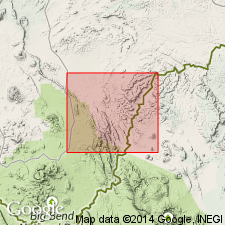
Pg. 20, geol. map; App. II (p. 82). Boquillas Formation. Dark-gray, generally unfossiliferous shale. Weathers buff yellow. Is similar in appearance to Lower Cretaceous Del Rio Formation of Washita Group. Differs by lack of EXOGYRA, common in the Del Rio, and lower part contains diagnostic thin-bedded limestone laminae not found in the Del Rio. Is subdivision 11 of Bose (1910) who gave thickness of 110 m (360 feet). Separated from overlying Tertiary Fort Hancock Formation and underlying Lower Cretaceous Buda Formation of Washita Group by erosional unconformities. Age is Late Cretaceous (Gulfian).
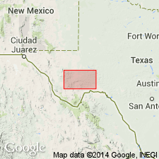
[Mapped in areas around the Cerro de Cristo Rey pluton, a volcanic intrusive body in Dona Ana Co., New Mexico, U.S.A., and Ciudad Juarez, Chihuahua, Mexico.]
Mapped in Cerro de Cristo Rey, Dona Ana Co, NM, Orogrande basin and Chihuahua, MX. Small exposures form slopes on north and south sides of Cerro de Cristo Rey intrusion. Andesite sills have intruded shales of Boquillas. Cross sections. age.
Source: GNU records (USGS DDS-6; Denver GNULEX).

- Usage in publication:
-
- Boquillas Flags
- Modifications:
-
- Areal extent
- Mapped 1:250k
- Dominant lithology:
-
- Shale
- Limestone
- Siltstone
- AAPG geologic province:
-
- Permian basin
Summary:
Is Upper Cretaceous formation mapped in southern Terrell and southern Val Verde Cos, TX (southern part of Permian basin). Facies change eastward is gradual from Boquillas Flags to Eagle Ford Group; nomenclature change arbitrarily placed at Devils River, Val Verde Co. Overlies Buda Limestone; overlain by Austin Chalk. Map unit consists of four units (not separately mapped): upper unit mostly shale, silty, medium-gray, interbedded with some limestone, nodular to laminar, granular, brownish-gray; followed downward by shale, silty, medium-gray, interbedded with limestone, granular, yellowish-gray; shale, silty, dark-gray, interbedded with siltstone, laminated, grading upward to silty limestone; and a basal unit of limestone, clastic, in thin mostly cross-laminated beds that pinch and swell along strike, interbedded with siltstone, light yellowish-gray to grayish-orange. Thickness 160-220 ft.
Source: GNU records (USGS DDS-6; Denver GNULEX).
- Usage in publication:
-
- Boquillas Formation, Boquillas Flags
- Modifications:
-
- Mapped 1:250k
- Dominant lithology:
-
- Shale
- Limestone
- Siltstone
- AAPG geologic province:
-
- Permian basin
Summary:
Boquillas Formation. Notable exposures in Big Bend National Park, Black Gap area, Tascotal Mesa quadrangle, and Terlingua area. Includes (descending) San Vicente Member, 130 to 400 feet, equivalent to lower part of Austin Chalk, and Ernst Member, 277 to 1,000 feet, equivalent to Boquillas Flags; not separately mapped.
Boquillas Flags. In eastern part of sheet comprised of four units: (1) upper unit, shale, silty, medium-gray, interbedded with limestone, nodular to laminar, granular, brownish-gray; (2) followed downward by shale, silty, medium-gray, interbedded with limestone, granular, yellowish-gray; (3) shale, silty, dark-gray, interbedded with siltstone, laminated, grading upward to silty limestone; and (4) a lower unit of limestone, clastic, in thin mostly cross-laminated beds, interbedded with siltstone, light yellowish-gray to grayish-orange, and shale, black. Thickness 100 to 450 feet.
Mapped in Presidio, Brewster, and Terrell Counties, Texas. Overlies Buda Limestone (Lower Cretaceous). Most areas, underlies Pen Formation; eastern exposures, underlies Austin Chalk. Age is Late Cretaceous.
Source: Publication; supplemental information from GNU records (USGS DDS-6; Denver GNULEX).
- Usage in publication:
-
- Boquillas Limestone*
- Modifications:
-
- Biostratigraphic dating
- AAPG geologic province:
-
- Permian basin
Summary:
Collection from a 20-cm-thick bed of chalky limestone 20 m above base is assigned a middle Turonian (Late Cretaceous) age based on presence of the ammonite SPATHITES RIOENSIS from USGS Mesozoic locality D11193 on Gold Hill, 2.15 km N 53 degrees E of Gomez Peak, Jeff Davis Co, TX in the Permian basin.
Source: GNU records (USGS DDS-6; Denver GNULEX).
- Usage in publication:
-
- Boquillas Limestone*
- Modifications:
-
- Biostratigraphic dating
- AAPG geologic province:
-
- Permian basin
Summary:
Lower part of flaggy limestone member (6-12 ft above base of formation) is assigned a late middle Cenomanian (Late Cretaceous) age based on probable identification of the ammonite TARRANTOCERAS SELLARDSI from USGS Mesozoic locality D11320 on Gold Hill, northern Jeff Davis Co, TX in the Permian basin. Fauna places lower part of unit in CUNNINGTONICERAS AMPHIBOLUM AMPHIBOLUM subzone of AMPHIBOLUM zone.
Source: GNU records (USGS DDS-6; Denver GNULEX).
- Usage in publication:
-
- Boquillas Formation
- Modifications:
-
- Mapped 1:250k
- Dominant lithology:
-
- Shale
- Limestone
- Siltstone
- AAPG geologic province:
-
- Permian basin
Summary:
Is Upper Cretaceous formation mapped in southern Terrell Co, TX and west-central Brewster Co, TX (both in southern part of Permian basin). Overlies Buda Limestone. Overlain by Gulfian rocks undivided. In southeastern map area (southern Terrell Co)--top part eroded, on adjacent sheets consists of four units: upper unit mostly shale, silty, medium gray, interbedded with some limestone, nodular to laminar, granular, brownish gray; followed downward by shale, silty, medium gray, interbedded with limestone, granular, yellowish gray; shale, silty, dark gray, interbedded with siltstone, laminated, grading upward to silty limestone; and a basal unit of granular limestone, in thin, mostly cross-laminated beds, interbedded with siltstone, light yellowish gray to grayish orange, and shale black; thickness remaining probably less than 100 ft. South of Del Norte Mountains (west-central Brewster Co), San Vicente (upper) and Ernst (lower) Members are recognized, but not separately mapped; thickness not stated. Age is Late Cretaceous.
Source: GNU records (USGS DDS-6; Denver GNULEX).
For more information, please contact Nancy Stamm, Geologic Names Committee Secretary.
Asterisk (*) indicates published by U.S. Geological Survey authors.
"No current usage" (†) implies that a name has been abandoned or has fallen into disuse. Former usage and, if known, replacement name given in parentheses ( ).
Slash (/) indicates name conflicts with nomenclatural guidelines (CSN, 1933; ACSN, 1961, 1970; NACSN, 1983, 2005, 2021). May be explained within brackets ([ ]).