

- Usage in publication:
-
- Bobcat Member*
- Modifications:
-
- Named
- Dominant lithology:
-
- Conglomerate
- Sandstone
- AAPG geologic province:
-
- Yellowstone province
Summary:
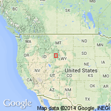
Named for exposures near Bobcat Ridge, Teton Co., WY, Yellowstone province. Type section measured from East Fork of Pilgrim Creek in T46N, R114W about a mile southwest of ridge west-southwest for 2 3/4 mi to top of point (8,800 ft el) overlooking North Fork, Pilgrim Creek. Is a coarse mostly quartzite (90 percent) conglomerate characterized by rounded pebbles, cobbles, and boulders of red, black, green, brown, and light-gray quartzite embedded in a green, brown, or olive-drab, drab, coarse-grained sandstone. Remainder of conglomerate is welded tuff, porphyry, basalt, and other igneous rocks, and deeply weathered gray, green calcareous Paleozoic rocks (chert, sandstone, dolomite, limestone). Also includes massive, coarse-grained, some cross-bedded sandstone, dark-gray, carbonaceous claystone, some siltstone and coal beds. Is 4,572+/-ft thick at type (units 39-19) where it overlies lower member of Harebell. Basal contact is 872 ft above base of formation. Underlies Pinyon Conglomerate at type. Reference section for lower part of member measured on East Fork, Pilgrim Creek about 300 ft upstream from middle of three right angle bends in stream. Is of Late, but not latest, Cretaceous age; has dinosaur, pollen, mollusk, ostracod, seed, and leaf fossils. Deposited by streams in a high to low energy, warm and humid environment; probably associated with rise of Targhee uplift.
Source: GNU records (USGS DDS-6; Denver GNULEX).
For more information, please contact Nancy Stamm, Geologic Names Committee Secretary.
Asterisk (*) indicates published by U.S. Geological Survey authors.
"No current usage" (†) implies that a name has been abandoned or has fallen into disuse. Former usage and, if known, replacement name given in parentheses ( ).
Slash (/) indicates name conflicts with nomenclatural guidelines (CSN, 1933; ACSN, 1961, 1970; NACSN, 1983, 2005, 2021). May be explained within brackets ([ ]).