The National Geologic Map Database is migrating to a new infrastructure. We apologize for any service disruptions during this process.
|
|---|


- Usage in publication:
-
- Bliss sandstone
- Modifications:
-
- Original reference
- Dominant lithology:
-
- Sandstone
- AAPG geologic province:
-
- Orogrande basin
Summary:
Pg. 27, geol. map. Bliss sandstone. Massive, compact, fine-textured, fossiliferous gray sandstone, about 300 feet thick, varying in color from almost white to brown; toward top locally cross-bedded and some of beds hard. Overlies coarse red granite and unconformably underlies El Paso limestone (Ordovician). Fossils, notably brachiopods OBOLUS MATINALIS(?), LINGULELLA, and LINGULEPIS ACUMINATA, traces of trilobite HYOLITHES, and numerous worm borings; identified by C.D. Walcott [ca. 1896], Director, USGS. Age is Late Cambrian (Saratogan).
Named from Fort Bliss, which is situated on mesa immediately east of outcrop of the formation, southern Franklin Mountains, El Paso Co., western TX. [Considered type locality by subsequent workers.]
Source: Publication; US geologic names lexicon (USGS Bull. 896, p. 212).
- Usage in publication:
-
- Bliss sandstone*
- Modifications:
-
- Areal extent
- Dominant lithology:
-
- Sandstone
- Quartzite
- AAPG geologic province:
-
- Basin-and-Range province
Summary:
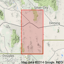
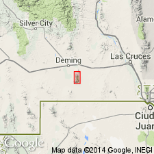
Pg. 3-4, geol. map. Bliss sandstone. Quartzose sandstone and glauconitic sandstone, calcareous near top. Glauconite is prominent constituent here in Silver City quadrangle (glauconite not mentioned in description of the beds in Franklin Mountains, El Paso quadrangle). Thickness 180+/- feet. Unconformably overlies pre-Cambrian complex. Unconformably underlies Ordovician El Paso limestone; contact placed where strata ceases to be dominantly arenaceous. Age is considered Late Cambrian, based on fossils identified by Ulrich.
Sections measured between Treasure Mountain and Silver City, Silver City quadrangle, Grant Co., west-central NM.
Source: Publication.
- Usage in publication:
-
- Bliss sandstone*
- Modifications:
-
- Revised
- Age modified
- Biostratigraphic dating
- AAPG geologic province:
-
- Permian basin
Summary:
Pg. 153-156. Type Bliss has hitherto been classed as Cambrian, but paleontological evidence for this is questionable. Type locality may be Ordovician.
In Van Horn region, Culberson and Hudspeth Counties, Texas, the Van Horn sandstone of Richardson (1904) is restricted to lower red arkosic part below the unconformity. The upper, white quartzose sandstones above the unconformity are included in the Bliss, based on lithologic and paleontologic similarities, and stratigraphic relations. Fossils collected from the Bliss in the Van Horn region, identified by Josiah Bridge, include SCOLITHUS [SKOLITHOS] worm tubes, ECCYLIOMPHALUS and OPHILETA gastropods, and rare HYSTRICURUS trilobites, indicating a Beekmantown age. Evidence for correlation seems sufficiently definite for the beds at Van Horn to be termed Bliss and reclassified as of Ordovician age based on fauna. These beds are overlain, perhaps disconformably, by El Paso limestone. The basal El Paso limestone at its type section in Franklin Mountains contains the PILOCERAS-CALATHIUM faunal assemblage (upper Beekmantown); this same zone occurs directly above the Bliss at Van Horn.
Source: Publication; US geologic names lexicon (USGS Bull. 1200, p. 384-385).
- Usage in publication:
-
- Bliss sandstone
- Modifications:
-
- Age modified
- AAPG geologic province:
-
- [Basin-and-Range province]
Summary:
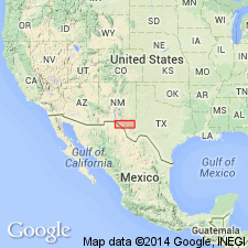
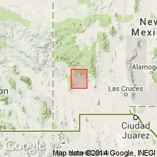
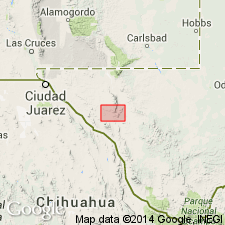
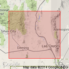
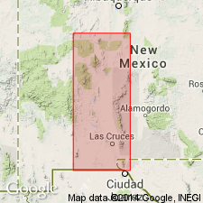
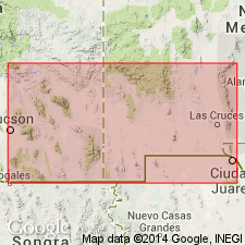
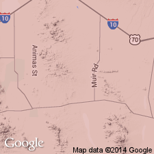
Pg. 19-20, [pl. 1]. Bliss sandstone. In this report, Bliss sandstone in New Mexico is considered to be of Cambrian age because of (1) valid evidence in Silver City area [Grant County] and in Sierra Caballos [Sierra County], (2) presence of thick sandstones of known Cambrian age in southeastern Arizona, and (3) lithologic and stratigraphic similarity between Silver City and Sierra Caballos occurrences and outcrops of basal sandstones called Bliss in Cooks Peak and in Mimbres, Florida, Organ, and San Andres Mountains [Dona Ana, Grant, Lincoln, Luna, Sierra, and Socorro Counties, southwestern New Mexico].
Source: US geologic names lexicon (USGS Bull. 1200, p. 384-385).
- Usage in publication:
-
- Bliss sandstone*
- Modifications:
-
- Age modified
- AAPG geologic province:
-
- [Orogrande basin]
Summary:
Pg. 67-69, 369. Bliss sandstone. Age of Bliss sandstone remains unsettled, but evidence seems to slightly favor its tentative consideration as Early Ordovician.
Source: US geologic names lexicon (USGS Bull. 1200, p. 384-385).
- Usage in publication:
-
- Bliss sandstone
- Modifications:
-
- Areal extent
- AAPG geologic province:
-
- Orogrande basin
Summary:
Pg. 2200-2213. Bliss sandstone. Underlies Sierrite limestone (new) of El Paso group. Age is considered Late Cambrian. [See also entry under Kelley and Silver (1952).]
Source: US geologic names lexicon (USGS Bull. 1200, p. 384-385).
- Usage in publication:
-
- Bliss formation
- Modifications:
-
- Redescribed
- AAPG geologic province:
-
- Orogrande basin
Summary:
Pg. 31 (table), 33-39. Bliss formation. Designated as formation because of diverse lithology. Overlies Precambrian; underlies Sierrite formation of El Paso group. Thickness 110 to 160 feet. Age is considered Cambrian.
Area of report is Caballo Mountains.
Source: US geologic names lexicon (USGS Bull. 1200, p. 384-385).
- Usage in publication:
-
- [Bliss sandstone]
- Modifications:
-
- Age modified
- AAPG geologic province:
-
- Orogrande basin
Summary:
Pg. 2054-2055. Paleontological evidence indicates that base of Bliss may be as old as middle of Franconia and its top may extend into earliest Ordovician.
Source: US geologic names lexicon (USGS Bull. 1200, p. 384-385).
- Usage in publication:
-
- Bliss sandstone
- Modifications:
-
- Age modified
- AAPG geologic province:
-
- [Basin-and-Range province]
Summary:
Pg. 14-16. Bliss sandstone in San Andres Mountains considered to be Ordovician in age. At base of Bliss, however, are unfossiliferous beds lithologically similar to those bearing Upper Cambrian fossils in Caballo and San Diego Mountains. Summary discussion of unit.
Source: US geologic names lexicon (USGS Bull. 1200, p. 384-385).
- Usage in publication:
-
- Bliss Formation
- Modifications:
-
- Areal extent
- AAPG geologic province:
-
- Pedregosa basin
Summary:
Bliss Formation. Exposed in Sierra Rica and Big Hatchets area, Hidalgo County, New Mexico. Consists of (ascending): (1) arkosic sediments; (2) well-sorted quartz sand; and (3) dolomite mud. Interpreted to be a marine sandstone deposited along shoreline of advancing sea. Unconformably overlies Precambrian granite. Conformably underlies Sierrite Member of El Paso Formation. Correlative with Abrigo Limestone of Arizona (fig. 4). Fossils (brachiopods, SKOLITHUS worm tubes). Age is considered Late Cambrian (Dresbachian?, Franconian, and Trempealeauan) and may extend into Ordovician.
Sections measured in
(1) Mescal Canyon, in NE/4 SE/4 sec. 29, T. 30 S., R. 15 W., 192 feet thick;
(2) Chaney Canyon, in S/2 NW/4 sec. 31, T. 30 S., R. 15 W., 327 feet thick;
(3) Ram Gorge, in NW/4 SE/4 sec. 20, T. 30 S., R. 15 W., 249 feet thick;
(4) Hatchet Gap, in S/2 sec. 1, T. 30 S., R. 16 W., 223 feet thick.
Source: Modified from GNU records (USGS DDS-6; Denver GNULEX).
- Usage in publication:
-
- Bliss Sandstone*
- Modifications:
-
- Overview
- Dominant lithology:
-
- Sandstone
- AAPG geologic province:
-
- Orogrande basin
- Pedregosa basin
Summary:
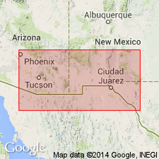
Bliss Sandstone. Name applied to a dominantly sandstone sequence beneath the El Paso Limestone, from El Paso, Texas, westward to eastern Hidalgo County, New Mexico. To the west upper part becomes dolomitic. To the north of Bliss, Texas, formation contains oolitic hematite and thin carbonate units. Thickness ranges from 30 to 90 m; thickness variations due to irregularities or unevenness of the underlying Precambrian surface. Becomes progressively older from east (Texas) to west (southwestern New Mexico). In general age is Cambrian and Ordovician.
Source: Modified from GNU records (USGS DDS-6; Denver GNULEX).
- Usage in publication:
-
- Bliss Sandstone*
- Modifications:
-
- Principal reference
- Dominant lithology:
-
- Sandstone
- AAPG geologic province:
-
- Basin-and-Range province
- Orogrande basin
- Pedregosa basin
- Permian basin
Summary:
Pg. 2-3 (fig. 1), 27-35, 80, 82, 96-98 (table 1), pl. 1. Bliss Sandstone. Recognized in western Texas, southern New Mexico and Arizona. East of type locality consists almost wholly of sandstone; to northwest and west of type includes 10+ percent sandy limestone or dolomite and/or siltstone or shale. Thickness 0 to about 375 feet. Unconformably overlies Precambrian rocks. At most places conformably underlies El Paso Group. Age is considered Late Cambrian to Early Ordovician based on fossils; becomes younger from west to east.
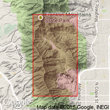
Principal reference section: in McKelligon Canyon, Franklin Mountains, approx. Lat. 31 deg. 50.5 min. N., Long. 106 deg. 39.5 min. W., El Paso quadrangle, El Paso Co., western TX (geology of area mapped by Richardson, USGS Geol. Atlas El Paso folio, 1909).
Type locality [area] stated to be in Franklin Mountains, between Hitt Canyon and Scenic Drive, [btw. Lat. 31 deg. 47 min. N., Long. 106 deg. 29 min. W. and Lat. 32 deg. 00 min. N., Long. 106 deg. 30 min. W.], El Paso quadrangle, El Paso Co., western TX.
Source: Publication.
- Usage in publication:
-
- Bliss Sandstone*
- Modifications:
-
- Mapped
- AAPG geologic province:
-
- Pedregosa basin
Summary:
Bliss Sandstone. Mapped in central Peloncillo Mountains, Hidalgo County, New Mexico. Unconformably overlies Precambrian granite porphyry; basal part [thickness unspecified] consists of reworked Precambrian regolith. Unconformably underlies El Paso Limestone (Lower Ordovician). Age is Late Cambrian, based on age of trilobites reported by Sabins (1957) from temporally correlative Bolsa Quartzite, on Blue Mountain 22 km to the west in Chiricahua Mountains, Arizona.
Source: Modified from GNU records (USGS DDS-6; Denver GNULEX).
- Usage in publication:
-
- Bliss Sandstone*
- Modifications:
-
- Age modified
- Geochronologic dating
- AAPG geologic province:
-
- Basin-and-Range province
Summary:
Pg. 742-743, 750. Bliss Sandstone. In the Florida Mountains, Luna County, New Mexico, primarily an arkosic sandstone with hematite, silica, and calcite cements. Basal beds are locally conglomeratic, containing clasts of the underlying alkalic plutonic complex. Thickness varies from 0 to 60 m, reflecting the irregular pre-Bliss erosional surface. U-Th-Pb isotope ages (zircon) from the underlying alkalic plutonic complex indicate deposition of the Bliss was after 503 +/-10 Ma, which roughly corresponds to the Cambrian-Ordovician boundary of Palmer (1983).
Source: Publication.
- Usage in publication:
-
- Bliss Sandstone*
- Modifications:
-
- Age modified
- Biostratigraphic dating
- AAPG geologic province:
-
- Orogrande basin
Summary:
Conodonts from type region of Bliss Sandstone indicate at least upper three-quarters of formation is Early Ordovician (early Canadian; ROSSODUS MANITOUENSIS zone). [In westernmost exposures, near Arizona-New Mexico state line, most of the Bliss Sandstone is Late Cambrian age.] Same fauna occurs in overlying El Paso Group, arguing against any significant time gap in deposition between the two units.
Measured section: above Scenic Drive [approx. Lat. 31 deg. 47 min. 32 sec. N., Long. 106 deg. 28 min. 25 sec. W.], El Paso 7.5-min quadrangle, El Paso, Texas, at south end of Franklin Mountains, where the Bliss is about 278 feet thick.
Source: Publication.

- Usage in publication:
-
- Bliss Formation*
- Modifications:
-
- Mapped 1:24k
- Dominant lithology:
-
- Sandstone
- Dolomite
- Conglomerate
- Siltstone
- AAPG geologic province:
-
- Pedregosa basin
Summary:
Bliss Formation. Very light-gray to yellowish-brown sandstone with some interbedded dolomite near top. Includes a pebble and cobble conglomerate at base. Thickness about 192 to 327 feet (60 to 100 m). Overlies Middle Proterozoic granite with angular unconformity. Underlies El Paso Formation (Lower Ordovician). Sparsely fossiliferous. Age is Late Cambrian and Early Ordovician. Is oldest Paleozoic unit mapped in study area, Big Hatchet Mountains, Hidalgo County, southwestern New Mexico.
Source: Publication.
- Usage in publication:
-
- Bliss Formation
- Modifications:
-
- Areal extent
- AAPG geologic province:
-
- Orogrande basin
- Permian basin
Summary:
Pg. 173. Bliss Formation. Quartzitic sandstone. Divided into a lower member, strongly hematitic sandstone (ore-grade in some areas), and an upper member, sandstone with abundant glauconite and significantly more carbonate. Total thickness 77.64 m in McKelligon Canyon, Franklin Mountains, western Texas [=principal reference section, Hayes and Cone, 1975, USGS Prof. Paper 873, p. 27]. Overlies Red Bluff Granite. Underlies Sierrite Member of Hitt Canyon Formation of El Paso Group. Age is Late Cambrian to Early Ordovician (Sunwaptan to Skullrockian; conodont biozones PROCONODONTUS TENUISERRATUS to ROSSODUS MANITOUENSIS; trilobite biozones SARATOGIA to SYMPHYSURINA). Biostratigraphic data is sparse, but available data suggests that the base of the upper member in New Mexico is significantly older than the base of the upper member in Texas.
Field trip stops: Cable Canyon, Caballo Mountains, [Sierra Co.], NM; Scenic Drive, Franklin Mountains, [Dona Ana Co.], NM; McKelligon Canyon, Franklin Mountains, [El Paso Co.], TX; and Hueco Mountains, [El Paso Co.], TX.
Source: Publication.
For more information, please contact Nancy Stamm, Geologic Names Committee Secretary.
Asterisk (*) indicates published by U.S. Geological Survey authors.
"No current usage" (†) implies that a name has been abandoned or has fallen into disuse. Former usage and, if known, replacement name given in parentheses ( ).
Slash (/) indicates name conflicts with nomenclatural guidelines (CSN, 1933; ACSN, 1961, 1970; NACSN, 1983, 2005, 2021). May be explained within brackets ([ ]).