

- Usage in publication:
-
- Blair formation*
- Modifications:
-
- Original reference
- Dominant lithology:
-
- Sandstone
- Shale
- AAPG geologic province:
-
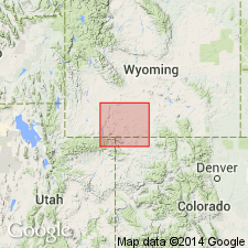
- Green River basin
Summary:
[Blair formation of Mesaverde group.] Drab yellow, and brown sandstones and interbedded shale and shaly sandstone with little or no bituminous matter; massive sandstones are grouped near top of formation, giving rise to the "golden wall," and are the "Goldenwall sandstone" of Powell. Thickness 1,000 to 1,200 feet. In previous reports included in Mesaverde formation. May possibly belong to the Mesaverde, but seems to be older, and for present at least the base of Rock Springs coal group is regarded as base of Mesaverde. The Blair constitutes a distinct lithologic unit. Overlies Baxter shale. Age is Late Cretaceous.
Named from exposures at Blair Ranch, east of Aspen Mountain, [in T. 17 N., R. 103 W.], Sweetwater Co., southwestern WY.
Source: US geologic names lexicon (USGS Bull. 896, p. 210).
- Usage in publication:
-
- Blair formation*
- Modifications:
-
- Revised
- AAPG geologic province:
-
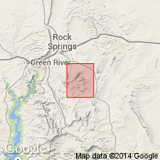
- Green River basin
Summary:
Mancos-Mesaverde contact placed at the base of the Blair formation, a horizon that represents a change from shale below (Baxter shale) to sandstone, shale, and coal above (Blair formation). The basal Mesaverde contact in WY will be in keeping with the lithologic boundary used in CO. The Blair newly added to the Mesaverde [and therefore removed from the Montana group]. Overlain by the Rock Springs formation (formerly called Rock Springs coal group) of the Mesaverde. Geologic map. Cross section. Tongues out into the Mancos shale to the south. Stratigraphic table. Report area lies in Sweetwater Co, WY in the Greater Green River basin. Of Late Cretaceous age.
Source: GNU records (USGS DDS-6; Denver GNULEX).
- Usage in publication:
-
- Blair formation
- Modifications:
-
- Overview
- Revised
- AAPG geologic province:
-
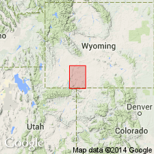
- Green River basin
Summary:
Is revised to include the Chimney Rock tongue (new), named as uppermost unit in the Blair formation of the Mesaverde group on the Rock Springs uplift, Greater Green River basin, WY. Is basal formation of Mesaverde. Overlies Baxter shale. Underlies Rock Springs formation of Mesaverde. Thickness is noted to range from 890 ft in northern subsurface to 1,776 ft near the type locality; is 920 ft thick on Rock Springs uplift. Is an alternating sequence of gray sandy marine shale and ripple-marked sandstone in transitional contact with marine sandstone at the base and top. Lack of diagnostic fossil fauna makes detailed correlation impossible; is tentatively considered equivalent to upper Telegraph Creek and lower Eagle. Age is Late Cretaceous.
Source: GNU records (USGS DDS-6; Denver GNULEX).
- Usage in publication:
-
- Blair formation
- Modifications:
-
- Revised
- AAPG geologic province:
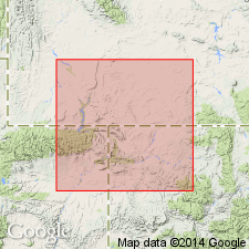
-
- Green River basin
Summary:
Chimney Rock tongue (formerly a tongue at top of Blair) reassigned as tongue at base of Rock Springs formation on Rock Springs uplift, Sweetwater Co, WY in Greater Green River basin. Age is Late Cretaceous.
Source: GNU records (USGS DDS-6; Denver GNULEX).

- Usage in publication:
-
- Blair Formation*
- Modifications:
-
- Overview
- AAPG geologic province:
-
- Green River basin
Summary:
Is the lowest formation (of four formations) in Mesaverde Group on the Rock Springs uplift, Greater Green River basin, WY. Correlation of this unit of early Campanian, Late Cretaceous age with other units of this age in south-central WY shown on table 1.
Source: GNU records (USGS DDS-6; Denver GNULEX).
For more information, please contact Nancy Stamm, Geologic Names Committee Secretary.
Asterisk (*) indicates published by U.S. Geological Survey authors.
"No current usage" (†) implies that a name has been abandoned or has fallen into disuse. Former usage and, if known, replacement name given in parentheses ( ).
Slash (/) indicates name conflicts with nomenclatural guidelines (CSN, 1933; ACSN, 1961, 1970; NACSN, 1983, 2005, 2021). May be explained within brackets ([ ]).