

- Usage in publication:
-
- Blaine division
- Modifications:
-
- Original reference
- Dominant lithology:
-
- Shale
- Gypsum
- Dolomite
- AAPG geologic province:
-
- Anadarko basin
- Palo Duro basin
- Sedgwick basin
Summary:
Pg. 42, 47. Blaine division. Red shales, with interbedded strata of gypsum and dolomite, averaging 75 feet in thickness, divided into following members (descending): Shimer gypsum; Altona dolomite; red shale (Jenkins clay of Cragin); Medicine Lodge gypsum; Magpie dolomite; red shale; and Ferguson gypsum. Overlies Norman division (Enid group) and underlies Woodward division (group). Where Ferguson gypsum member disappears the underlying Norman (Enid) division extends up to base of Medicine Lodge gypsum. [Age is Permian.]
[Named from exposures in Blaine Co., western OK.]
[GNC remark (ca. 1925, US geologic names lexicon, USGS Bull. 896, p. 209): In Texas the top member has been called Acme dolomite and basal member Quanah gypsum. The formation underlying the Blaine in Oklahoma was named Chickasha formation by Gould in 1924.]
Source: US geologic names lexicon (USGS Bull. 896, p. 209).
- Usage in publication:
-
- Blaine gypsum*
- Modifications:
-
- Revised
- AAPG geologic province:
-
- Anadarko basin
- Palo Duro basin
- South Oklahoma folded belt
Summary:
Modified the definition of Blaine gypsum so as to include beds above Shimer gypsum and below Ferguson gypsum, and discarded †Greer formation. The Blaine as mapped included all beds from top of Chickasha formation up to base of Dog Creek shale. [Age is Permian.]
Source: US geologic names lexicon (USGS Bull. 896, p. 209).
- Usage in publication:
-
- Blaine formation
- Modifications:
-
- Revised
- AAPG geologic province:
-
- Bend arch
- Palo Duro basin
- Permian basin
Summary:
Pg. 950-951, pl. 9. Blaine formation of Double Mountain group. As here described it includes considerably more than in the Oklahoma section. Terms "Chickasha formation" and "Dog Creek shales" are not used because the equivalents of these members in Texas, although recognizable in most places, are not especially outstanding. Those beds between the San Angelo formation and the Whitehorse sandstone have been included in the Blaine, as all are similar and belong together. The southwestern Oklahoma section of Blaine commences about 200 feet above Duncan sandstone, and top is represented by Acme gypsum of the Texas section. Mapped as a wide belt in Hardeman and Childress Counties, Texas, which converges to a narrow strip in western Taylor County and eastern Nolan County, due to thinning of the southern section, the latter measuring about 375 feet, although the thickness in northern area, in Hardeman and Childress Counties, is almost 600 feet. Throughout nearly all of its outcrop, the Blaine is recognized by a rough, hilly topography, covered with heavy growth of stunted cedar trees. Beds of heavy gypsum intercalated with thin beds of red and blue shale comprise most of the formation, and the thicker shale beds are ordinarily gypsiferous and contain thin laminae of gypsum and satin spar. Several of the gypsum and dolomite beds can be traced almost the entire distance from the Red River to the Cretaceous overlap. Separately mapped beds are (ascending): Mangum dolomite, Acme dolomite, Guthrie dolomite, and Childress dolomite; these are the most prominent and are sufficiently close together to make useful reference points for stratigraphic and structural work. Age is Late Permian.
Source: Publication.
- Usage in publication:
-
- [Blaine formation]
- Modifications:
-
- Not used
- AAPG geologic province:
-
- Anadarko basin
Summary:
Pg. 161-172. Blaine [formation]. Evidences in field seem to indicate Blaine should be dropped and some new formation name be adopted to include what now comprises Blaine and Dog Creek beds.
Source: US geologic names lexicon (USGS Bull. 896, p. 209).
- Usage in publication:
-
- Blaine formation
- Modifications:
-
- Revised
- AAPG geologic province:
-
- Anadarko basin
Summary:
Pg. 405-432. Blaine formation includes Medicine Lodge, Shimer, Lovedale (new), and Haskew (new) gypsum members. [Age is Permian.]
Source: US geologic names lexicon (USGS Bull. 1200, p. 379).

- Usage in publication:
-
- Blaine formation
- Modifications:
-
- Overview
- AAPG geologic province:
-
- Bend arch
- Palo Duro basin
- Permian basin
Summary:
Pg. 168, 178. Blaine formation as now used in Texas includes more than does Blaine of type locality in Oklahoma. Not only is underlying Chickasha, or a part of it, merged with the Blaine in Texas usage, but overlying Dog Creek of Oklahoma is included in part or entirely. Childress dolomite and gypsum is top member of Blaine in Texas and Quanah gypsum lies near base. [Age is Permian.]
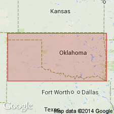
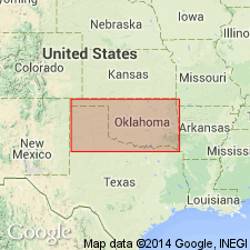
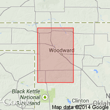
[Type locality in Salt Creek (Henquenet's) Canyon in northern Blaine Co., western OK.]
Source: US geologic names lexicon (USGS Bull. 896, p. 209).
- Usage in publication:
-
- Blaine formation
- Modifications:
-
- Areal extent
- AAPG geologic province:
-
- Anadarko basin
Summary:
Pg. 1300. Blaine formation. Gave detailed section of Blaine formation at type locality in Salt Creek Canyon, Blaine County, Oklahoma, showing it as underlying Dog Creek shales, overlying Flowerpot [Flower-pot] shales, and including Lovedale gypsum at top, Shimer gypsum in middle and Medicine Lodge gypsum 2 feet above base. [Age is Permian.]
Source: US geologic names lexicon (USGS Bull. 896, p. 209).
- Usage in publication:
-
- Blaine formation
- Modifications:
-
- Revised
- AAPG geologic province:
-
- Anadarko basin
- South Oklahoma folded belt
Summary:
Pg. 1468-1469. Blaine formation. In central and west-central Oklahoma, includes (ascending) Medicine Lodge, Alabaster (new), Shimer, Lovedale, and Haskew members. Thickness about 125 feet. [Age is Permian.]
Source: US geologic names lexicon (USGS Bull. 1200, p. 379).
- Usage in publication:
-
- Blaine gypsum
- Modifications:
-
- Revised
Summary:
Blaine gypsum of Double Mountain group. Mapped in Double Mountain group.
Source: US geologic names lexicon (USGS Bull. 1200, p. 379).
- Usage in publication:
-
- Blaine formation*
- Modifications:
-
- Revised
- AAPG geologic province:
-
- Anadarko basin
- Sedgwick basin
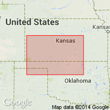
Summary:
Pg. 1764 (fig. 3), 1766, 1793-1799. Blaine formation. In Kansas, included in Salt Fork division of Cimarron series. Includes (ascending) Medicine Lodge, Nescatunga (new), Shimer, and Haskew gypsum members. Overlies Flowerpot [Flower-pot] shale; underlies Dog Creek shales. [Age is Permian.]
Source: US geologic names lexicon (USGS Bull. 1200, p. 379).

- Usage in publication:
-
- Blaine gypsum
- Modifications:
-
- Areal extent
Summary:
Pg. 66 (fig. 1). Blaine gypsum. Included in El Reno (San Andres) group in Texas. [Age is Permian.]
Source: US geologic names lexicon (USGS Bull. 1200, p. 379).
- Usage in publication:
-
- Blaine gypsum*
- Modifications:
-
- Revised
- AAPG geologic province:
-
- Permian basin
Summary:
Pl. 2. Blaine gypsum. Included in El Reno group in Texas; †Double Mountain group abandoned. [Age is Permian.]
Source: US geologic names lexicon (USGS Bull. 1200, p. 379).
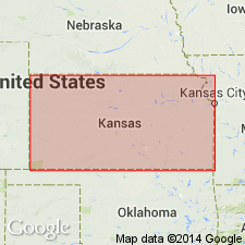
- Usage in publication:
-
- Blaine formation
- Modifications:
-
- Overview
Summary:
Pg. 158, 161 (fig. 4). Blaine formation. In Kansas, included in Nippewalla group. Comprises (ascending) Medicine Lodge, Nescatunga, Shimer, and Haskew gypsum members. Thickness about 50 feet. Underlies Dog Creek shale; overlies Flowerpot [Flower-pot] shale. [Age is Early Permian (Leonardian).]
Source: US geologic names lexicon (USGS Bull. 1200, p. 379).
- Usage in publication:
-
- Blaine formation
- Modifications:
-
- Revised
Summary:
Pg. 893-907. Blaine formation. Included in Pease River group in Texas.
Source: US geologic names lexicon (USGS Bull. 1200, p. 379).

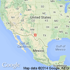
- Usage in publication:
-
- Blaine formation*
- Modifications:
-
- Areal extent
- AAPG geologic province:
-
- Anadarko basin
- Las Animas arch
- Las Vegas-Raton basin
Summary:
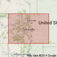
Extended into the subsurface of Otero County, Colorado, on the Las Animas arch, Las Animas County, Colorado, in the Las Vegas-Raton basin, and Baca County, Colorado, in the Anadarko basin. Correlates with Lykins formation; may be equivalent of the Lykins formation of Otero County. Underlies Whitehorse sandstone. Age is Permian. Report includes correlation chart.
Source: Modified from GNU records (USGS DDS-6; Denver GNULEX).
- Usage in publication:
-
- Blaine formation
- Modifications:
-
- Revised
- AAPG geologic province:
-
- Anadarko basin
Summary:
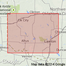
Pg. 16-28, pl. 1. Blaine formation of El Reno group. In Carter area [Beckham County, Oklahoma], redefined to include all strata, characterized by thick gypsum beds, that lie between Flowerpot [Flower-pot] shale below and Dog Creek shale above. Comprises (ascending) Haystack gypsum, Cedartop gypsum, Collingsworth gypsum, Mangum dolomite, and Van Vacter gypsum (new) members. Three intervening shale beds are unnamed. The thin Chaney and Kiser gypsums are excluded from the Blaine and placed in underlying [Flower-pot] shale. Thickness 130 to 140 feet. El Reno group. [Age is Middle Permian (Guadalupe).]
Source: US geologic names lexicon (USGS Bull. 1200, p. 379).
- Usage in publication:
-
- Blaine formation
- Modifications:
-
- Areal extent
- AAPG geologic province:
-
- Anadarko basin
Summary:
Pg. 24 (fig. 6), 27-34, pl. 1. Blaine formation of El Reno group. Described in Harper County, western Oklahoma, where it consists of four gypsum members interbedded with red shales and some dolomite, which lie above the Flowerpot [Flower-pot] shale and below the Dog Creek. Named members are (ascending) Medicine Lodge, Nescatunga, Shimer, and Haskew. Thickness about 90 feet. El Reno group. [Age is Middle Permian (Guadalupian).]
Source: US geologic names lexicon (USGS Bull. 1200, p. 379).
- Usage in publication:
-
- Blaine Formation
- Modifications:
-
- Areal extent
- AAPG geologic province:
-
- Permian basin
Summary:
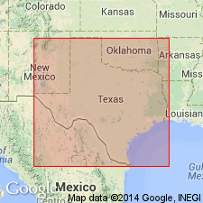
Area of report is in central Texas; in this area the Whitehorse Sandstone and Cloud Chief Gypsum are mapped undivided. Separately mapped units of Whitehorse and Cloud Chief include (ascending): Childress Dolomite, Eskota Gypsum, and Claytonville Dolomite. Whitehorse Sandstone and Cloud Chief Gypsum (undivided) are mapped in Nolan, Coke, and Stonewall Counties, Texas; Whitehorse Sandstone, Cloud Chief Gypsum, and Blaine Formation (undivided) are mapped in Runnels and Nolan Counties, Texas. Whitehorse, Cloud Chief, and Blaine (undivided) overlie Permian San Angelo Formation and underlie Permian Quartermaster Formation. Assigned to the Permian. Report includes geologic map.
Source: GNU records (USGS DDS-6; Denver GNULEX).
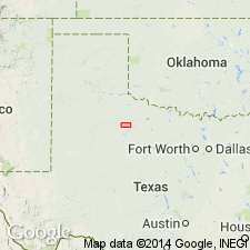
- Usage in publication:
-
- Blaine Formation
- Modifications:
-
- Areal extent
- AAPG geologic province:
-
- Bend arch
Summary:
Blaine Formation of Pease River Group. In subsurface of northwestern Jones County, north-central Texas, cannot be easily separated from the Flowerpot [Flower-pot] Shale, thus for purposes of this report "Blaine" includes all Permian sediments above the San Angelo Formation. Consists of red to gray gypsiferous shales in the lower part, anhydrite or gypsum and dolomite near the middle, and calcareous sandstone and dolomite in the upper part. Thickness about 55 feet.
Source: Modified from GNU records (USGS DDS-6; Denver GNULEX).
- Usage in publication:
-
- Blaine Formation*
- Modifications:
-
- Areal extent
- AAPG geologic province:
-
- Anadarko basin
Summary:
Blaine Formation. Occurs above the Nippewalla Group and below the Dog Creek Shale in eastern Colorado and western Kansas. Correlates with: (1) Minnekahta Limestone of northern Front Range, Colorado, and south-central Wyoming; (2) Rex Chert Member of Phosphoria Formation of northeast Utah and northwest Colorado; and (3) San Andres Limestone of northeast New Mexico.
Source: Modified from GNU records (USGS DDS-6; Denver GNULEX).

- Usage in publication:
-
- Blaine Formation
- Modifications:
-
- Mapped 1:250k
- Age modified
- Dominant lithology:
-
- Mudstone
- Gypsum
- Dolomite
- Sandstone
- AAPG geologic province:
-
- Palo Duro basin
- Permian basin
Summary:
Blaine Formation, uppermost formation of Pease River Group. Mudstone and gypsum, with lesser dolomite and sandstone. Mudstone, locally silty, brownish-red and gray-green; thin lenses and discordant seams of satin spar and selenite gypsum and thin beds and nodules of alabaster gypsum common. Gypsum, typically of nodular alabaster, friable, white, gray, and light-green, thick-bedded in units 1 to 10 feet thick, occurs also in laminated, dolomitic beds; units pinch out locally in outcrop owing to dissolution. Base of formation is placed at first occurrence of bedded gypsum. Minor channel-fill sandstone mostly near base, reddish-brown, fine-grained, cross-bedded, laminated, cross-laminated, cemented with calcite and dolomite, local zones of copper mineralization. Total thickness 250 to 400 feet; upper part of formation not exposed. Locally (Foard and Hardeman Counties) faulted and folded due to gypsum and salt(?) dissolution (karst). Includes (descending): Aspermont Dolomite, Guthrie Dolomite, Acme Dolomite, and Mangum Dolomite; separately mapped. Overlies San Angelo Formation, basal formation of Pease River Group. Lies below Trinity and younger deposits. Age is Middle Permian (Guadalupian).
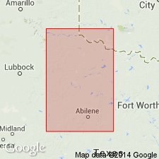
Mapped in King, Knox, Foard, and Hardeman Cos., TX.
Source: Publication; supplemental information from GNU records (USGS DDS-6; Denver GNULEX).
- Usage in publication:
-
- Blaine Formation
- Modifications:
-
- Revised
- AAPG geologic province:
-
- Anadarko basin
- Palo Duro basin
- South Oklahoma folded belt
Summary:
Blaine Formation, 1 of 5 formations assigned to the El Reno Group. Divided into (ascending) Elm Fork Member (first published use) and Van Vacter Member (revised). Elm Fork has six named persistent beds. Gypsum Creek Gypsum Bed (first published use) is the basal bed at several localities. Where Gypsum Creek is missing, the Haystack Gypsum Bed (rank reduced) is the basal bed. The remaining sequence of the Elm Fork is (ascending) unnamed shale, Jester Dolomite Bed (reassigned to Elm Fork), Cedartop Gypsum Bed (rank reduced), unnamed shale, Creta Dolomite Bed (rank reduced), Collingsworth Gypsum Bed (rank reduced), and an upper unnamed shale. The Mangum Dolomite Bed, the most significant bed in the Blaine, is used as the base of unit 1 of Van Vacter Member; formerly Mangum designated a member of Blaine. Unit 1 is overlain (in sequence) by: units 2, 3, 4, 5, and 6. Acme Dolomite Bed is the basal bed of unit 6. Ranges between 135 to 255 feet thick. Considered to be a cyclic deposit; each cycle has (in ascending order) dolomite, gypsum, red-brown shale, gray-green shale. Overlies Flowerpot [Flower-pot] Shale; underlies Dog Creek Shale. Age is Permian. Cross sections.
Source: GNU records (USGS DDS-6; Denver GNULEX).

- Usage in publication:
-
- Blaine Formation
- Modifications:
-
- Mapped 1:250k
- Dominant lithology:
-
- Shale
- Sandstone
- Gypsum
- Dolomite
- AAPG geologic province:
-
- Palo Duro basin
- Permian basin
Summary:
Blaine Formation. Consists of interbedded shale, sandstone, gypsum, and dolomite. Shale, silty, in part calcareous, selenitic, in part very thin-bedded, mostly indistinctly bedded to massive, various shades of gray and red. Sandstone, fine-grained quartz, silty, locally cross-bedded, moderately indurated, red. Gypsum, thin-bedded to massive, contorted, white, bluish-gray, pink. Dolomite, locally calcitic and argillaceous, sand scarce, locally oolitic, beds a few inches to 3 feet in units up to 10 feet thick, various shades of gray streaked purple and pink, white. Includes (from youngest to oldest) Aspermont Dolomite, Guthrie Dolomite, Acme Dolomite, Mangum Dolomite [all unranked]. Marine megafossils are scarce. Total thickness is 650 to 700 feet (includes additional beds both above and below boundaries of type Blaine in Oklahoma). Overlies San Angelo Formation; underlies Childress Dolomite [unranked] at base of Cloud Chief Gypsum. Age is Permian.
[Mapped along eastern margin of map sheet in Cottle, Foard, King, and Stonewall Cos., TX.]
Source: Publication.
For more information, please contact Nancy Stamm, Geologic Names Committee Secretary.
Asterisk (*) indicates published by U.S. Geological Survey authors.
"No current usage" (†) implies that a name has been abandoned or has fallen into disuse. Former usage and, if known, replacement name given in parentheses ( ).
Slash (/) indicates name conflicts with nomenclatural guidelines (CSN, 1933; ACSN, 1961, 1970; NACSN, 1983, 2005, 2021). May be explained within brackets ([ ]).