- Usage in publication:
-
- Blacklead limestone
- Modifications:
-
- Original reference
- Dominant lithology:
-
- Limestone
- AAPG geologic province:
-
- Idaho Mountains province
Summary:
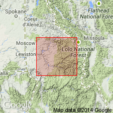
Blacklead limestone. Massive, thick-bedded limestone greatly resembling the grayish thick-bedded Paleozoic limestones in Montana, and in Idaho southeast of Salmon River Mountains. Considerably metamorphosed by intrusives, so that no fossils are preserved, but bedding is everywhere distinct. Magnetite in seams and lenses is extensively developed through the limestone along bedding planes and fractures, the result of contact metamorphism. Thickness 400+ feet; base not exposed. Lies far back in Clearwater Mountains, at head of Cayuse Creek, a tributary of North Fork of Clearwater River. Forms an engulfed block or pendant 2+/- miles long and 0.5 mile wide near north margin of Idaho batholith, in a high glaciated valley between Blacklead Peak and Rhodes Creek. Assigned to Paleozoic(?) (pre-Permian).
[Derivation of name not stated, but almost certainly is Blacklead mining district, Orofino region, Clearwater Co., northern ID.]
Source: US geologic names lexicon (USGS Bull. 896, p. 203).

- Usage in publication:
-
- Blacklead limestone
- Modifications:
-
- Overview
- AAPG geologic province:
-
- Idaho Mountains province
Summary:
Pg. 701, chart no. 6 (column 49b, northern Idaho, collated by J. Steele Williams). Blacklead limestone. Age span of Pennsylvanian deposits of this region is not yet satisfactorily determined. Age shown on chart as Mississippian and Pennsylvanian.
Source: Publication; GNC index card files (USGS-Menlo); US geologic names lexicon (USGS Bull. 1200, p. 367).
For more information, please contact Nancy Stamm, Geologic Names Committee Secretary.
Asterisk (*) indicates published by U.S. Geological Survey authors.
"No current usage" (†) implies that a name has been abandoned or has fallen into disuse. Former usage and, if known, replacement name given in parentheses ( ).
Slash (/) indicates name conflicts with nomenclatural guidelines (CSN, 1933; ACSN, 1961, 1970; NACSN, 1983, 2005, 2021). May be explained within brackets ([ ]).

