The National Geologic Map Database is migrating to a new infrastructure. We apologize for any service disruptions during this process.
|
|---|


- Usage in publication:
-
- Bedford shale*
- Modifications:
-
- Original reference
- Dominant lithology:
-
- Shale
- AAPG geologic province:
-
- Appalachian basin
Summary:
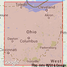
Pg. 21. Bedford shale. Red and blue clay shale, 60 feet thick, overlying Cleveland shale and underlying Berea grit in northern Ohio. Included in Waverly group. [Age is Devonian or Mississippian.]
[Named from Bedford, Cuyahoga Co., eastern OH.]
Source: US geologic names lexicon (USGS Bull. 896, p. 142).

- Usage in publication:
-
- Bedford shale*
- Modifications:
-
- Overview
- AAPG geologic province:
-
- Appalachian basin
Summary:
Bedford shale. For many years this formation was classified as Carboniferous. In 1912 (New York Acad. Sci. Annals, v. 22, p. 295) G.H. Girty placed it in Devonian. The same year C.S. Prosser (also E.M. Kindle) assigned it to Devonian, and repeated this classification in 1913, as did VerWiebe in 1917; but most geologists continue to classify it as Carboniferous. In 1914 the USGS adopted Devonian or Carboniferous as age designation of Bedford shale, and still classifies it thus.
Source: US geologic names lexicon (USGS Bull. 896, p. 142).
- Usage in publication:
-
- Bedford shale
- Modifications:
-
- Areal extent
- AAPG geologic province:
-
- Appalachian basin
Summary:
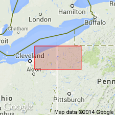
Bedford shale has been traced across Ohio and into Pennsylvania where it lies below the Berea and above the Cussewago sandstone. In Pennsylvania, name Cussewago was first applied to this shale by White (1881, Pennsylvania 2nd Geol. Survey Rpt. QQQQ), and later named Hayfield was substituted by Chadwick (1925, GSA Bull., v. 36, no. 3). The Hayfield has been found to be Bedford in present investigation. Name Bedford has priority; hence term Hayfield is invalid. [Age is Devonian and Mississippian(?).]
Source: US geologic names lexicon (USGS Bull. 1200, p. 267).
- Usage in publication:
-
- Bedford shale*
- Modifications:
-
- Principal reference
- Dominant lithology:
-
- Shale
- Siltstone
- AAPG geologic province:
-
- Appalachian basin
Summary:
Pg. 1354-1357; J.F. Pepper, Wallace de Witt, Jr., and D.F. Demarest, 1954, USGS Prof. Paper 259, p. 13, 21-25. Bedford shale. At type locality, composed of about 85 feet of light-gray silty shale, many platy siltstones, and some hard discordal limy nodules. A wedge of red shale, which is 25 feet thick in Independence Township and thins to featheredge on Cuyahoga-Lake County line, present in upper part of formation north of type locality. In eastern half of Cuyahoga County, contains two members: Sagamore siltstone and Euclid siltstone. Thins eastward from type locality to about 45 feet in western Trumbull County. Overlies Cleveland shale member of Ohio shale; contact gradational. Upper contact irregular in area between Cuyahoga County and Trumbull County, because Berea sandstone fills deep channels into, and in some places through, the Bedford. Traced into vicinity of Meadville, Crawford County, Pennsylvania. East of Grand River, underlain by Cussewago sandstone and overlain by siltstone facies of Berea. In vicinity of Meadville, Bedford shale and overlying siltstones of Berea sandstone grade laterally into Shellhammer Hollow formation (new) and lose identity as individual formations.
Type locality: near Bedford, along Tinkers Creek on east side of Cuyahoga River opp. town of Independence, Bedford Twp., [Cleveland 15-min quadrangle], Cuyahoga Co., eastern OH.
[GNC remark (ca. 1960, US geologic names lexicon, USGS Bull. 1200, p. 267): The USGS currently designated age of Bedford as Devonian and Mississippian(?) on basis of study now in progress.]
Source: US geologic names lexicon (USGS Bull. 1200, p. 267).
- Usage in publication:
-
- Bedford Shale*
- Modifications:
-
- Age modified
- Biostratigraphic dating
- AAPG geologic province:
-
- Michigan basin
- Appalachian basin
Summary:
The age of the Bedford Shale and the Berea Sandstone is changed from Late Devonian and Early Mississippian to Late Devonian only (late Famennian) in the Michigan and Appalachian basins because of the realignment of the Devonian-Mississippian boundary in the U.S. with the accepted Devonian-Carboniferous boundary in Europe. This agrees with the realignment in the Upper Mississippi Valley and the Western United States. Age is Late Devonian based on spores, conodonts, ammonoids, and by the close fit to the Devonian sea-level curve.
Source: GNU records (USGS DDS-6; Reston GNULEX).
- Usage in publication:
-
- Bedford Shale
- Modifications:
-
- Areal extent
- AAPG geologic province:
-
- Michigan basin
Summary:
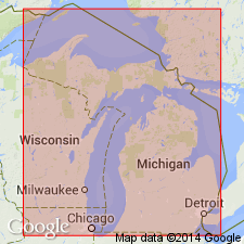
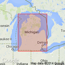
Bedford Shale and Berea Sandstone are not exposed in MI. They record, in the subsurface, a southwestward growth of a deltaic system into the Antrim sea during Kinderhookian time. The Bedford Shale is a bluish to light gray, silty shale that becomes sandy in its upper part and has a gradational contact with the overlying Berea Sandstone. It is commonly 15 to 30 m thick and thins and becomes fine grained to the west, where it intertongues with the Antrim. Reaches a maximum thickness of 76 m in the Michigan thumb area.
Source: GNU records (USGS DDS-6; Reston GNULEX).

- Usage in publication:
-
- Bedford Shale Member
- Modifications:
-
- Revised
- AAPG geologic province:
-
- Appalachian basin
Summary:
In this study, the Chattanooga Shale is divided into (ascending) Rhinestreet Shale, Upper Olentangy Shale, Ohio Shale, Bedford Shale, Berea Sandstone, and Sunbury Shale Members. The Chattanooga thins westward. Geophysical logs indicate that in the western region, unit consists of only the Sunbury, Berea-Bedford, and Ohio Members, the Rhinestreet and Olentangy having pinched out. The Berea-Bedford interval can be recognized in the eastern and central part of the study area. In the extreme eastern part of the study area, where the interval of Ohio Shale is dominated by gray shale, the Berea-Bedford interval is not recognized because it also is composed of mainly gray shale. The interval thickens eastward up to the extreme eastern part of the Pineville strike section, where it again begins to thin. According to the author, formal nomenclature presented in this report has been accepted by the Kentucky Stratigraphic Nomenclature Committee. Report includes correlation charts, cross-sections, and measured sections.
Source: GNU records (USGS DDS-6; Reston GNULEX).

- Usage in publication:
-
- Bedford Shale*
- Modifications:
-
- Areal extent
- AAPG geologic province:
-
- Appalachian basin
Summary:
Bedford Shale extended into western VA and the subsurface of northern TN. Overlies the Cleveland Shale Member or Bed and underlies the Berea Sandstone. The Bedford and Berea show a pattern of vertically increasing grain size. Locally, in northern OH, the Berea fills channels cut in the Bedford. Elsewhere, the boundary is gradational. Bedford-Berea sequence thins from more than 300 ft in northern OH to a featheredge in central KY. Locally, in eastern OH and central WV, the Bedford overlaps the Cleveland Member of the Ohio Shale. Age, according to stratigraphic chart, is Late Devonian and Early Mississippian.
[GNU remark (June 2, 1993, USGS DDS-6; Reston GNULEX): This manuscript was reviewed by GNU in 1987. Age does not agree with Gutschick and Sandberg (1991), who changed the age of the Bedford to Late Devonian only. Their manuscript was reviewed in 1989.]
Source: GNU records (USGS DDS-6; Reston GNULEX).
For more information, please contact Nancy Stamm, Geologic Names Committee Secretary.
Asterisk (*) indicates published by U.S. Geological Survey authors.
"No current usage" (†) implies that a name has been abandoned or has fallen into disuse. Former usage and, if known, replacement name given in parentheses ( ).
Slash (/) indicates name conflicts with nomenclatural guidelines (CSN, 1933; ACSN, 1961, 1970; NACSN, 1983, 2005, 2021). May be explained within brackets ([ ]).