

- Usage in publication:
-
- Banbury volcanics*
- Modifications:
-
- Original reference
- Dominant lithology:
-
- Basalt
- Tuff
- AAPG geologic province:
-
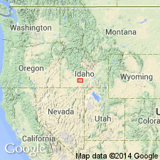
- Snake River basin
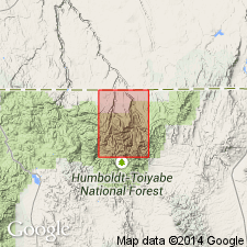
Summary:
Pg. 434-439; H.T. Stearns, 1932 (Corr. chart of Idaho compiled by M.G. Wilmarth, dated Sept. 1, 1932). Banbury volcanics. Massive dark-brown weathered basalt flows and fragmental tuff beds, 300+/- feet thick. Older than Hagerman lake beds (new) and younger than Raft lake beds (new). There are thick exposures of formation near [type locality]. At old Riverside Ferry there is a cone from which the tuffs issued. Age is late Pliocene.
Type locality: exposures near Banbury Hot Springs, in sec. 33, T. 8 S., R. 14 E., Twin Falls Co., southern ID. Named from Banbury Hot Springs.
Source: US geologic names lexicon (USGS Bull. 896, p. 108).
- Usage in publication:
-
- Banbury volcanics*
- Modifications:
-
- Areal extent
- AAPG geologic province:
-
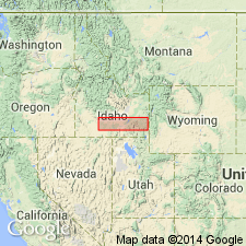
- Snake River basin
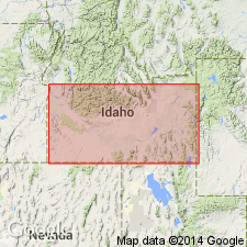
Summary:
Pg. 31 (table), 50-51, pl. 5. Banbury volcanics. Crop out fairly consistently as a series of even-bedded, massive basalt flows 300+ feet thick. Weathers to dark brown, often with greenish cast. Probably originated from vent located at Riverside Ferry, in secs. 20 and 29, T. 8 S., R. 14 E., Gooding County, Idaho; vent probably formed beneath a lake. Overlies Raft lake beds. Underlies and interbedded with Hagerman lake beds, which contain late Pliocene fossils. Age is considered late Pliocene.
[USGS currently (ca. 1966) classifies the Banbury Basalt as a formation in Idaho Group on basis of study now in progress.]
Source: US geologic names lexicon (USGS Bull. 1200, p. 208); supplemental information from GNU records (USGS DDS-6; Denver GNULEX).
- Usage in publication:
-
- Banbury Basalt*
- Modifications:
-
- Areal extent
- AAPG geologic province:
-
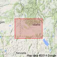
- Snake River basin
Summary:
Pg. 1199 (fig. 1), 1204-1205. Banbury Basalt of Idaho Group. Now recognized also in uplands north and south of Snake River, in Gooding, Twin Falls, Elmore, and Owyhee Counties, southern Idaho. In type area consists of (ascending): (1) olivine basalt, about 15 to 30 feet thick, usually occur as amygdular flows; (2) stream and lake deposits and siliceous volcanic ash, about 100 feet thick; and (3) columnar flows of olivine basalt locally interbedded with sand and silt, up to 500 feet thick. Total thickness at least 400 feet. Unconformably overlies Poison Ceek Formation of Idaho Group or Idavada Volcanics (new). Unconformably underlies Chalk Hills Formation (new) of Idaho Group. Age is middle Pliocene, based on fossils and stratigraphic position.
Source: Publication.
- Usage in publication:
-
- Banbury formation
- Modifications:
-
- Areal extent
- Redescribed
- Dominant lithology:
-
- Basalt
- Sandstone
- Conglomerate
- Siltstone
- Ash
- AAPG geologic province:
-
- Great Basin province
Summary:
Banbury formation. Redescribed to include sedimentary rocks. Extended into Goose Creek basin area, Cassia County, Idaho, where it consists of basalt flows and associated sedimentary rocks which include tuffaceous (basaltic) sandstone and pebble conglomerate, white to gray siltstone, diatomite and beds of siliceous volcanic ash. Thickness about 300 feet on west side of Cassia Mountains. Unconformably overlies Cougar Point formation of Idavada volcanics; underlies a basalt flow that may be part of Banbury or Glenns Ferry formation. Age is middle Pliocene. Report includes stratigraphic charts.
Source: Modified from GNU records (USGS DDS-6; Denver GNULEX).
- Usage in publication:
-
- Banbury formation*
- Modifications:
-
- Areal extent
- Redescribed
- Dominant lithology:
-
- Basalt
- Gravel
- Tuff
- AAPG geologic province:
-
- Snake River basin
- Great Basin province
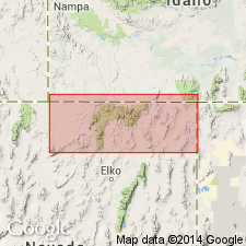
Summary:
Banbury formation of Idaho group. Extended from Owyhee County, Idaho, into Jarbidge quadrangle, northern Elko County, Nevada. Consists of: (1) interbedded gravels, 200 to 600 feet thick; (2) basalt, 4 to 105 feet thick; and (3) rhyolitic tuff, <20 feet thick. Overlies Cougar Point welded tuff (new); underlies Pleistocene deposits. Age is middle Pliocene. Report includes geologic map. Banbury formation of Idaho group adopted by the USGS.
Source: GNC index card files (USGS-Menlo); GNU records (USGS DDS-6; Denver GNULEX).
- Usage in publication:
-
- Banbury Basalt*
- Modifications:
-
- Geochronologic dating
- AAPG geologic province:
-
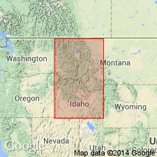
- Snake River basin
Summary:
Banbury Basalt of Idaho Group. Isotopic data indicates the name Banbury has been applied to rocks of several ages, as did Malde and others (1963, USGS I-373). At its type locality (on Snake River near mouth of Salmon Falls Creek), samples from the Banbury yielded K-Ar ages 4.4 +/-0.6 and 4.9 +/-0.6 Ma, and samples from the overlying Glenns Ferry Formation of Idaho Group yielded K-Ar ages 4.4 to 6.2 Ma, indicating the Banbury is about the same age as parts of the Glenns Ferry. To the northwest, near Murphy, Owyhee County, Idaho, the Banbury is overlain by Chalk Hills Formation of Idaho Group, which yielded K-Ar ages of at least 8.4 Ma, indicating the Banbury here is older than the type Banbury. In Mount Bennett Hills, samples from the Banbury yielded a very imprecise K-Ar age of 13.5 +/-1.5 Ma. Isotopic dates (E.H. McKee, written commun., 1971) obtained from the Banbury in the Owyhee-Jarbidge region range from 8.0 to 10.6 Ma, with older dates being preferred. At some localities, K-Ar ages obtained from the Banbury were as young as 3 Ma. Report includes sample locality map, schematic stratigraphic-chronologic diagram, table of K-Ar ages.
Source: Modified from GNU records (USGS DDS-6; Denver GNULEX).
- Usage in publication:
-
- Banbury Basalt*
- Modifications:
-
- Areal extent
- AAPG geologic province:
-
- Snake River basin
Summary:
Banbury Basalt restricted from Nevada; name Big Island Formation proposed for rocks previously assigned to the Banbury in Elko County, Nevada. Age of rocks in Elko County are between 8.2 +/-0.6 and 10.6 +/-1.0 Ma (late Miocene) and are older than type Banbury in southern Idaho.
Source: GNC index card files (USGS-Menlo); GNU records (USGS DDS-6; Denver GNULEX).
- Usage in publication:
-
- Banbury Basalt*
- Modifications:
-
- Not used
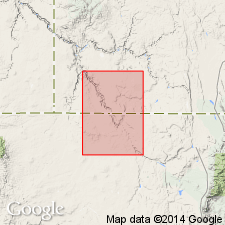
Summary:
A unit called basalt of Devils Corral is the same as the unit previously mapped as Banbury Basalt. Basalts in the study area are of a different age (10-6 Ma) than the Banbury (7 Ma) and they are different chemically than the Banbury. Unconformably overlies Swisher Mountain Tuff. Mapped occurrence is in southwest Owyhee Co, ID along the south fork of the Owyhee River in the Snake River basin.
Source: GNU records (USGS DDS-6; Denver GNULEX).
- Usage in publication:
-
- Banbury Basalt
- Modifications:
-
- Not used
Summary:
Not used in study area in northeast Owyhee Co, ID, Snake River basin. In northeast and east parts of sheet 1 and in northern part of sheet 1 of mapped area, basalts here assigned to units informally referred to as basalt of Winter Camp Butte and basalt at Hot Creek were mapped by Malde and others (1963) as both basalt within Glenns Ferry Formation and Banbury in northeast and east parts, sheet 1 and as both basalt within Chalk Hills Formation and Banbury in northern part, sheet 1. Because of this confusion and lack of radiometric age dates, these basalts are here separately mapped as informal units and are not assigned to previously established stratigraphic units. Source of basalt of Winter Camp Butte is shield volcano located in sec 22, T9S, R8E.
Source: GNU records (USGS DDS-6; Denver GNULEX).
For more information, please contact Nancy Stamm, Geologic Names Committee Secretary.
Asterisk (*) indicates published by U.S. Geological Survey authors.
"No current usage" (†) implies that a name has been abandoned or has fallen into disuse. Former usage and, if known, replacement name given in parentheses ( ).
Slash (/) indicates name conflicts with nomenclatural guidelines (CSN, 1933; ACSN, 1961, 1970; NACSN, 1983, 2005, 2021). May be explained within brackets ([ ]).