The National Geologic Map Database is migrating to a new infrastructure. We apologize for any service disruptions during this process.
|
|---|


- Usage in publication:
-
- Badger Flat Formation*
- Modifications:
-
- Named
- Dominant lithology:
-
- Limestone
- Siltstone
- Chert
- AAPG geologic province:
-
- Great Basin province
Summary:
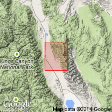
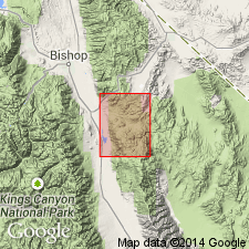
Pg. B75 (fig. 21.1), B80-B81. Badger Flat Formation, upper formation (of 2) of Mazourka Group. Recognized in Independence and adjacent Waucoba Mountain 15-min quadrangles. Consists of about 600 feet of fossiliferous silty blue-gray limestone, siltstone, and chert. Dark- to medium-gray limestone is dominant rock type. Overlies Al Rose Formation (new) of Mazourka Group. Underlies Barrel Spring Formation of Phleger (1933, Southern California Acad. Sci. Bull., v. 32, pt. 1). Age is Middle Ordovician on basis of fossils (brachiopods and trilobites).
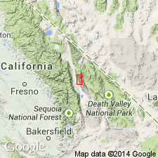
Type section: on a spur along east wall of Mazourka Canyon. Top of composite section (AI Rose and Badger Flat) is 6,000 feet S. 70 deg. E., from SE corner of sec. 36, T. 11 S., R. 35 E., Independence 15-min quadrangle, Inyo Co., CA. Named for exposures in and near Badger Flat. Formation crops out in faulted belt parallel to Al Rose Formation.
Source: US geologic names lexicon (USGS Bull. 1350, p. 40-41); supplemental information from GNU records (USGS DDS-6; Menlo GNULEX).
- Usage in publication:
-
- Badger Flat Limestone*
- Modifications:
-
- Mapped 1:62.5k
- Dominant lithology:
-
- Limestone
- Siltstone
- Chert
- AAPG geologic province:
-
- Great Basin province
Summary:
Pg. O23 (fig. 8), O24-O25, pl. 1 (geol. map). Badger Flat Limestone of Mazourka Group. Mapped in Independence 15-min quadrangle, Inyo County, California. Consists of blue-gray silty limestone and calcarenite and yellowish-gray siltstone; black chert abundant in lower part. Overlies Al Rose Formation; underlies Phleger's (Southern California Acad. Sci. Bull., v. 32, pt. 1, 1933) Barrel Spring Formation. Possibly correlative with unit "d" of Pogonip Group of Darwin area (Hall and MacKevett, 1962 [1963], USGS Prof. Paper 368, p. 8), and unit "8" of Pogonip Limestone of Quartz Spring area (McAllister, 1952, California Div. Mines Spec. Rept., no. 25). Age is Middle Ordovician.
Source: Publication.
- Usage in publication:
-
- Badger Flat Limestone*
- Modifications:
-
- Mapped
- AAPG geologic province:
-
- Great Basin province
Summary:
Mapped in Waucoba Mountain 15-min quadrangle, Inyo County, California; occurs in sec. 9, T. 11 S., R. 35 E. Conformably overlies Al Rose Formation; conformably underlies Barrel Spring Formation. Age is Early and Middle Ordovician.
Source: Modified from GNU records (USGS DDS-6; Menlo GNULEX).
- Usage in publication:
-
- Badger Flat Limestone*
- Modifications:
-
- Areal extent
- AAPG geologic province:
-
- Great Basin province
Summary:
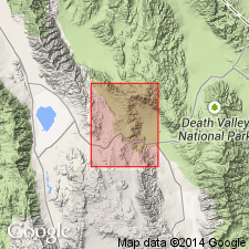
Unit geographically extended into area of report (Talc City Hills). Previously mapped as unit "d" of Pogonip Group by Hall and MacKevett (1962 [1963], USGS Prof. Paper 368, p. 8). Thickness is 200 m. Age is Middle Ordovician.
Source: GNU records (USGS DDS-6; Menlo GNULEX).
For more information, please contact Nancy Stamm, Geologic Names Committee Secretary.
Asterisk (*) indicates published by U.S. Geological Survey authors.
"No current usage" (†) implies that a name has been abandoned or has fallen into disuse. Former usage and, if known, replacement name given in parentheses ( ).
Slash (/) indicates name conflicts with nomenclatural guidelines (CSN, 1933; ACSN, 1961, 1970; NACSN, 1983, 2005, 2021). May be explained within brackets ([ ]).