


- Usage in publication:
-
- Arnett Member*
- Modifications:
-
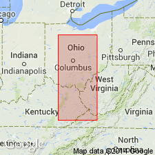
- Areal extent
- AAPG geologic province:
-
- Appalachian basin
Summary:
Arnett Member of Breathitt Formation. Marine unit in middle part of Breathitt Formation below Stoney Fork Member and above Magoffin Member. Lies below the Big Wheel, Coalburg, Hazard No. 7, Lenox, Mudseam, Nickell, Flag, Oakley, or Peach Orchard coals; lies above the Hazard or Prater coal zone. Age is Middle Pennsylvanian.
Recognized in Licking River, Hazard, Southwestern, and Big Sandy districts, eastern KY.
Source: Publication.
- Usage in publication:
-
- Arnett Member*
- Modifications:
-
- Principal reference
- Dominant lithology:
-
- Shale
- Limestone
- Siltstone
- Sandstone
- AAPG geologic province:
-
- Appalachian basin
Summary:
Arnett Member of Breathitt Formation. Fossiliferous marker bed. Generally a resistant calcareous siltstone or calcareous sandstone; in places where poorly exposed is a sparsely fossiliferous shale. At type consists of dark-gray, fissile shale and siltstone, thickness 10 m; marine fossils reported in basal beds. Separated from overlying Stoney Fork Member or underlying Magoffin Member of Breathitt by unnamed shale, siltstone, and sandstone. Tentatively correlated with Poverty Run limestone (informal, unranked) in Pottsville Formation of central and southern Ohio, or its correlative, Lowellville limestone (informal, unranked) in Pottsville Formation of northeastern Ohio; correlation based mainly on earliest occurrence of palynomorph RADIIZONATES sp. in underlying Vandusen coal bed. Replaces informal Cowcreek member of Breathitt, a name applied by Chesnut (1991) to strata overlying Hazard (5, 5A, 6) coal zone and equivalent coal beds exposed in Cowcreek 7.5-min quadrangle. Fossils (brachiopods, bryozoans, pelecypods, gastropods, conularids, and foraminifers). Age is Middle Pennsylvanian.
Type section (subsurface): corehole (unknown driller) at 447m elev. on ridge between head of Dusty Fork of Leatherwood Creek and head of Log Fork of Squabble Creek (Lat. 37 deg. 17 min. 11 sec. N., Long. 38 deg. 31 min. 17 sec. W.), southeastern part of Mistletoe 7.5-min quadrangle, Perry Co., southeastern KY. Named from village of Arnett on KY Highway 28, Cowcreek 7.5-min quadrangle, Owsley Co., southeastern KY. Traced into Oneida, Canoe, and Buckhorn 7.5-min quadrangles.
Source: Modified from GNU records (USGS DDS-6; Reston GNULEX).

- Usage in publication:
-
- Arnett Member
- Modifications:
-
- Areal extent
- AAPG geologic province:
-
- Appalachian basin
Summary:
Corr. chart. Arnett Member of Vowell Mountain Formation (TN); Arnett Member of Four Corners Formation of Breathitt Group (KY). Shale and/or mudstone. In Tennessee is a member of Vowell Mountain Formation; lies below the Upper and Lower Buffalo Mountain coal and above the Wheeler Gap rider coal. In Kentucky is a member of Four Corners Formation. In eastern Kentucky lies below the lower Peach Orchard (Hazard No. 7) coal zone; lies above the Hazard (Prater) coal zone. In southeastern Kentucky [Upper Cumberland River district] lies below the High Splint (No. 12) coal bed and above the Red Springs coal bed. Carries marine fossils. Age is Middle Pennsylvanian (Westphalian; Atokan).
[Peppers (1996, GSA Memoir 188, p. 9, pl.) placed the Vowell Mountain Formation in Westphalian C, TORISPORA SECURIS-T. LAEVIGATA (SL) miospore assemblage zone of western Europe. The Wheeler Gap rider coal of Tennessee, Hazard (Prater) coal zone and Red Springs coal bed of Kentucky, and Bear Run coal bed of Ohio, = Winifrede coal zone of West Virginia, which Eble and others, 2009 (Kentucky Geol. Survey, ser. XII, Spec. Pub. 10, fig. 5.2) placed at the Duckmantian/Bolsovian (Westphalian B/C) boundary on basis of miospores. Unpublished collections from overlying Stoney Fork Member of Princess Formation in Kentucky, and its equivalents, informal Lake City member of Cross Mountain Formation in Tennessee and Blunt Run (Boggs) limestone of Pottsville Group in Ohio, yielded distinctive conodonts correlative with the marine Aegir bed (=base of Westphalian C) thus shifting the Four Corners, Vowell Mountain, lower part of Cross Mountain, and upper part of Pottsville, downward into Westphalian B (R.G. Stamm, USGS, pers. commun., Oct. 17, 2013).]
[See also Chesnut, 1997 (revised Oct. 12, 1999), Stratigraphy of the coal-bearing strata of the Eastern Kentucky coal field, available online through the Kentucky Geol. Survey (http://www.uky.edu/KGS/coal/coalcorrel.htm) and geologic descriptions of stratigraphic units in the Kentucky Geological Survey database (http://kgs.uky.edu/kgsmap/KGSLitho/lithoSearch.asp#).]
Source: Publication.
For more information, please contact Nancy Stamm, Geologic Names Committee Secretary.
Asterisk (*) indicates published by U.S. Geological Survey authors.
"No current usage" (†) implies that a name has been abandoned or has fallen into disuse. Former usage and, if known, replacement name given in parentheses ( ).
Slash (/) indicates name conflicts with nomenclatural guidelines (CSN, 1933; ACSN, 1961, 1970; NACSN, 1983, 2005, 2021). May be explained within brackets ([ ]).