The National Geologic Map Database is migrating to a new infrastructure. We apologize for any service disruptions during this process.
|
|---|


- Usage in publication:
-
- Arlington formation
- Modifications:
-
- Original reference
- Dominant lithology:
-
- Slate
- Sandstone
- AAPG geologic province:
-
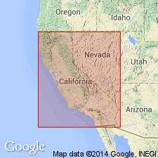
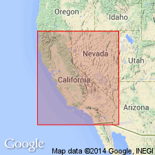
- Sierra Nevada province
Summary:
Pg. 370-394. Arlington beds. Slates and sandstones with traces of conglomerate; 5,700 feet thick. No fossils, but as they lie beneath Shoo Fly beds at one end and are associated with Silurian slates at the other, they are regarded as probably belonging to upper Paleozoic. Older than Shoo Fly beds and younger than Taylor[s]ville slates.
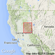
[Named from Arlington Heights, Plumas Co., northern CA, which is composed of the formation, and where middle member is well exposed. Recognized in Taylorsville and Lassen Peak regions, northern CA.]
Source: US geologic names lexicon (USGS Bull. 896, p. 73-74).
- Usage in publication:
-
- Arlington formation*
- Modifications:
-
- Age modified
- AAPG geologic province:
-
- Sierra Nevada province
Summary:
Arlington formation. Chiefly fine, gray, thin-bedded sandstone, with some shale in part silicified and a few beds of conglomerate. In lower member yellowish shales prevail and grade up into the shaly and thin-bedded greenish gray sandstone of middle member, which is well exposed in bold escarpment of Arlington Heights. In upper member, which is well exposed about Crystal Lake, slaty gray shales are most abundant, with local conglomerates and highly silicified red jaspery portions near top. Measured thickness 5,700 feet. Is separated from overlying Shoo Fly formation by great thickness of Taylor meta-andesite. Is younger than Taylorsville formation. [Age is Mississippian.]
Source: US geologic names lexicon (USGS Bull. 896, p. 73-74).
- Usage in publication:
-
- Arlington formation*
- Modifications:
-
- Overview
- AAPG geologic province:
-
- Sierra Nevada province
Summary:
Chart 5 (column 14). Arlington formation. Underlies Shoofly [Shoo Fly] formation (Pennsylvanian?); overlies Devonian Taylorsville formation. [Age is Mississippian.]
Source: US geologic names lexicon (USGS Bull. 1200, p. 135).
- Usage in publication:
-
- Arlington formation
- Modifications:
-
- Areal extent
- AAPG geologic province:
-
- Sierra Nevada province
Summary:
Arlington formation. Water-laid tuff and slate, and minor andesitic metabreccia and metaconglomerate. Mapped with Permian marine sedimentary and metasedimentary rocks. (Formation as redefined and mapped by V.E. McMath [Univ. California unpub. PhD dissert. 1958, unpub. geol. maps 1959-1960].)
Source: Publication; US geologic names lexicon (USGS Bull. 1200, p. 135).
- Usage in publication:
-
- Arlington Formation*
- Modifications:
-
- Age modified
- Biostratigraphic dating
- Areal extent
- AAPG geologic province:
-
- Sierra Nevada province
Summary:
Age is Permian based on Early Permian (Leonardian) megafossils near base of unit near Mount Hough (J.T. Dutro, written communication, 1986) and correlation with Reeve and Goodhue Formations (lower part of all three formations is late Early Permian in age). Geographically restricted from area southwest of Lake Almanor. Name Arlington Formation is applied only to rocks southeast of Lake Almanor that are contiguous with type Arlington.
Source: GNU records (USGS DDS-6; Menlo GNULEX).
- Usage in publication:
-
- Arlington Formation*
- Modifications:
-
- Areal extent
- AAPG geologic province:
-
- Sierra Nevada province
Summary:
(advance copy). Unit geographically extended into Keddie Ridge in area of report. Age is Early Permian.
Source: GNU records (USGS DDS-6; Menlo GNULEX).
- Usage in publication:
-
- Arlington Formation*
- Modifications:
-
- Principal reference
- AAPG geologic province:
-
- Sierra Nevada province
Summary:
Principal reference locality designated as exposures on and about Arlington Heights that extend northeast toward Hough Creek to an elevation of about 4,400 ft (sections 4-5 T25N R10E, Greenville 15' quad [Plumas Co, CA]). Unit geographically extended to Peel Ridge (overlies chert member of Peale Formation); minor stratigraphic restriction at principal reference locality on Mount Hough where volcanic rocks and ribbon chert are reassigned to underlying Peale Formation. Overall age is considered as Early Permian varying from late Wolfcampian(?) into Wordian (early Guadalupian) based on fossils.
Source: GNU records (USGS DDS-6; Menlo GNULEX).
For more information, please contact Nancy Stamm, Geologic Names Committee Secretary.
Asterisk (*) indicates published by U.S. Geological Survey authors.
"No current usage" (†) implies that a name has been abandoned or has fallen into disuse. Former usage and, if known, replacement name given in parentheses ( ).
Slash (/) indicates name conflicts with nomenclatural guidelines (CSN, 1933; ACSN, 1961, 1970; NACSN, 1983, 2005, 2021). May be explained within brackets ([ ]).