


- Usage in publication:
-
- Archer City Formation
- Modifications:
-
- First used
- Dominant lithology:
-
- Mudstone
- Sandstone
- Siltstone
- Conglomerate
- AAPG geologic province:
-
- Bend arch
- Fort Worth syncline
Summary:
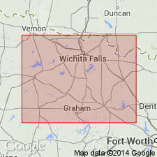
First published use of Archer City Formation, upper formation of the Bowie Group (first used). Mapped in a northeastward-trending belt in Throckmorton, Young, and Archer Counties, Texas [on Bend arch], and in Clay and Jack Counties, Texas [on Fort Worth syncline]. Ranges in thickness from 350 to 400 feet. Fifteen sandstone and conglomerate bodies, 5 to 40 feet thick, individually mapped. Consists mostly of red-brown mudstone. Calcareous and ferruginous nodules locally common. Also has thin siltstone beds, lenticular calcareous-nodule conglomerate, and sandstone as sheets and lentils 1 to 3 feet thick that are brown, green, gray, very fine- to medium-grained, locally calcareous, thin-bedded to massive, cross-bedded, ripple marked. Vertebrate fossils abundant locally, plant fragments. Some of the sandstone beds are brown, fine- to very coarse-grained, upward-fining, friable to moderately well indurated, massive to thick-bedded, and show soft sediment deformation of Wolfcamp age. South of Salt Fork of Brazos River, is equivalent to (in ascending order) Moran and Sedwick Formations, and Santa Anna Branch Shale of Cisco Group. Overlies Markley Formation (first used) of Bowie Group. Underlies Nocona Formation (first used) of Wichita Group.
Source: Modified from GNU records (USGS DDS-6; Denver GNULEX).
- Usage in publication:
-
- Archer City Formation
- Modifications:
-
- Named
- Dominant lithology:
-
- Sandstone
- Mudstone
- Siltstone
- AAPG geologic province:
-
- Bend arch
- Fort Worth syncline
Summary:
Named topmost of two formations of Bowie Group (all named in this report). Stratotype designated as road cut along Farm Road 2581, about 5 mi southeast of Archer City, Archer Co, TX. Named for sandstone-supported cuestas that occur near Archer City. Overlies Markley Formation of Bowie; underlies Nocona Formation (new) of Wichita Group (revised). Archer City is present in Young, southeast Archer, northern Jack, southern Clay, and southwestern Montague Cos, TX on Bend arch and Fort Worth syncline. Comprises all continental strata that are approximately equal to Moran and Sedwick Formations and Santa Anna Branch Shale, all of Cisco Group. Exposure of Archer City rocks in the Brazos, Little Wichita, and Red River drainages extends from a stratigraphic cutoff of Cisco Group formations in northeastern Throckmorton and westernmost Young Cos northeastward to Red River and basal Cretaceous rocks in Montague Co. Coleman Junction Limestone locally defines top at Brazos River. Contains 9 sandstone members with intervening mudstone sequences. Within the formation, individual members generally become thinner, finer grained, and more discontinuous along strike to west. Sandstones are commonly conglomeratic and more closely spaced in eastern area, separated by 10-50 ft of yellowish- and reddish-brown mudstone in Montague and eastern Clay Cos. Mudstones thicken to west. Calcareous nodules and some siltstone shown at stratotype. Early Permian (Wolfcampian).
Source: GNU records (USGS DDS-6; Denver GNULEX).

- Usage in publication:
-
- Archer City Formation
- Modifications:
-
- Mapped 1:250k
- Dominant lithology:
-
- Mudstone
- Sandstone
- Siltstone
- Conglomerate
- AAPG geologic province:
-
- Fort Worth syncline
- South Oklahoma folded belt
Summary:
Pamphlet [p. 9]. Archer City Formation of Bowie Group. Mudstone, sandstone, siltstone, and conglomerate. Mostly mudstone best exposed below cuesta-forming sandstones, reddish-brown, minor tan and variegated, thick-bedded and massive in units 10 to 50 feet thick, calcareous nodules and ferruginous concretions locally common, thin siltstone beds throughout, sparse vertebrate fossils; sandstone in lentils and sheets 1 to 3 feet thick, brown, grayish-green, gray, very fine-grained to fine-grained, locally calcareous, thin-bedded to massive, laminated, ripple cross-laminated, small-scale crossbeds, a few unmapped channel-fill bodies.
Sandstones and conglomerates (descending, ss9, ss8, ss6, ss5, ss4, and ss3, separately mapped); sandstone, brown, fine-grained to very coarse-grained, units typically upward-fining, thick-bedded to massive, commonly soft-sediment-deformed, small- to large-scale crossbeds, friable to moderately well cemented, clay clasts and ferruginous concretions common near base of units, local coarse plant fragments; chert-pebble conglomerate and gravelly sandstone mostly at base of thicker units; individual members are in part composed of multiple superimposed or closely spaced units; thickness of sandstone members 5 to 40 feet.
Thickness of formation 370 to 400 feet. Lies above Markley Formation of Bowie Group and below Nocona Formation of Wichita Group. Age is Early Permian (Wolfcamp). [Mapped in northwestern corner of map sheet, in Clay and Montague Cos., central northern TX. Rocks previously (1967 ed. of map) included in "Permian rocks above Graham Formation." See also Hentz, 1988, and adjacent Wichita Falls-Lawton sheet, Texas Geol. Atlas, 1987.]
Source: Publication.
For more information, please contact Nancy Stamm, Geologic Names Committee Secretary.
Asterisk (*) indicates published by U.S. Geological Survey authors.
"No current usage" (†) implies that a name has been abandoned or has fallen into disuse. Former usage and, if known, replacement name given in parentheses ( ).
Slash (/) indicates name conflicts with nomenclatural guidelines (CSN, 1933; ACSN, 1961, 1970; NACSN, 1983, 2005, 2021). May be explained within brackets ([ ]).