The National Geologic Map Database is migrating to a new infrastructure. We apologize for any service disruptions during this process.
|
|---|


- Usage in publication:
-
- Antelope Creek bed
- Modifications:
-
- Original reference
- Dominant lithology:
-
- Sandstone
- Conglomerate
- Clay
- AAPG geologic province:
-
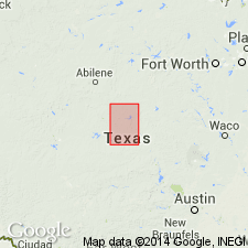
- Bend arch
- Llano uplift
Summary:
Pg. 374, 385, 386. Antelope Creek bed in Strawn division. Variable sandstone, friable to hard, pure to clayey, with a little conglomerate and some clay. Local deposit. Member of Strawn division [Strawn is 2nd from base of 5 Carboniferous divisions of Cummins, 1891]. Underlies Indian Creek bed and overlies Comanche Creek bed. Age is Pennsylvanian.
Best exposures are along the north side of the Colorado River, and from there north to the Indian Creek-San Saba Road. [Named from Antelope Creek, San Saba Co., Colorado River region, central TX.]
Source: Publication; US geologic names lexicon (USGS Bull. 896, p. 56-57).
- Usage in publication:
-
- Antelope Creek bed
- Modifications:
-
- Areal extent
- AAPG geologic province:
-
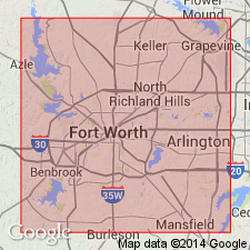
- Fort Worth syncline
Summary:
Pg. 70. Antelope Creek bed in Strawn series. Variable sandstone, friable to hard, pure to clayey, with conglomerate and some clay. Underlies Indian Creek bed; overlies Comanche Creek bed. Strawn series. [Age is Pennsylvanian; age of Strawn not discussed.]
[Report area in Parker County, central Texas.]
Source: US geologic names lexicon (USGS Bull. 1200, p. 108); supplemental information from GNU records (USGS DDS-6; Denver GNULEX).
- Usage in publication:
-
- Antelope Creek bed
- Modifications:
-
- Not used
- AAPG geologic province:
-
- Bend arch
Summary:
Pg. 58, pl. 27. [†Antelope Creek bed of Strawn formation not used by the USGS; a local term considered obsolete. See also entry under Strawn.] Drake (1893) separated rocks of Strawn group [division] into 20 units of alternating sandstone and shale beds. He gave local names to these units, or "beds" as he termed them, and numbered them from bottom to top, 4 to 23. Only Drake's name for upper unit, Ricker, is in use today, and that name has been restricted to base of Drake's Ricker bed.
Source: US geologic names lexicon (USGS Bull. 1200, p. 108).
For more information, please contact Nancy Stamm, Geologic Names Committee Secretary.
Asterisk (*) indicates published by U.S. Geological Survey authors.
"No current usage" (†) implies that a name has been abandoned or has fallen into disuse. Former usage and, if known, replacement name given in parentheses ( ).
Slash (/) indicates name conflicts with nomenclatural guidelines (CSN, 1933; ACSN, 1961, 1970; NACSN, 1983, 2005, 2021). May be explained within brackets ([ ]).