The National Geologic Map Database is migrating to a new infrastructure. We apologize for any service disruptions during this process.
|
|---|


- Usage in publication:
-
- Ankareh shale*
- Ankareh formation
- Modifications:
-
- Original reference
- Dominant lithology:
-
- Sandstone
- Shale
- Limestone
- AAPG geologic province:
-
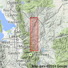
- Uinta uplift
- Central Western Overthrust
Summary:
Pg. 439-458. Ankareh shale (also Ankareh formation). Siliceous detrital deposits, chiefly red shales, which frequently become sandy through considerable thicknesses. Also includes a number of well-marked beds of rather coarse whitish gray sandstone, 20 to 55 feet thick. A few fossiliferous grayish blue limestones a few feet thick are also intercalated. Thickness of formation 1,500+ feet. The dividing line between Ankareh and underlying Thaynes formation is made on lithologic grounds, calcareous members characterizing the Thaynes and siliceous members characterizing the Ankareh. The basal member is taken as the coarse massive sandstone that lies at base of the red shale as a whole and immediately overlies a thin limestone. Only a part of this formation occurs in Park City district, the highest part being marked by a prominent massive white sandstone member. Carries a few fossils (petrified wood and bark). Age is Permian and Triassic.
Named from Ankareh Ridge, Park City district, on which it attains its fullest and most characteristic development within the district.
Source: US geologic names lexicon (USGS Bull. 896, p. 55).

- Usage in publication:
-
- Ankareh shale*
- Modifications:
-
- Overview
- AAPG geologic province:
-
- Uinta uplift
Summary:
The same year (1907) that Boutwell introduced the name Ankareh shale in Park City district, Utah, A.C. Veatch introduced the name Nugget sandstone for approximately equivalent deposits in southwestern Wyoming.
H.S. Gale and R.W. Richards, 1910 (USGS Bull. 430), restricted both Nugget sandstone and Ankareh shale. (See 1910 entry under Nugget sandstone.)
J.M. Boutwell, 1912 (USGS Prof. Paper 77, p. 59), redefined his Ankareh shale, as explained in 1912 entry under Nugget sandstone, and called the upper part Nugget sandstone.
The name Ankareh is no longer used in southeastern Idaho. (See 1916 and 1920 entries under Nugget sandstone.) According to G.R. Mansfield (USGS Prof. Paper 152, 1927) the Ankareh shale of Park City district, Utah, as restricted by Boutwell in 1912 is = lower part of Nugget sandstone restricted of Mansfield plus underlying Wood shale, Deadman limestone, Higham grit, and Timothy sandstone of southeastern Idaho.
Present in northeastern Utah (Park City region) and southwestern Wyoming. Age is Triassic(?).
Source: US geologic names lexicon (USGS Bull. 896, p. 55).
- Usage in publication:
-
- Ankareh shale*
- Modifications:
-
- Revised
- AAPG geologic province:
-
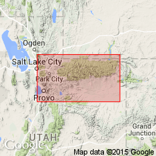
- Wasatch uplift
Summary:
Pg. 474, 476, 477 (fig. 2). Ankareh shale. Name Ankareh shale restricted to those red beds between Thaynes limestone and unconformity below Higham grit in northeastern Utah. Name Red Wash formation proposed for red beds at eastern end of Uinta Mountains that are equivalent to Woodside, Thaynes, and Ankareh (restricted).
Source: US geologic names lexicon (USGS Bull. 1200, p. 103).
- Usage in publication:
-
- Ankareh formation
- Modifications:
-
- Revised
- AAPG geologic province:
-
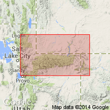
- Uinta basin
- Wasatch uplift
Summary:
Pg. 1260 (fig. 2), 1266 (fig. 5), 1270, strat. sections. Ankareh formation. In western Uinta and central Wasatch Ranges, overlies Thaynes limestone and unconformably underlies Gartra member of Stanaker formation (both new). Thickness 862 to 1,400 feet. [Age is Triassic.] Summary of stratigraphic nomenclature in area [Fort Douglas, Salt Lake Co., to Whiterocks Canyon, Duchesne Co., UT].
Source: US geologic names lexicon (USGS Bull. 1200, p. 103).
- Usage in publication:
-
- Ankareh formation*
- Modifications:
-
- Revised
- AAPG geologic province:
-
- Uinta uplift
- Wasatch uplift
Summary:
Pg. 166 (fig. 18), 178 (fig. 21), 179-180. Ankareh formation. As now used, name Ankareh is applied to different parts of post-Thaynes sequence in middle Rocky Mountains. In western Wyoming, applied to all strata between Thaynes formation and Nugget sandstone. In Utah, applied only to beds from Thaynes to Gartra grit. In Idaho, name Ankareh was abandoned by Mansfield (1927) although Gartra grit is probably equivalent to Higham grit and Higham grit is present in Ankareh in Wyoming. It is here proposed that Ankareh formation, as originally defined by Boutwell to include all strata between Thaynes and Nugget formations, be applied in northern Utah and western Wyoming and all formations that have been proposed for parts of this sequence be reduced to member rank. In eastern Uinta Mountains, Colorado Plateau nomenclature is used following Kinney and Rominger, 1947 (USGS Oil and Gas Inv. Prelim. Map 82). Wood shale is considered westward tongue of Ankareh formation as used in Wyoming. Stanaker formation and Gartra grit (Thomas and Krueger, 1946) are reduced to member status in Ankareh. Unit referred to Ankareh by Thomas and Krueger (1946) and Williams (1945) must be renamed. Name Mahogany member is here proposed for unit between top of Thaynes and base of Gartra member. Name Lanes tongue of Ankareh proposed for Sheep Creek section in Idaho. Main areas of outcrop and units present in each discussed briefly. [Age is Early and Late Triassic.]
Source: US geologic names lexicon (USGS Bull. 1200, p. 103).
- Usage in publication:
-
- Ankareh redbeds*
- Modifications:
-
- Mapped
- AAPG geologic province:
-
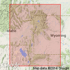
- Green River basin
Summary:
Ankareh redbeds. Red and purplish, sandy, calcareous mudstone and red to white, fine-grained quartzite. Contains a few beds of dense, red- to greenish-gray limestone (Deadman limestone equivalent) and discontinuous lentils of grit-sized conglomerate (equivalent to Highman grit of Idaho). Thickness from about 750 to 900 feet. Lies above Thaynes limestone (Lower Triassic) and below Nugget sandstone (Lower Jurassic). Age is considered Late Triassic(?).
Source: Publication.
- Usage in publication:
-
- Ankareh formation*
- Modifications:
-
- Age modified
- AAPG geologic province:
-
- Uinta uplift
Summary:
Used in northwest UT on the Uinta uplift for red beds above the Thaynes limestone and beneath the Chinle formation in the restricted sense of Thomas and Krueger (1946). Correlated (correlation chart) with upper part of State Bridge formation of central CO and with upper part of Moenkopi formation of northeast UT. Assigned to Early and questionably to the Middle Triassic on basis of correlation with upper part of Moenkopi. Assignment is a modification of the Triassic age used in earlier reports. In the southern Green River basin of west WY the Mahogany member and the Lanes tongue of the Ankareh are recognized and placed only in the Lower Triassic (Oriel, p. 9; correlation chart).
Source: GNU records (USGS DDS-6; Denver GNULEX).
- Usage in publication:
-
- Ankareh Formation*
- Modifications:
-
- Areal extent
- AAPG geologic province:
-
- Wasatch uplift
Summary:
Pg. 42-45, pls. (geol. maps, columnar section). Author follows Kummel's (1954) nomenclature. Ankareh formation. In this area, underlies Jurassic Nugget sandstone with apparent conformity, and overlies and intertongues with Triassic Thaynes formation. Divided into (descending) Wood shale tongue and Lanes tongue, which are separated by nearly 600 feet of strata assigned to the Thaynes. Age of Ankareh is considered Triassic.
The Wood shale tongue is a moderate red shale and dense pale-red dolomite, 200 to 400 feet thick. As mapped, includes Kummel's Deadman limestone, which is too thin and its contacts too poorly defined to make it a practical mapping unit. Overlies Timothy sandstone member of Thaynes formation; outside of study area the Timothy is overlain by Kummel's Higham grit (absent from this area possibly due to faulting). Top of Wood shale tongue provisionally placed at Triassic-Jurassic boundary. The Lanes tongue is a dark-red and maroon shale and very fine-grained calcareous siltstone, 450+/- feet thick; is interbedded with the Portneuf limestone member of the Thaynes formation; age is Early Triassic.
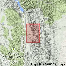
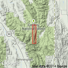
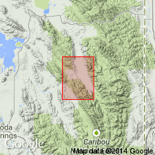
Measured section on ridge on north side of Preuss Creek, in sec. 15, T. 11 S., R. 45 E., Caribou Co., ID.
[GNC remark (July 25, 2016): Although the rank and lithologic terms are lower case, these are formal names.]
Source: Publication.
- Usage in publication:
-
- Ankareh Formation*
- Modifications:
-
- Overview
- AAPG geologic province:
-
- Wasatch uplift
Summary:
Two named tongues assigned to the Ankareh Formation are mapped in Caribou Co., ID, Wasatch uplift. The lower one, the Lanes Tongue, is Early Triassic in age; it lies between the lower and upper parts of the Portneuf Limestone Member of the Thaynes Formation in the north-central and northeast parts of the quad. The upper tongue, the Wood Shale Tongue, is Late Triassic age; it lies above the Deadman Limestone and below the Nugget Sandstone.
Source: GNU records (USGS DDS-6; Denver GNULEX).
- Usage in publication:
-
- Ankareh Formation*
- Modifications:
-
- Areal extent
- AAPG geologic province:
-
- Uinta uplift
- Uinta basin
- Wasatch uplift
Summary:
Used for all rocks between underlying Thaynes Formation and overlying Nugget Sandstone from data point 1 (NW/4 NW/4 sec. 14, T. 4 N., R. 7 E., Summit Co, UT) to between data points 11 and 12 (NE/4 SE/4 sec. 13, T. 5 S, R. 12 W., Wasatch Co, UT and SE/4 SW/4 sec. 27, T. 11 S., R. 5 E., Utah Co, UT) which includes the Uinta uplift, Uinta basin, and Wasatch uplift. Nomenclature changes occur between data points 11 and 12; lower part of Ankareh (Mahogany Member) becomes upper part of Moenkopi Formation; upper part of Ankareh (Gartra Member and unnamed upper member, in ascending order) becomes Chinle Formation (Moss Back and Petrified Forest Members, in ascending order). Lower and Upper Triassic section is separated by Tr-3 unconformity; Middle Triassic is missing. Contact with Thaynes is conformable; contact with Nugget is unconformable (J-0 unconformity). Lower part (Mahogany) is Early Triassic age; upper part (Gartra and unnamed upper part) is Late Triassic age.
Source: GNU records (USGS DDS-6; Denver GNULEX).
For more information, please contact Nancy Stamm, Geologic Names Committee Secretary.
Asterisk (*) indicates published by U.S. Geological Survey authors.
"No current usage" (†) implies that a name has been abandoned or has fallen into disuse. Former usage and, if known, replacement name given in parentheses ( ).
Slash (/) indicates name conflicts with nomenclatural guidelines (CSN, 1933; ACSN, 1961, 1970; NACSN, 1983, 2005, 2021). May be explained within brackets ([ ]).