The National Geologic Map Database is migrating to a new infrastructure. We apologize for any service disruptions during this process.
|
|---|


- Usage in publication:
-
- Angola Shale
- Modifications:
-
- Overview
- Dominant lithology:
-
- Shale
- AAPG geologic province:
-
- Appalachian basin
Summary:
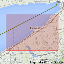
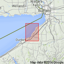
Pg. 24 and chart. Angola shale. Soft gray shales underlying Dunkirk shale and overlying Rhinestreet shale. Included in Portage. [See also New York State Mus. Mem., no. 6, 1903.] [Age is Late Devonian.]
Source: US geologic names lexicon (USGS Bull. 896, p. 53).
- Usage in publication:
-
- Angola soft shales with concretions
- Modifications:
-
- Areal extent
- AAPG geologic province:
-
- Appalachian basin
Summary:
Pg. 1019-1029. Angola soft shales with concretions. Upper 100 feet soft shales; lower 68 feet concretionary shale. Underlie Silver Creek light soft shales and overlie Rhinestreet black shale. Included in Portage group of Lake Erie section. [Age is Late Devonian.]
Source: US geologic names lexicon (USGS Bull. 896, p. 53).
- Usage in publication:
-
- Angola shale
- Modifications:
-
- Overview
- AAPG geologic province:
-
- Appalachian basin
Summary:
Pg. 76 and chart. Angola shale named from Angola, Erie County, western New York, where it is exposed along Big Sister Creek. Overlain by Hanover shale and underlain by Rhinestreet shale. The Hanover and Angola = Hatch shale and flags to east. [Age is Late Devonian.]
Source: US geologic names lexicon (USGS Bull. 896, p. 53).
- Usage in publication:
-
- Angola shales
- Modifications:
-
- Areal extent
- AAPG geologic province:
-
- Appalachian basin
Summary:
Pg. 157. Angola shales are disconformably overlain by Hanover shales and disconformably underlain by Rhinestreet shale. [Age is Late Devonian.]
Source: US geologic names lexicon (USGS Bull. 896, p. 53).

- Usage in publication:
-
- Angola shale
- Modifications:
-
- Areal extent
- AAPG geologic province:
-
- Appalachian basin
Summary:
Pg. 69. Angola shale is much younger than Hatch shale and is = Gardeau shale [narrow sense]. Is separated from overlying Hanover shale [restricted] by Pipe Creek shale, with which it is disconformable(?). [Age is Late Devonian.]
Source: US geologic names lexicon (USGS Bull. 896, p. 53).
- Usage in publication:
-
- Angola shale
- Modifications:
-
- Areal extent
- AAPG geologic province:
-
- Appalachian basin
Summary:
(No. 3, p. 189-204, Oct. 1933.) Pg. 193. Angola shale overlies Hatch and underlies Wiscoy. Is = (ascending) Grimes sandstone, Gardeau shale (restricted), Letchworth shale, and Portage ("Nunda") sandstone. [Age is Late Devonian.]
Source: US geologic names lexicon (USGS Bull. 896, p. 53).
- Usage in publication:
-
- Angola shale*
- Modifications:
-
- Mapped 1:24k
- Dominant lithology:
-
- Mudstone
- Shale
- AAPG geologic province:
-
- Appalachian basin
Summary:
Angola shale conformably underlies Pipe Creek member of Hanover shale. Gradational contact with underlying Rhinestreet shale. About 235 ft thick in Silver Creek quad. Composed largely of medium- to light-gray even- to lumpy-bedded shale and blocky- to irregular-bedded mudstone. Interbedded are small amounts of fissile grayish-black and dark-brown shale; a few medium-light-gray muddy siltstones; some thin beds of medium-gray argillaceous limestone; many calcareous nodules and concretions. Age is Late Devonian.
Source: GNU records (USGS DDS-6; Reston GNULEX).
- Usage in publication:
-
- Angola shale member*
- Modifications:
-
- Revised
- AAPG geologic province:
-
- Appalachian basin
Summary:
Angola reallocated to member status in West Falls formation (new name). Overlies Rhinestreet member; in some areas, intertongues with Gardeau shale member; in some areas, overlies Nunda sandstone member; locally underlies Pipe Creek member of Hanover shale.
Source: GNU records (USGS DDS-6; Reston GNULEX).

- Usage in publication:
-
- Angola Shale Member*
- Modifications:
-
- Areal extent
- AAPG geologic province:
-
- Appalachian basin
Summary:
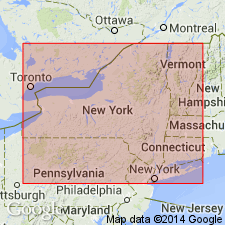
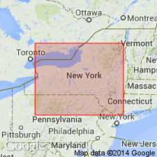
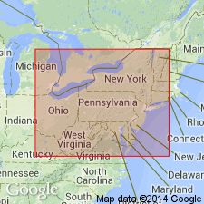
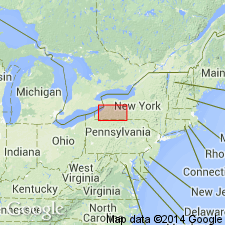
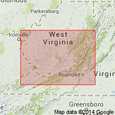
Angola Shale Member of West Falls Formation extended from western NY into western PA, eastern OH, western WV, eastern KY, westernmost VA, and the subsurface of northeastern TN.
Source: GNU records (USGS DDS-6; Reston GNULEX).
- Usage in publication:
-
- Angola Shale Member
- Modifications:
-
- Revised
- AAPG geologic province:
-
- Appalachian basin
Summary:
Cross section between Norton and Asberrys, VA, in the Clinch Mountain outcrop belt shows more detailed divisions of Chattanooga Shale than previously indicated. Base of Chattanooga marked by Belpre Ash. Ascending, members are Rhinestreet Shale, Angola Shale, Java Shale (which contains the Center Hill Ash), Dunkirk Shale Tongue of Huron Shale Member and remaining upper part of Huron, Three Lick Bed, Cleveland Shale Member, and Sunbury Shale Member. According to authors, divisions are based on careful outcrop description and outcrop gamma-ray log. Divisions can be traced by borehole gamma-ray logs to their type areas in OH and NY.
Source: GNU records (USGS DDS-6; Reston GNULEX).
For more information, please contact Nancy Stamm, Geologic Names Committee Secretary.
Asterisk (*) indicates published by U.S. Geological Survey authors.
"No current usage" (†) implies that a name has been abandoned or has fallen into disuse. Former usage and, if known, replacement name given in parentheses ( ).
Slash (/) indicates name conflicts with nomenclatural guidelines (CSN, 1933; ACSN, 1961, 1970; NACSN, 1983, 2005, 2021). May be explained within brackets ([ ]).