

- Usage in publication:
-
- American Flag Formation*
- Modifications:
-
- Original reference
- Dominant lithology:
-
- Conglomerate
- Graywacke
- AAPG geologic province:
-
- Basin-and-Range province
Summary:
Pg. 41-44, pl. 1. American Flag Formation. Mostly fresh-water conglomerates and graywackes. In exposure between Peppersauce and Nugget Canyons, fine-to medium-grained graywackes characterize lower part of section, and conglomerates the upper part. Lower rocks particularly well bedded. About 200 feet above base is a 30-foot limestone conglomerate. This is approximately where conglomerate beds become conspicuous. Higher in section conglomerates increase in abundance, alternating with graywacke beds. Higher in section conglomerates become thicker, reaching maximum of 10 to 20 feet, and relative abundance of conglomerates increases until it is predominant rock type. Thickness in Nugget Canyon 2,077 feet. Unconformably overlies Escabrosa Limestone and unconformably overlain by Gila Conglomerate. Intruded by granodiorite porphyry whose Cretaceous(?) age is based on lithologic correlation with the Cretaceous(?) granodiorite porphyry in San Manuel [ore] deposit. Paleozoic section in southeastern Arizona contains no rocks remotely similar to American Flag Formation, and Triassic and Jurassic sedimentary rocks are missing in southeastern Arizona. Seems likely that American Flag Formation is Cretaceous(?).
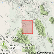
Type area: Nugget Canyon, south of Mogul Fault, SW/4 Mammoth 15-min quadrangle [in T. 10 S., R. 16 E.], Pinal Co., south-central AZ. Named from nearby American Flag Spring, a well-known landmark, in sec. 21, T. 10 S., R. 16 E., Mammoth quadrangle, Pinal Co., south-central AZ.
Source: US geologic names lexicon (USGS Bull. 1350, p. 14); supplemental information from GNU records (USGS DDS-6; Denver GNULEX).

- Usage in publication:
-
- American Flag Formation*
- Modifications:
-
- Age modified
- Overview
- AAPG geologic province:
-
- Basin-and-Range province
Summary:
Is oldest Cretaceous formation in northern Santa Catalina Mountains area, Pinal Co, AZ in Basin-and-Range province. Unconformably overlies Mississippian strata. Is more than 2,000 ft thick sequence of graywacke, olive-hued siltstones, and conglomerates with well-rounded pebbles to boulders probably derived from Paleozoic and Precambrian rocks. Has yielded fresh-water mollusks UNIO and VIVIPARUS. Is considered probable general equivalent of Fort Crittenden Formation (Campanian) on basis of lithologic similarity. Age is refined as shown to be Campanian (Late Cretaceous) on correlation chart (figure 5).
Source: GNU records (USGS DDS-6; Denver GNULEX).
For more information, please contact Nancy Stamm, Geologic Names Committee Secretary.
Asterisk (*) indicates published by U.S. Geological Survey authors.
"No current usage" (†) implies that a name has been abandoned or has fallen into disuse. Former usage and, if known, replacement name given in parentheses ( ).
Slash (/) indicates name conflicts with nomenclatural guidelines (CSN, 1933; ACSN, 1961, 1970; NACSN, 1983, 2005, 2021). May be explained within brackets ([ ]).