

- Usage in publication:
-
- Alboroto formation
- Modifications:
-
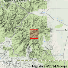
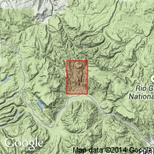
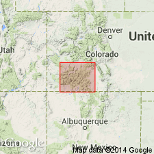
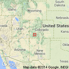
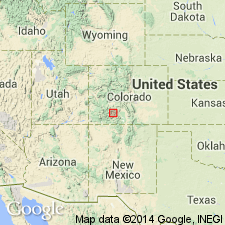
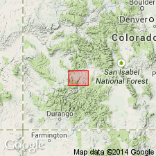
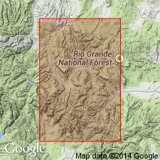
- Areal extent
- AAPG geologic province:
-
- San Juan basin
- San Juan Mountains province
- San Luis basin
Summary:
(E.S. Larsen's 1917 provisional and field names for Summitville quadrangle), p. 20, 36. Alboroto formation. A formation of Potosi volcanic series. Underlies Huerto formation and overlies Summitville formation in Platoro-Summitville district, southwestern Colorado. [Age is Miocene.]
Source: US geologic names lexicon (USGS Bull. 896, p. 27).
- Usage in publication:
-
- Alboroto group*
- Modifications:
-
- Revised
- AAPG geologic province:
-
- San Juan Mountains province
Summary:
Alboroto formation. In Platoro-Summitville district consists of 0 to 3,000 feet of quartz latite and rhyolite flows with some tuff. Is overlain by Huerto formation and rests unconformably on Summitville andesite. In Creede district, Mineral County, southwestern Colorado, the Alboroto becomes a group, divisible into 6 formations, and is unconformably overlain by Piedra formation (the Huerto being absent) and rests unconformably on rocks much older than Summitville andesite. [Age is Miocene.]
Source: US geologic names lexicon (USGS Bull. 896, p. 27).
- Usage in publication:
-
- Alboroto quartz latite*
- Modifications:
-
- Redefined
- Dominant lithology:
-
- Rhyolite
- Quartz latite
- AAPG geologic province:
-
- Piceance basin
- San Juan Mountains province
- San Luis basin
Summary:
[Credited to Larsen.] Alboroto quartz latite of Potosi volcanic series. Changed name to Alboroto quartz latite, and stated (p. 80) that the formation is confined to north and east flanks of Alboroto dome. [Age is Miocene.]
Source: US geologic names lexicons (USGS Bull. 896, p. 28).
- Usage in publication:
-
- Alboroto Rhyolite*
- Modifications:
-
- Areal extent
- AAPG geologic province:
-
- San Juan Mountains province
Summary:
Areally restricted from the western San Juan Mountains, San Juan Mountain province, CO. Rocks formerly called Alboroto now assigned to Sunshine Peak Rhyolite of middle and late Tertiary age.
Source: GNU records (USGS DDS-6; Denver GNULEX).
- Usage in publication:
-
- Alboroto Group
- Modifications:
-
- Not used
Summary:
Includes units widely scattered within the revised volcanic sequence as determined by authors. Name not used in this report.
Source: GNU records (USGS DDS-6; Denver GNULEX).
- Usage in publication:
-
- Alboroto Rhyolite*
- Modifications:
-
- Not used
Summary:
Ash-flow tuffs of Tertiary age formerly assigned to Alboroto Rhyolite of Potosi Volcanic Series, Montrose Co. in Paradox basin and Gunnison Co. in Piceance basin reassigned in this report to four newly named formations. Lower member of Alboroto is divided into: Blue Mesa (base); Dillon Mesa; and Sapinero Mesa Tuffs. Upper Member of Alboroto replaced by Fish Canyon Tuff. Terms Alboroto and Potosi not abandoned; they are not used.
Source: GNU records (USGS DDS-6; Denver GNULEX).
- Usage in publication:
-
- Alboroto Rhyolite†
- Modifications:
-
- Abandoned
- AAPG geologic province:
-
- San Luis basin
Summary:
Pg. A2-A3, A78. †Alboroto Rhyolite (abandoned) of Potosi Volcanic Group. Hitherto, included intracaldera and out-flow rocks of the San Juan field (Platoro-Summitville area, Rio Grande County, Colorado) derived from the La Garita caldera. These rocks are here reallocated to the Fish Canyon Tuff and its La Garita Member. Potosi Volcanic Group with other named formations remains in good usage outside report area.
Source: Publication; supplemental information from GNU records (USGS DDS-6; Denver GNULEX).
For more information, please contact Nancy Stamm, Geologic Names Committee Secretary.
Asterisk (*) indicates published by U.S. Geological Survey authors.
"No current usage" (†) implies that a name has been abandoned or has fallen into disuse. Former usage and, if known, replacement name given in parentheses ( ).
Slash (/) indicates name conflicts with nomenclatural guidelines (CSN, 1933; ACSN, 1961, 1970; NACSN, 1983, 2005, 2021). May be explained within brackets ([ ]).