The National Geologic Map Database is migrating to a new infrastructure. We apologize for any service disruptions during this process.
|
|---|


- Usage in publication:
-
- Abercrombie formation*
- Modifications:
-
- Original reference
- Dominant lithology:
-
- Limestone
- Shale
- AAPG geologic province:
-
- Great Basin province
Summary:
Pg. 421-432. Abercrombie formation. Most characteristic type is a blue-gray dense limestone, whose thin bedding is caused by thin bands or partings of yellow, buff, pink, or light-gray fossiliferous shale. The limestone bands are 0.25 to 0.5 inch thick. The shaly material is present only locally along many bedding planes and similar splotches of shale occur less commonly within the limestone and not parallel to the bedding. With increase or decrease in amount of shale the rock grades into lenticular shale beds or into relatively massively bedded limestones. Thickness 2,700+/- feet. Grades into underlying Busby quartzite and into overlying Young Peak dolomite. Age is Middle Cambrian, based on fossils (identified by C.E. Resser) from shale in lower part.
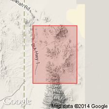
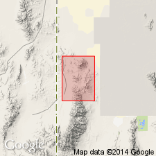
Abercrombie Peak on ridge south of Dry Canyon, [in T. 9 S., R. 18 W.], Gold Hill district, southern edge of Gold Hill 15-min quadrangle [1955 ed.], Tooele Co., western UT, is underlain by this formation, hence the name.
[See also Nolan's USGS Prof. Paper 177, 1935.]
Source: US geologic names lexicon (USGS Bull. 896, p. 8); supplemental information from GNU records (USGS DDS-6; Denver GNULEX, Menlo GNULEX).
- Usage in publication:
-
- Abercrombie formation*
- Modifications:
-
- Mapped
- Biostratigraphic dating
- AAPG geologic province:
-
- Great Basin province
Summary:
Measured section from south side of Dry Canyon is 2708 feet thick. Unit completely exposed only in southern third of Gold Hill 15-min quadrangle. Composed dominantly of thin-bedded argillaceous limestone, interbedded with a few more massive limestones and considerable amounts of shale. Rock most characteristic of series is blue-gray dense limestone; thin bedding caused by thin partings of yellow to buff, locally pink or light-gray shale. Thickness of partings is variable. Bedding boundaries are gradational; there is little persistence of beds along strike. Massive limestone is dolomitized. Unit may possibly be equivalent to Chisholm shale, lower part of Highland Peak, Teutonic, Dagmar, Herkimer, Hartmann, and Bowman limestones. Age is Middle Cambrian based on trilobites, brachiopods, mollusks.
Source: GNU records (USGS DDS-6; Menlo GNULEX).
- Usage in publication:
-
- Abercrombie Formation
- Modifications:
-
- [Not used]
- AAPG geologic province:
-
- Great Basin province
Summary:
Pg. 8 (fig. 5, Deep Creek Mountains, Utah, column). Majority of information below gleaned from L.B. McCollum and M.B. McCollum, 1984, IN Kerns, G.J., and Kerns, R.L., Jr., eds., Geology of northwest Utah, southern Idaho, and northeast Nevada, Field Conf. Gdbk., Utah Geol. Assoc. Pub., no. 13, p. 37 (fig. 2), 38-39.
[In Deep Creek Mountains, Utah, authors replace Nolan's Middle Cambrian Abercrombie Formation and Young Peak Dolomite with House Range terminology of Hintze and Robison (1975). Rocks previously assigned to the Abercrombie are reallocated to, ascending: Howell Formation, Chisholm Shale, Dome Limestone, Whirlwind Formation, Swasey Limestone, Wheeler Shale, and Pierson Cove Formation (also includes rocks previously assigned to Young Peak Dolomite).]
[Use of Middle Cambrian Abercrombie Formation and Young Peak Dolomite in the Deep Creek Mountains, Utah, retained by the USGS and the Utah Geological Survey.]
Source: Publication.
For more information, please contact Nancy Stamm, Geologic Names Committee Secretary.
Asterisk (*) indicates published by U.S. Geological Survey authors.
"No current usage" (†) implies that a name has been abandoned or has fallen into disuse. Former usage and, if known, replacement name given in parentheses ( ).
Slash (/) indicates name conflicts with nomenclatural guidelines (CSN, 1933; ACSN, 1961, 1970; NACSN, 1983, 2005, 2021). May be explained within brackets ([ ]).