- Usage in publication:
-
- Abbott formation*
- Modifications:
-
- Original reference
- Dominant lithology:
-
- Sandstone
- Shale
- Siltstone
- Coal
- AAPG geologic province:
-
- Illinois basin
Summary:
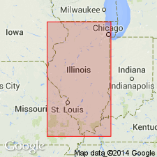
Pg. 8 (fig. 1), 28 (fig. 4), 30-31, 44 (table 1), pl. 1 geol. sections. Abbott formation of McCormick group. Proposed for strata from top of Pounds sandstone member of Caseyville formation to top of Bernadotte sandstone member of western Illinois. Overlaps Caseyville, and throughout most of central, northern, and western Illinois is basal formation of Pennsylvanian. Overlapped by Spoon formation of Kewanee group (both new). Consists of strata that were included in lower part of sequence formerly called Tradewater group. Characterized by dominance of sandstone, sandy shale, and siltstone; coals rarely more than 24 inches thick and have much less continuity than higher coals. Maximum thickness 300 to 350 feet in southern Illinois; thins westward and northward. In southern Illinois, subdivided into (ascending) Reynoldsburg coal, Grindstaff sandstone, Willis coal, Finnie sandstone (new), Delwood coal, and Murray Bluff sandstone members. In western Illinois, subdivided into Babylon sandstone, Manley coal, Tarter coal, Pope Creek coal, and Bernadotte sandstone members. Age is Middle Pennsylvanian (Desmoinesian). Report presents new rock-stratigraphic classification of Pennsylvanian of Illinois. Cyclical classification is retained but is independent of rock-stratigraphic classification; includes rocks also assigned to (alphabetical): Babylon, Delwood, Grindstaff, Macedonia (part), Pope Creek, Pounds (part), Seville (part), and Tarter cyclothems.
Type locality: along the Illinois Central RR, in secs. 5, 6, 7, 18, and 19, T. 11 S., R. 5 E., Harrisburg quadrangle, Pope Co., southeastern IL. Named from Abbott Station.
Source: Publication; US geologic names lexicon (USGS Bull. 1200, p. 7-8).

- Usage in publication:
-
- Abbott Formation
- Modifications:
-
- Overview
- AAPG geologic province:
-
- Illinois basin
Summary:
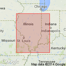
Pg. 165 (fig. P-2), 171 (fig. P-5), 181-183. Abbott Formation of McCormick Group of Kosanke and others (1960). Extends from top of Pounds Sandstone Member of Caseyville Formation to top of Bernadotte Sandstone Member of western Illinois (Murray Bluff Sandstone Member of southern Illinois). Includes (ascending): Reynoldsburg Coal Member, Grindstaff Sandstone Member, Babylon Sandstone Member, Manley Coal Member, Willis Coal Member, Tarter Coal Member, Finnie Sandstone Member, Delwood Coal Member, Pope Creek Coal Member, Bernadotte Sandstone Member, and Murray Bluff Sandstone Member. In subsurface, both the top and base of the Abbott are difficult to determine. Lithology is similar to underlying Caseyville. Maximum thickness 300 to 500 feet in southern Illinois; generally less than 100 feet in western Illinois. In northern and northeastern Illinois, overlain by Spoon Formation. Age is Middle Pennsylvanian (Atokan).
Source: Publication.

- Usage in publication:
-
- Abbott Formation
- Modifications:
-
- Revised
- AAPG geologic province:
-
- Illinois basin
Summary:
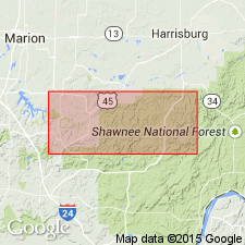
Authors have elected to retain the names Abbott and Spoon Formations despite difficulties in mapping caused by definition of Kosanke and others (1960). Though Abbott Formation was defined as all strata from the top of the Caseyville Formation to the top of the Murray Bluff Sandstone Member, the member was incorrectly identified by Kosanke and others at the Abbott type section. Abbott and Spoon lithologies grade into one another and where the Bernadotte Sandstone Member of the basal Spoon and the Murray Bluff of the uppermost Abbott are absent or unidentifiable, there is no means of differentiating the two formations. The Abbott covers most of the Eddyville quadrangle. It crops out southeast of the McCormick Anticline and on the New Burnside Anticline in the Stonefort quadrangle, and is on the surface in most of the southern half of the Creal Springs quadrangle. Unit is estimated to be 350 to 400 feet thick in the Eddyville quadrangle. Consists almost entirely of siliciclastics and a few lenses of coal and rare limestone. Proportions of sandstone, siltstone, and shale vary widely from place to place. Formation is not completely divided into members in this publication. Only the Reynoldsburg Coal Bed, at the base of the Abbott, and the Murray Bluff Sandstone Member, at the top, can be readily identified. Tunnel Hill Coal Bed named in this report; other units are informally designated. Map units from top to bottom include: Murray Bluff Sandstone Member; olive shale; middle Abbott sandstone lentils--including the Cedar Creek sandstone lentil; lower Abbott sandstone lentils--including the Ozark sandstone lentil; the Tunnel Hill Coal Bed, basal Abbott shale and sandstone--including the Sugar Creek sandstone lentil, and the Reynoldsburg Coal Bed. Reynoldsburg and Tunnel Hill Coal Beds assigned a late Morrowan (Early Pennsylvanian) age on the basis of palynological study, therefore age of Abbott is now Early and Middle Pennsylvanian. [Assignment to McCormick Group not mentioned in this report.]
Source: GNU records (USGS DDS-6; Reston GNULEX).

- Usage in publication:
-
- Abbott Formation
- Modifications:
-
- Not used
- AAPG geologic province:
-
- Illinois basin
Summary:
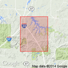
Abbott Formation. Not used in this report. Tradewater Formation in the Goreville quadrangle is subdivided into two informal mapping units, the lower Tradewater and the upper. These two units were mapped originally as the Abbott and Spoon Formations, but this earlier nomenclature was abandoned midway through the COGEOMAP project. The Tradewater Formation of Kentucky is revived and applied to this interval of rocks in Illinois as part of an agreement with the Indiana and Kentucky Geological Surveys to standardize Pennsylvanian terminology in the Illinois basin.
Source: Modified from GNU records (USGS DDS-6; Reston GNULEX).

- Usage in publication:
-
- Abbott Formation†
- Modifications:
-
- Abandoned
- AAPG geologic province:
-
- Illinois basin
Summary:
Pg. 6, pl. 1. †Abbott Formation. Use of Abbott Formation abandoned and Tradewater Formation of western Kentucky (has priority) is reintroduced into Illinois. Recent mapping in southern Illinois in type area of Abbott Formation has documented lateral facies changes which have led to miscorrelations in the past and which have rendered differentiation of the †Spoon (also abandoned) and Abbott Formations impractical in many areas (Nelson and others, 1991, Illinois State Geol. Survey Bull., no. 96; Jacobson, 1992, Illinois State Geol. Survey Bull., no. 97). Classification proposed in this report agreed upon by State Geological Surveys of Illinois, Indiana, and Kentucky. Report includes correlation chart.
Source: Publication.
For more information, please contact Nancy Stamm, Geologic Names Committee Secretary.
Asterisk (*) indicates published by U.S. Geological Survey authors.
"No current usage" (†) implies that a name has been abandoned or has fallen into disuse. Former usage and, if known, replacement name given in parentheses ( ).
Slash (/) indicates name conflicts with nomenclatural guidelines (CSN, 1933; ACSN, 1961, 1970; NACSN, 1983, 2005, 2021). May be explained within brackets ([ ]).

