

- Usage in publication:
-
- Sangre de Cristo conglomerate
- Modifications:
-
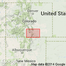
- Areal extent
- AAPG geologic province:
-
- Las Vegas-Raton basin
Summary:
Pg. 1. Sangre de Cristo conglomerate. The exposures in neighboring mountains to west indicate that it was not until near end of Carboniferous, when Sangre de Cristo conglomerate was formed, that any considerable accumulation of sediments took place.
Source: US geologic names lexicon (USGS Bull. 896, p. 1911-1912).
- Usage in publication:
-
- Sangre de Cristo formation
- Modifications:
-
- Areal extent
- AAPG geologic province:
-
- Las Vegas-Raton basin
Summary:
Sangre de Cristo formation. In Sangre de Cristo Range, [Colorado], the stratigraphic section corresponds very nearly with that at southern extremity of Greenhorn Mountains [in this quadrangle] except in respect to thickness of the conglomerate. Below Morrison formation there is in each case about same thickness of capping red sandstone, the coarse conglomerate and sandstone on which it rests attain in the Sangre de Cristo a thickness of several thousand feet. In that locality the beds have yielded an upper Carboniferous fauna and flora. Evidence of similar character from Fountain formation on eastern slope of Rocky Mountains is meager and contradictory, and it is still a question whether it should be classed as Permian or Triassic.
As Fountain and Sangre de Cristo formations have not sufficient geologic importance to warrant separation on areal geologic sheet, they are grouped together under name Badito formation, and referred to upper Carboniferous. The upper part of the Badito consists of 100 feet of massive or thick-bedded brick-red sandstone, sometimes shaly on weathered surface, and apparently corresponds to some part of Fountain formation. The lower part consists of coarse brownish red conglomerate. [In chart in back of folio Fountain formation is shown as overlying Sangre de Cristo formation and both as = Badito formation.]
Source: US geologic names lexicon (USGS Bull. 896, p. 1911-1912).
- Usage in publication:
-
- Sangre de Cristo formation
- Modifications:
-
- Areal extent
- AAPG geologic province:
-
- Las Vegas-Raton basin
Summary:
Pg. 2. Sangre de Cristo formation. A few miles west of the district [Spanish Peaks quadrangle] there are extensive exposures of reddish-brown coarse conglomerate (Sangre de Cristo formation) which attains an enormous thickness and is regarded as of late Carboniferous age. It was the erosion of this conglomerate that furnished bulk of material composing Huerfano beds of Spanish Peaks area (Huerfano and Las Animas Cos., central southern Colorado).
Source: US geologic names lexicon (USGS Bull. 896, p. 1911-1912).
- Usage in publication:
-
- Sangre de Cristo conglomerate
- Modifications:
-
- Principal reference
- Revised
- Dominant lithology:
-
- Conglomerate
- Siltstone
- Shale
- AAPG geologic province:
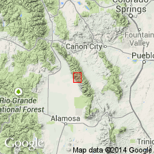
-
- San Luis basin
Summary:
Pg. 807-815. Sangre de Cristo conglomerate. Conglomerates, arkoses, and shales, noteworthy for red color throughout nearly entire formation. Most characteristic development and greatest thickness is in central part of Sangre de Cristo Range near village of Crestone [Saguache County, central southern Colorado], where it is probably at least 13,000 feet thick and where it forms backbone of the range. From this place it thins irregularly in both directions until it is 6,000 feet at Culebra Range, near southern border of State. To north of Crestone it thins to 4,300 feet in valley of Arkansas River southeast of Salida. Near Crestone it is divisible into 2 groups of strata: Upper Sangre de Cristo conglomerate (Permian), consisting of 5,500+/- feet of very coarse red conglomerates; and Lower Sangre de Cristo conglomerate (Pennsylvanian), consisting of 7,500+/- feet of finer conglomerates and arkoses, of darker color than Upper Sangre de Cristo conglomerate, and containing at base the Veta Pass limestone member. Rests on Leadville limestone (Mississippian). Though an angular unconformity was not seen between the Upper and Lower Sangre de Cristo conglomerates, it is believed that further search in this area may reveal such a break. The coarse conglomerate beds in Upper Sangre de Cristo conglomerate are "here named Crestone conglomerate phase of the Upper Sangre de Cristo conglomerate." [See under Crestone.]
Source: US geologic names lexicon (USGS Bull. 896, p. 1911-1912).
- Usage in publication:
-
- Sangre de Cristo formation
- Modifications:
-
- Areal extent
- AAPG geologic province:
-
- Las Vegas-Raton basin
Johnson, J.H., 1929, Contribution to the Geology of the Sangre de Cristo Mountains of Colorado: Colorado Scientific Society Proceedings, v. 12, no. 1, p. 1-21.
Summary:
Pg. 3-18. Sangre de Cristo formation. There is distinct unconformity between Upper Sangre de Cristo formation and Lower Sangre de Cristo at some localities, Sangre de Cristo Range, central southern Colorado. [Age is Pennsylvanian and Permian.]
Source: US geologic names lexicon (USGS Bull. 896, p. 1911-1912).
- Usage in publication:
-
- Sangre de Cristo formation*
- Modifications:
-
- Areal extent
- AAPG geologic province:
-
- Las Vegas-Raton basin
Summary:
Pg. 223. Sangre de Cristo formation. For continental arkoses and red beds that rest conformably, disconformably, or unconformably on Magdalena group over large areas in New Mexico, several terms have been used. Throughout most of the State, Abo formation is accepted. In Rowe-Mora basin, where indivisible arkose and red shale range in age from Upper Pennsylvanian to Permian, Sangre de Cristo formation is used. Arkosic member of Madera formation grades laterally and vertically into Sangre de Cristo. [Age is Pennsylvanian and Permian.]
Source: US geologic names lexicon (USGS Bull. 1200, p. 3444-3445).
- Usage in publication:
-
- Sangre de Cristo formation*
- Modifications:
-
- Mapped
- AAPG geologic province:
-
- Las Vegas-Raton basin
Summary:
Sangre de Cristo formation. Composed of terrestial sedimentary rocks; brownish-red conglomerate, arkose, sandstone, and shale. Total thickness within mapped area is unknown (estimated to be 3,300 feet); exposures are highly faulted. A thickness of 943 feet measured in northwestern Ocate Creek Valley, but probably is only upper one-fourth of formation. Is generally correlative with Abo formation of central New Mexico. In the Rowe-Mora basin, northwestern Mora County, northeastern New Mexico, possibly represents lateral equivalent of upper part of Magdalena group to south, thus in vicinity of Las Vegas, New Mexico, intertongues with Madera formation (citing Northrop and others, 1946, USGS Oil Gas Inv. Prelim. Map 54). [Shown in graphic sections of parts of Mora County underlying, and interfingering with, Yeso formation; where Yeso is absent, directly underlies Glorieta sandstone member of San Andres formation.] Age is considered Pennsylvanian and Permian(?).
Source: Publication; US geologic names lexicon (USGS Bull. 1200, p. 3444-3445).
- Usage in publication:
-
- Sangre de Cristo formation
- Modifications:
-
- Areal extent
- AAPG geologic province:
-
- Las Vegas-Raton basin
Baltz, E.H., and Bachman, G.O., 1956, Notes on the geology of the southeastern Sangre de Cristo Mountains, New Mexico: New Mexico Geological Society Field Conference Guidebook, Oct. 19-21, 1956, no. 7, p. 96-108.
Summary:
Pg. 98 (fig. 2), 100-101. Sangre de Cristo formation. Summary article on occurrence of formation in southeastern Sangre de Cristo Mountains, New Mexico. Lower contact generally placed at top of highest marine limestone of underlying Magdalena group (Madera limestone). Underlies Yeso formation. Ranges in age from Middle or Late Pennsylvanian to Early Permian.
Source: US geologic names lexicon (USGS Bull. 1200, p. 3444-3445).
- Usage in publication:
-
- Sangre de Cristo formation
- Modifications:
-
- Revised
- AAPG geologic province:
-
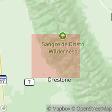
- San Luis basin
Summary:
Pg. 1903 (fig. 5), 1904 (fig. 6), 1922-1927 [see also D.W. Bolyard, 1956, Univ. Colorado unpub. MS thesis; D.W. Bolyard, 1956a, Permo-Pennsylvanian section at La Veta Pass, CO, Rocky Mtn. Geol. Raton Basin Gdbk.].
Sangre de Cristo formation. Described in Sangre de Cristo Mountains between La Veta Pass and Westcliffe, Colorado. Comprises up to 8,000 feet or more of predominantly fluvial strata; differentiated from underlying units by its redbeds. Two members recognized in northern part of area: lower, characterized by piedmont cyclothems and Crestone conglomerate. In fault contact with Pass Creek sandstone (new); overlies Madera formation and in some areas Minturn formation. Age is [Middle] Pennsylvanian(?) (Desmoinesian?) and [Early?] Permian (probably Wolfcamp). Type locality designated.
[Type area]: area east of Crestone townsite, on west flank of central anticline between Crestone Needle on south and Eureka Mountain on north, Saguache Co., central southern CO. Here, both members are well developed and structure is least complex. Continuous type section not designated for entire formation because faulting, topography, and inaccessibility make it difficult to measure such a section.
Source: US geologic names lexicon (USGS Bull. 1200, p. 3444-3445); GNU records (USGS DDS-6; Denver GNULEX).
- Usage in publication:
-
- Sangre de Cristo formation*
- Modifications:
-
- Revised
- AAPG geologic province:
-
- Las Vegas-Raton basin
Summary:
Pg. 1895-1902. Sangre de Cristo formation. Sedimentary rocks of Triassic age generally have been thought to be missing from outcrops in Sangre de Cristo formation of Pennsylvanian and Permian age. Two units of probable Triassic age have been separated from top of the Sangre de Cristo formation; one is herein named Johnson Gap formation [see entry under Johnson Gap]. The other correlated with Lykins formation and in this report referred to as Lykins(?) formation.
Source: US geologic names lexicon (USGS Bull. 1200, p. 3444-3445).
- Usage in publication:
-
- Sangre de Cristo Formation*
- Modifications:
-
- Mapped 1:250k
- Dominant lithology:
-
- Conglomerate
- Sandstone
- Siltstone
- Shale
- Limestone
- AAPG geologic province:
-
- Las Vegas-Raton basin
Summary:
Sangre de Cristo Formation. Subdivided into, and separately mapped, (1) red and gray conglomerate, arkose, sandstone, siltstone, shale, and gray limestone; and (2) Crestone conglomerate phase of Melton (1925), maroon massive conglomerate facies. Underlies Jurassic and Cretaceous rocks and overlies Pennsylvanian Minturn Formation. Age is Pennsylvanian to Permian.
Source: Publication.
- Usage in publication:
-
- Sangre de Cristo Formation*
- Modifications:
-
- Principal reference
- Revised
- Dominant lithology:
-
- Conglomerate
- Sandstone
- Siltstone
- AAPG geologic province:
-
- San Luis basin
Summary:
Sangre de Cristo Formation. In Crestone-Rito Alto Peak area, Custer and Saguache Counties, central southern Colorado, subdivided into (descending): Crestone Conglomerate Member, coarse conglomerate, conglomeratic sandstone, minor siltstone and shale, 1,132 m thick; and unnamed lower member, red conglomerate, sandstone, siltstone and minor shale, 607 m thick, containing fossil plant fragments and conodonts. Overlies Minturn Formation; contact placed at top of coarse-grained, pink, medium-bedded sandstone that lies 23.8 m above a gray, fossiliferous, silty marker limestone. Top eroded. Age is considered Middle Pennsylvanian to Early Permian.
Principal reference section (=principal reference section of Crestone Conglomerate Member): northeast of Crestone in Groundhog Basin, [in NW/4 sec. 15, T. 44 N., R. 12 E., Lat. 38 deg. 03 min. 55 sec. N., Long. 105 deg. 39 min. 07 sec. W., Rito Alto Peak 7.5-min quadrangle], Saguache Co., southern central CO. See also Lindsey and others, 1985, USGS Misc. Field Stud. Map MF-1787.
[Additional locality information from USGS historical topographic map collection TopoView and USGS GNIS database, accessed Mother's Day 2018.]
Source: Modified from GNU records (USGS DDS-6; Denver GNULEX).
- Usage in publication:
-
- Sangre de Cristo Formation*
- Modifications:
-
- Mapped 1:24k
- Dominant lithology:
-
- Conglomerate
- Sandstone
- Siltstone
- Shale
- AAPG geologic province:
-
- Las Vegas-Raton basin
Summary:
Sangre de Cristo Formation. In Crestone-Rito Alto Peak area, Custer and Saguache Counties, central southern Colorado, subdivided into (descending): Crestone Conglomerate Member, red conglomerate, conglomeratic sandstone, sandstone, and minor siltstone and shale, about 1,100 to 2,000 m thick; and unnamed lower member, about 600 to 900 m thick, of red arkosic sandstone, conglomeratic sandstone, siltstone, and shale, arranged in fining-upward cycles, lower part contains a few fossiliferous (crinoids, brachiopods, stromatolites, fusulinids, conodonts) limestone beds. Conformably overlies Minturn Formation. Age is considered Pennsylvanian and Permian.
Source: Publication.
- Usage in publication:
-
- Sangre de Cristo Formation*
- Modifications:
-
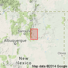
- Areal extent
- AAPG geologic province:
-
- Las Vegas-Raton basin
- Palo Duro basin
Summary:
Mapped in southeastern Sangre de Cristo Mountains, Mora and San Miguel Cos, NM, Las Vegas-Raton and Palo Duro basins. Crops out northward from Montezuma to edge of map along hogbacks, on Crestone anticline, in Chapelle syncline, in drainage basin of Pecos River, and in Las Gallinas and Las Dispensas synclines; occurs in subsurface of Las Vegas basin and Sierra Grande uplift. Consists mostly of nonmarine red, purple, and some greenish shale with interbeds of feldspathic to arkosic sandstone, pebbly arkosic conglomerate, and few nonfossiliferous, bedded limestones and limestone nodules. Maximum thickness is 2575 ft at Mora River; minimum thickness is 300 ft near Starvation and Tecolote Peaks; in subsurface thickness ranges from 180 ft on Sierra Grande uplift thickening northward to 2560 ft in Las Vegas basin. Isopach map (pl. 4); measured sections; fossil list. Overlies Alamitos Formation of Madera Group; conformably underlies Yeso Formation. Early Permian (Wolfcampian) age from south of Gallinas Creek to probably as far north as La Canada del Guajalote; farther north lower part is probably Late Pennsylvanian (Virgilian?) based partly on palynomorphs. Name Abo Formation should have been retained for Lower Permian rocks because of similar lithology, age, and stratigraphic relations to adjacent rocks as Abo of central NM, but Sangre de Cristo has been used in area since Read and others (1944, USGS Oil and Gas Invest. Prelim. Map 21).
Source: GNU records (USGS DDS-6; Denver GNULEX).
For more information, please contact Nancy Stamm, Geologic Names Committee Secretary.
Asterisk (*) indicates published by U.S. Geological Survey authors.
"No current usage" (†) implies that a name has been abandoned or has fallen into disuse. Former usage and, if known, replacement name given in parentheses ( ).
Slash (/) indicates name conflicts with nomenclatural guidelines (CSN, 1933; ACSN, 1961, 1970; NACSN, 1983, 2005, 2021). May be explained within brackets ([ ]).