

- Usage in publication:
-
- Sage pebble-conglomerate member
- Modifications:
-
- Named
- Dominant lithology:
-
- Conglomerate
- Shale
- Limestone
- AAPG geologic province:
-
- Montana folded belt
Summary:
Name Sage pebble-conglomerate member proposed for the upper member of Snowy Range formation. Formerly called "Pebbly limestones" by Peale (1893, USGS Bull. 110). Occurs in Horseshoe Hills area, western Gallatin County, Montana, to western slope of Absaroka Range, Park County, Montana. Consists of intercalated shales and limestone pebble conglomerates with a dense columnar limestone near the base. Thickness 150 to 175 feet thick in southern Montana where entire member is preserved. Conformably underlies Upper Devonian Maywood formation. Conformably overlies Dry Creek shale member of Snowy Range formation. Age is Late Cambrian, based on stratigraphic position. Report includes correlation chart, cross section.
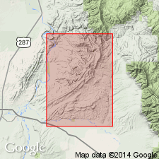
Type locality on south slope of Castle Rock, at junction of the East Fork (of Mill Creek) with Mill Creek, in either N/4[?] or N/2[?] SE/4 sec. 13, T. 6 S., R. 9 E., Livingston quadrangle, Park Co., MT. Named from Lower Sage Creek which enters East Fork of Mill Creek 1.5 mi upstream from type locality, Park Co., MT, in Montana folded belt province.
[Discrepancy: GNC records (US geologic names lexicon, USGS Bull. 1200) state it is in "N/4…" GNU records (USGS DDS-6; Denver GNULEX) state type locality in "N/2…" --unresolved.]
Source: US geologic names lexicon (USGS Bull. 1200, p. 3379-3380); supplemental information from GNU records (USGS DDS-6; Denver GNULEX).
- Usage in publication:
-
- Sage limestone member
- Modifications:
-
- Revised
- Areal extent
- AAPG geologic province:
-
- Montana folded belt
Summary:
Assigns to Red Lion formation as upper of two members. Unit is valid from Phillipsburg, Granite Co, to Madison Range, Madison Co, MT, Montana folded belt province. Conformably overlies Dry Creek shale member; unconformably underlies Maywood formation. Where Dry Creek is locally missing at Camp, Whitetail and Jourdain Creeks, Sage in contact with underlying Pilgrim limestone. Fossil list. Measured sections. Correlation chart. Late Cambrian age.
Source: GNU records (USGS DDS-6; Denver GNULEX).
- Usage in publication:
-
- Sage limestone
- Modifications:
-
- Revised
- AAPG geologic province:
-
- Yellowstone province
- Green River basin
- Bighorn basin
- Wind River basin
Summary:
Gallatin formation raised to group rank and its members raised to formation rank in footnote on Chart II. Includes (ascending): Dunoir [sic] limestone (Dresbachian), Dry Creek shale (early Franconian), and Sage limestone (middle to late Franconian). Gallatin overlies Park shale (rank raised) of Gros Ventre group (rank raised). Gallatin unconformably underlies Darwin sandstone. This nomenclature is used from Jackson Hole in Yellowstone province, in southwest WY, Greater Green River basin, in the Bighorn and Wind River basins. Only the Sage limestone is present in eastern Bighorn basin.
Source: GNU records (USGS DDS-6; Denver GNULEX).
- Usage in publication:
-
- Sage pebble-conglomerate member
- Modifications:
-
- Areal extent
- AAPG geologic province:
-
- Montana folded belt
Summary:
Pg. 1388-1390 (table 1), 1395. Sage pebble-conglomerate member of Snowy Range formation. Is upper member of Snowy Range formation. In Bridger Range, Gallatin County, Montana, consists of fine-grained, thin-bedded, dense limestone and limestone pebble conglomerate, with interbedded green shale; includes at base a 4- to 25-foot-thick biostromal, columnar limestone composed of the calcareous algae COLLENIA MAGNA Fenton and Fenton. Total thickness 121 to 204 feet. Overlies Dry Creek shale member of Snowy Range formation; underlies Maywood(?) formation. Age is middle to late Late Cambrian (early Franconian to late Trempealeauan), based on fossils; basal columnar limestone yielded fossils of ELVINA zone (citing Lochman, 1950, AAPG Bull., v. 34, p. 2213).
Source: Publication.
- Usage in publication:
-
- Sage Member
- Modifications:
-
- Overview
- AAPG geologic province:
-
- Montana folded belt
- Central Montana uplift
- Bighorn basin
- Yellowstone province
Summary:
Snowy Range Formation measured at 24 locations in Horseshoe Hills and Bridger Mountains, MT, and at 8 locations elsewhere in MT and WY near Yellowstone National Park between Missouri River and Clarks Fork of Yellowstone River, all within Gallatin, Park, and Carbon Cos, MT and Park Co, WY, in Montana folded belt province, Central Montana uplift, Bighorn basin, and Yellowstone province. Snowy Range divided into, in ascending order: Dry Creek, Sage, and Grove Creek Members. Sage is thickest and most fossiliferous of three members. As originally deposited, thickness probably ranged from 120-220 ft, averaging close to 200 ft; however, upper part has been removed by pre-Late Devonian erosion at many localities. In Horseshoe Hills, its thickness ranges from 15-120 ft, averaging 55 ft; in Bridger Mountains, thickness ranges from 70-215 ft, averaging 120 ft; from Bridger Mountains to Yellowstone, average thickness is 50 ft; and from Mill Creek to Swamp Lake, its thickness is a relatively constant 200 ft. Petrographic descriptions; fossil list and descriptions; cross sections showing trilobite zones. Franconian and Trempealeauan (middle and late Late Cambrian) age based on trilobites and brachiopods.
Source: GNU records (USGS DDS-6; Denver GNULEX).
- Usage in publication:
-
- Sage Limestone Member*
- Modifications:
-
- Overview
- AAPG geologic province:
-
- Yellowstone province
- Montana folded belt
Summary:
Dry Creek Shale (lowermost), Sage Limestone, and Grove Creek (uppermost) Members mapped undivided as Snowy Range Formation in northern part of Yellowstone National Park, Park Co, WY, Yellowstone province, and Park Co, MT, Montana folded belt province. Thickness of Sage ranges from about 45 ft on Three Rivers Peak in Gallatin Range to 150 ft on southwest slope of Meridian Peak near Northeast Entrance. Reference section for Snowy Range designated at Three Rivers Peak, at head of Gallatin River, in Gallatin Range. Stratigraphic chart. Fossiliferous beds; some are coquinas. Bed, 10-15 ft thick, of algal columns of COLLENIA MAGNA present at base of unit, from Buffalo Plateau eastward to Northeast Entrance. Late Cambrian age.
Source: GNU records (USGS DDS-6; Denver GNULEX).
- Usage in publication:
-
- Sage Dolomite Member*
- Modifications:
-
- Redescribed
- Dominant lithology:
-
- Dolomite
- AAPG geologic province:
-
- Montana folded belt
Summary:
Upper of two members of Red Lion Formation in northern part of Ruby Range, Madison Co, MT, Montana folded belt province. Redescribed. Basal part consists of 1- to 3-in thick beds of pale yellowish-brown dolomite with intercalated reddish-brown silty dolomite laminae overlain by 1/2-2 in thick beds of yellowish-brown finely crystalline dolomite, locally mottled grayish-red with thin interbeds of bioclastic dolomite. Upper part consists of light-gray-weathering, thin- to thick-bedded dense dolomite. In small area north of McHesson Creek, upper part contains dolomitized stromatolites. Upper part mistakenly assigned to Bighorn Dolomite by Hanson (1952). Late Cambrian (Franconian) age.
Source: GNU records (USGS DDS-6; Denver GNULEX).
For more information, please contact Nancy Stamm, Geologic Names Committee Secretary.
Asterisk (*) indicates published by U.S. Geological Survey authors.
"No current usage" (†) implies that a name has been abandoned or has fallen into disuse. Former usage and, if known, replacement name given in parentheses ( ).
Slash (/) indicates name conflicts with nomenclatural guidelines (CSN, 1933; ACSN, 1961, 1970; NACSN, 1983, 2005, 2021). May be explained within brackets ([ ]).