

- Usage in publication:
-
- Yellowstone tuff
- Modifications:
-
- Named
- Dominant lithology:
-
- Tuff
- AAPG geologic province:
-
- Yellowstone province
Summary:
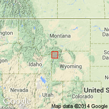
No type locality designated. Probably named for Yellowstone National Park. Is exposed over an area of 600 sq mi in Yellowstone National Park, Yellowstone province, WY. Crops out as a brown or purple lithoidal rock in highlands cut by numerous deep canyons. Probably underlies flows over an additional area of 1,000 sq mi. Welded rhyolite tuff similar to Yellowstone tuff crops out over large areas west of Park in MT and WY. Is commonly brown, gray, and purple tuff that crumbles easily, weathers in spheroidal masses, forms talus that has the consistency of fine gravel, has a pronounced foliation, and shows crude columnar jointing. Is underlain by up to 10 ft of finely laminated rhyolitic ash that is well sorted into coarse and fine layers. Base of Yellowstone tuff is characterized by a 1-15 ft layer of obsidian. Is as much as 1,000 ft thick. Is older than the Plateau flows. Assigned to the Pliocene.
Source: GNU records (USGS DDS-6; Denver GNULEX).
- Usage in publication:
-
- Yellowstone Group*
- Modifications:
-
- Geochronologic dating
- Revised
- AAPG geologic province:
-
- Yellowstone province
- Snake River basin
- Montana folded belt
Summary:
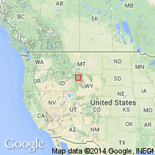
Three cooling units of ash-flow tuff recognized on the Yellowstone plateau. The three rhyolitic tuffs are named Huckleberry Ridge (oldest and belonging to first volcanic cycle), Mesa Falls (middle and belonging to second volcanic cycle), and Lava Creek (youngest and belonging to third volcanic cycle) Tuffs. Occurs in Yellowstone National Park, and extends south within Teton Co, Yellowstone province; extends west occurring in Island Park, Fremont Co area and southern Centennial Mountains area, ID, Snake River basin; and in southern Madison Range, MT, Montana folded belt province. No single exposure shows all three tuffs in succession. Tuffs are part of Yellowstone Group (raised in rank). Tuffs are welded, predominantly devitrified, containing phenocrysts of quartz, sanidine, and sodic plagioclase. Common minor phenocrysts are opaque oxides, clinopyroxene, fayalite, zircon, hornblende, allanite, and chevkinite. The group lies on rocks as old as Precambrian and as young as Quaternary. K-Ar dating on sanidine yielded ages of 2 m.y. [Pliocene] on Huckleberry Ridge, 1.2 m.y. [Pleistocene] on Mesa Falls, and 600,000 yrs [Pleistocene] on Lava Creek.
Source: GNU records (USGS DDS-6; Denver GNULEX).
For more information, please contact Nancy Stamm, Geologic Names Committee Secretary.
Asterisk (*) indicates published by U.S. Geological Survey authors.
"No current usage" (†) implies that a name has been abandoned or has fallen into disuse. Former usage and, if known, replacement name given in parentheses ( ).
Slash (/) indicates name conflicts with nomenclatural guidelines (CSN, 1933; ACSN, 1961, 1970; NACSN, 1983, 2005, 2021). May be explained within brackets ([ ]).