

- Usage in publication:
-
- Woods Ranch Formation
- Modifications:
-
- Revised
- AAPG geologic province:
-
- Paradox basin
Summary:
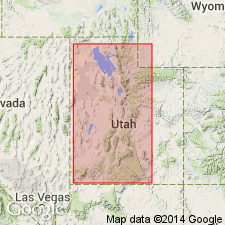
Dolomite unconformably above the White Rim Sandstone in UT in the Capitol Reef area and unconformably above the Cedar Mesa Sandstone in the San Rafael area formerly assigned to the Kaibab Limestone is removed from the Kaibab and reassigned to the newly named Black Box Dolomite. Term Kaibab is restricted geographically to two areas of southwest UT discussed in this report--Marysvale and Beaver Dam. Kaibab considered --at Marysvale, to be of group rank in this report and is divided into: 1) Toroweap Formation (basal unit) and Fossil Mountain Limestone (top); and 2) in the Beaver Dam Mountains --Seligman (base) and Brady Canyon Limestones, Woods Ranch Formation, Kaibab Limestone, and Plympton Formation ["when a unit is divided into two or more of the same rank as the original, the original name should not be used for any of the divisions." NASC, 1983, art. 19g.], and Plympton Formation (top). Black Box shown as equivalent to Kaibab of the Beaver Dam Mountains. Cross section. Permian age. [Intent or reason to modify rank of Kaibab not stated.]
Source: GNU records (USGS DDS-6; Denver GNULEX).
- Usage in publication:
-
- Woods Ranch Member*
- Modifications:
-
- Named
- Dominant lithology:
-
- Gypsum
- Dolomite
- Sandstone
- Limestone
- AAPG geologic province:
-
- Plateau sedimentary province
- Basin-and-Range province
Summary:
Named upper slope-forming member of Toroweap Formation for Woods Ranch in upper Whitmore Canyon, Mohave Co, AZ, Plateau sedimentary province. Type locality 182.7 ft thick measured 1.3 mi southeast of ranch house in SW1/4 sec 12, T33N, R9W at north end of Hurricane Cliffs. Consists of: 1) white massive gypsum; some beds have black bands; 2) dolomite that varies from tan, gray to black, and may be hard, dense, silty, fine grained, thin-bedded and has black chert as lenses and nodules; 3) sandstone that may be yellow or brown, silty, poorly sorted, soft, calcareous, slope-forming; 4) limestone tan and weathers light brown, fine grained, silty, thin to even bedded; 5) minor amounts of red and green, mottled siltstone, red mottled mudstone, or red mottled gypsiferous claystone. Gypsum predominant (67+ ft thick). East and south of Grand Canyon towards Flagstaff and Verde Valley, lithology changes to yellow and white, fine-grained, calcium-cemented sandstone that forms weak cliff over the Coconino. Ranges 180-200 ft thick. East of north-south line between Page and Prescott in Basin-and-Range province, member merges into Toroweap undivided. Overlies Brady Canyon Member (named) of Toroweap. Underlies Fossil Mountain Member (named) of Kaibab. Formerly assigned to Toroweap as alpha member by McKee (1938). Named by Sorauf (1962) in unpublished thesis. Nomenclature chart. Of Early Permian, Leonardian age.
Source: GNU records (USGS DDS-6; Denver GNULEX).

- Usage in publication:
-
- Woods Ranch Member*
- Modifications:
-
- Areal extent
- AAPG geologic province:
-
- Great Basin province
Summary:
Mapped in east-central Lincoln Co., NV, Great Basin province as the upper member of the Toroweap Formation. Overlies Brady Canyon Member of Toroweap. Underlies Fossil Mountain Member of Kaibab Formation. Consists of thin bedded, fine grained gray sandstone, siltstone, shale and gypsum about 15 m thick. Forms covered slope interval between the more resistant carbonate units. Of Early Permian, Leonardian age.
Source: GNU records (USGS DDS-6; Denver GNULEX).
For more information, please contact Nancy Stamm, Geologic Names Committee Secretary.
Asterisk (*) indicates published by U.S. Geological Survey authors.
"No current usage" (†) implies that a name has been abandoned or has fallen into disuse. Former usage and, if known, replacement name given in parentheses ( ).
Slash (/) indicates name conflicts with nomenclatural guidelines (CSN, 1933; ACSN, 1961, 1970; NACSN, 1983, 2005, 2021). May be explained within brackets ([ ]).