

- Usage in publication:
-
- Undine Falls Basalt*
- Modifications:
-
- Named
- Dominant lithology:
-
- Basalt
- AAPG geologic province:
-
- Yellowstone province
Summary:
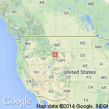
Named for waterfall on Lava Creek near Mammoth-Tower Junction road just south of Mount Everts, Yellowstone National Park, WY in Yellowstone province. Cliff on north side of Lava Creek Canyon just west of falls is designated the type locality. Consists of several thin basaltic flows 6 m thick at type. Overlies Cretaceous shale and sandstone; underlies Lava Creek Tuff (new) of Yellowstone Group (rank raised from formation). Source vent is a small scoria and cinder cone 3 km north of Broad Creek crossing of the Wapiti Lake Trail. Presumed to be younger than 700,000 years because of position beneath Lava Creek. Is part of the third volcanic cycle of the Yellowstone Plateau. Stratigraphic table; cross section.
Source: GNU records (USGS DDS-6; Denver GNULEX).
For more information, please contact Nancy Stamm, Geologic Names Committee Secretary.
Asterisk (*) indicates published by U.S. Geological Survey authors.
"No current usage" (†) implies that a name has been abandoned or has fallen into disuse. Former usage and, if known, replacement name given in parentheses ( ).
Slash (/) indicates name conflicts with nomenclatural guidelines (CSN, 1933; ACSN, 1961, 1970; NACSN, 1983, 2005, 2021). May be explained within brackets ([ ]).