

- Usage in publication:
-
- Torrey Member
- Modifications:
-
- Named
- Dominant lithology:
-
- Sandstone
- Siltstone
- AAPG geologic province:
-
- Paradox basin
Summary:
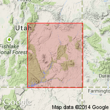
Named as a member (one of four) of Moenkopi Formation in southeast UT in Paradox basin. Type section designated on west side of prominent mesa south of Torrey in sec 30, T29S, R5E, Wayne Co. Same rocks were formerly called ledge forming member. Measured sections. Composed of very fine to fine-grained ledge-forming sandstone and silty sandstone intercalated with siltstone and very micaceous sandy siltstone. Varies from pale red brown to gray red and yellow brown to gray red. Mud-pebble conglomerate with micritic dolomite interclasts found in east part of study area. Sandy dolomite or dolomitic limestone common in west part of area. Is usually 200-300 ft thick. Is 272 ft thick at type. Areal limits shown on figure. Thickens westward. Characterized by variety of sedimentary structures (laminar and cross-laminar bedding, climbing ripples and ripple laminations, mud cracks, load casts, burrowing structures, disturbed bedding, tracks and trails, sole marks, feeding marks). Divisible into 5 facies (Hideout Canyon, North Wash, Goosenecks, Wickiup and basal siltstone and mudstone). Overlies Sinbad Limestone Member or Hoskinnini Formation. Underlies Moody Canyon Member (new) of Moenkopi. Diagnostic fossils uncommon. Fossil fish scales, pelecypods, ostracods, and rushes found. Is of Early Triassic, late Scythian or Spathian age. Deposited concurrently with Thaynes Formation and Virgin Limestone Member (of Moenkopi).
Source: GNU records (USGS DDS-6; Denver GNULEX).
For more information, please contact Nancy Stamm, Geologic Names Committee Secretary.
Asterisk (*) indicates published by U.S. Geological Survey authors.
"No current usage" (†) implies that a name has been abandoned or has fallen into disuse. Former usage and, if known, replacement name given in parentheses ( ).
Slash (/) indicates name conflicts with nomenclatural guidelines (CSN, 1933; ACSN, 1961, 1970; NACSN, 1983, 2005, 2021). May be explained within brackets ([ ]).