

- Usage in publication:
-
- Topopah Spring member*
- Modifications:
-
- Named
- Dominant lithology:
-
- Tuff
- AAPG geologic province:
-
- Great Basin province
Summary:
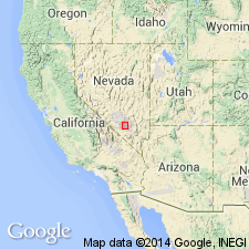
Named as a member (1 of 8) of Oak Spring formation for exposures near Topopah Spring south of Shoshone Mountain, and north of Shoshone Mesa, Nevada Test Site, Nye Co, NV in the Great Basin province. No type locality designated. Consists of brown and reddish-purple densely welded tuff. Has a persistent black and brown vitrophyre in upper part and local vitrophyre in lower part. Local zones of geodes and lithophysae. Strongly eutaxitic in west part of Site. Basal tuff is nonwelded to partly welded, locally silicified. Pale red crystal-poor tuff in lower part. Pumice fragments are as much as 18 inches long at east edge. Forms steep slopes and cliffs. Phenocrysts of feldspar, quartz and biotite make up about 1 percent of tuff at base increasing to 15 percent near top. Plagioclase predominates in lower vitrophyre. Potassium feldspar predominates in upper vitrophyre. Fragments of dark dense rocks make up less than 5 percent of the rock. Shown on cross as above the lower member and below the Tiva Canyon member (new) both of Oak Spring, and as tonguing out into the Survey Butte member (new) of Oak Spring. Of Miocene? or younger age.
Source: GNU records (USGS DDS-6; Denver GNULEX).

- Usage in publication:
-
- Topopah Spring Member*
- Modifications:
-
- Revised
- AAPG geologic province:
-
- Great Basin province
Summary:
Reassigned from being one of the members of the Oak Spring Formation to member (1 of 5) of Piapi Canyon Formation (new), upper formation of Oak Spring Group (rank raised). Shown on a cross section between Oak Spring Butte (north) and Skull Mountain (south), Nevada Test Site, Nye Co, NV in the Great Basin province above lower member of Indian Trail Formation (new) of Oak Spring, and as tonguing into the Survey Butte Member (also reassigned from Oak Spring Formation to Piapi Canyon Formation of Oak Spring), into the andesitic rocks of Wahmonie Flat. Is overlain southward successively by Survey Butte Member, Tiva Canyon Member (also reassigned from Oak Spring Formation to Piapi Canyon Formation), and farther south by Rainier Mesa Member (reassigned to Piapi Canyon). Is a multiple-flow simple or compound cooling unit of rhyolitic welded and nonwelded ash-flow tuff and associated ash-fall tuff. Thought to have been derived from the Timber Mountain area to west. Of early Pliocene or younger age.
Source: GNU records (USGS DDS-6; Denver GNULEX).

- Usage in publication:
-
- Topopah Spring Member*
- Modifications:
-
- Revised
- AAPG geologic province:
-
- Great Basin province
Summary:
Is one of five named members reassigned from the Piapi Canyon Formation to Paintbrush Tuff (new) of Piapi Canyon Group (rank raised). Term Oak Spring as a formation or as a group abandoned. Overlies and underlies unnamed bedded tuff of Paintbrush. Nomenclature chart. Cross section. Is recognized in the north and south part, and in the Frenchman Flat and Yucca Flat areas, Nevada Test Site, Nye Co, NV in the Great Basin province. Miocene? and Pliocene age assigned to the Paintbrush.
Source: GNU records (USGS DDS-6; Denver GNULEX).

- Usage in publication:
-
- Topopah Spring Member*
- Modifications:
-
- Areal extent
- AAPG geologic province:
-
- Great Basin province
Summary:
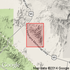
On Skull Mountain, Wahmonie Formation (new) is directly overlain by Topopah Spring Member of Paintbrush Tuff of Piapi Canyon Group. Northwest of Wahmonie Flat, late flow of Wahmonie occurs between Topopah Spring and Tiva Canyon Members of Paintbrush Tuff.
Source: GNU records (USGS DDS-6; Menlo GNULEX).
- Usage in publication:
-
- Topopah Spring Member*
- Modifications:
-
- Overview
- Geochronologic dating
- AAPG geologic province:
-
- Great Basin province
Summary:
Locations of eight measured sections of Topopah Spring Member of Paintbrush Tuff shown on geologic sketch map which also gives distribution and thickness. Chemical analyses, detailed lithological and petrographic description included. K-Ar age of 13.2 +/-0.3 Ma (R.W. Kistler, written commun., 1964) was determined on biotite from unit. [Based on DNAG 1983 Geologic Time Scale age is Miocene].
Source: GNU records (USGS DDS-6; Menlo GNULEX).
- Usage in publication:
-
- Topopah Spring Member*
- Modifications:
-
- Areal extent
- Overview
- AAPG geologic province:
-
- Great Basin province
Summary:
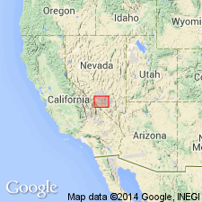
Is the lowest named member (of four named members) of the Paintbrush Tuff. Distribution map; extends across southern Nye Co, NV into eastern Inyo Co, CA in the Great Basin province. Has a maximum thickness of nearly 275 m on west flank of C P Hills. Is not exposed outside the Claim Canyon cauldron, its source area. Total extracauldron volume is about 160 cubic km. Probably more than 250 cubic km was erupted. Has a high-silica rhyolitic lower zone and a quartz latitic upper zone. A middle xenolithic unit containing granitic fragments separates the lower and upper parts near the south rim of the cauldron. Is distinguished from other members of the Paintbrush modally by lack of sphene. Has normal thermal remanent magnetization. Has a 13.2 m.y. age. Stratigraphic chart. Overlies and underlies bedded tuff of the Paintbrush. Modal analyses.
Source: GNU records (USGS DDS-6; Denver GNULEX).
- Usage in publication:
-
- Topopah Spring Member*
- Modifications:
-
- Age modified
- AAPG geologic province:
-
- Great Basin province
Summary:
Age of Topopah Spring Member of Paintbrush Tuff in report area [Bare Mountain, Nye Co, NV] revised from Miocene to: middle Miocene based on age revision of Paintbrush Tuff, locally.
Source: GNU records (USGS DDS-6; Menlo GNULEX).

- Usage in publication:
-
- Topopah Spring Tuff*
- Modifications:
-
- Revised
- Geochronologic dating
- AAPG geologic province:
-
- Great Basin province
Summary:
Within southwest Nevada volcanic field, Nye Co, NV, Great Basin province, units previously of formation rank are raised to group rank to allow for combining petrographically, geochemically, and temporally related lava flows and nonwelded tuffs with the principal correlative welded ash-flow tuff sheets (formerly members of the previous formation-rank tuffs). The ash-flow sheets are raised to formation rank and designated as "Tuff." Topopah Spring is lowermost of four formal formation-rank units of Paintbrush Group (rank raised). [Paintbrush also consists of informal units not discussed in this report.] Younger than Calico Hills Formation (new); older than Pah Canyon Tuff (rank raised) of Paintbrush. Nomenclature shown on table 1. 40Ar/39Ar dates on an average of 4 sanidine samples yielded an age of 12.8 +/-0.03 Ma (Miocene).
Source: GNU records (USGS DDS-6; Denver GNULEX).
For more information, please contact Nancy Stamm, Geologic Names Committee Secretary.
Asterisk (*) indicates published by U.S. Geological Survey authors.
"No current usage" (†) implies that a name has been abandoned or has fallen into disuse. Former usage and, if known, replacement name given in parentheses ( ).
Slash (/) indicates name conflicts with nomenclatural guidelines (CSN, 1933; ACSN, 1961, 1970; NACSN, 1983, 2005, 2021). May be explained within brackets ([ ]).