

- Usage in publication:
-
- South Flat formation
- Modifications:
-
- Named
- Dominant lithology:
-
- Sandstone
- Conglomerate
- Limestone
- AAPG geologic province:
-
- Great Basin province
Summary:
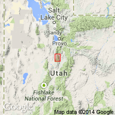
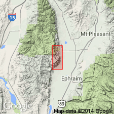
Named for erosion surface "South Flat" in secs 9 and 10, T14S, R2E between North Pole Canyon and Tidds Canyon. Type section measured in tributary of Fourmile Canyon from SW1/4 sec 17, T14S, R2E northeast to SW1/4 sec 9 south along Tidds-Fourmile divide to approximately the center of sec 21, T14S, R2E, Juab Co, UT in the Great Basin province, where it is divided into three informal members--lower, middle, and upper--that total 2,854 ft thick. Recognized only in northern part of Gunnison Plateau. Distribution map. Overlies Indianola group; underlies Price River formation. Cannot be traced south of South Pole Canyon. Consists of: tan to gray, brown, medium- to coarse-grained, arkosic, friable to well-cemented sandstone that may be conglomeratic, calcareous, and thinly bedded; orange-red to gray conglomerate with well-rounded pebbles as much as 2 inches in diameter of quartzite and limestone that may be poorly sorted; and gray to brown, coarse- to medium-crystalline, arenaceous, thin-bedded limestone. Gray clay, coal, and gray shale present in upper part. Deposited in a floodplain and piedmont while littoral marine Blackhawk formation deposited farther east. Plant fossils. Of Montana (Late Cretaceous) age.
Source: GNU records (USGS DDS-6; Denver GNULEX).

- Usage in publication:
-
- South Flat Formation*†
- Modifications:
-
- Abandoned
- AAPG geologic province:
-
- Wasatch uplift
Summary:
Name abandoned. Was used in San Pete Valley, Sanpete Co., UT on the Wasatch uplift. Rocks formerly assigned to it are included in the Sixmile Canyon Formation, upper formation of the Indianola Group.
Source: GNU records (USGS DDS-6; Denver GNULEX).
- Usage in publication:
-
- South Flat Formation*
- Modifications:
-
- Reinstated
- Age modified
- AAPG geologic province:
-
- Wasatch uplift
Summary:
Name applied on the east flank of the San Pitch Mountains to rocks above the Funk Valley Formation of the Indianola Group and beneath the North Horn Formation. In the northwest part of the San Pitch Mountains, a coal bed in the South Flat yielded palynomorphs of late Santonian to early Campanian age; the sample was collected 1,020 ft beneath a massive boulder to cobble conglomerate that is equivalent to the basal conglomerate and lower redbed unit of the North Horn at Wales Canyon. The charophytes are about 1,970 ft beneath the late Campanian to early Maastrichtian charophytes in the North Horn. Age shown on stratigraphic diagram as ranging from Santonian into early Campanian.
Source: GNU records (USGS DDS-6; Denver GNULEX).
For more information, please contact Nancy Stamm, Geologic Names Committee Secretary.
Asterisk (*) indicates published by U.S. Geological Survey authors.
"No current usage" (†) implies that a name has been abandoned or has fallen into disuse. Former usage and, if known, replacement name given in parentheses ( ).
Slash (/) indicates name conflicts with nomenclatural guidelines (CSN, 1933; ACSN, 1961, 1970; NACSN, 1983, 2005, 2021). May be explained within brackets ([ ]).