

- Usage in publication:
-
- Shooting Iron Formation*
- Modifications:
-
- Named
- Reference
- Dominant lithology:
-
- Claystone
- Conglomerate
- Sandstone
- AAPG geologic province:
-
- Yellowstone province
Summary:
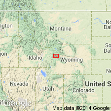
Named for Shooting Iron Ranch which is adjacent to measured type section (about 69 ft thick) in sec 19, T40N, R116W, Teton Co, WY in Yellowstone province. Called "lacustrine deposits near Shooting Iron Ranch" in earlier reports. All known occurrences are in southern Jackson Hole and on top and west flank of Gros Ventre Range. Ranges from 25 to 72 ft thick in measured sections. Thickest section about 300 ft thick in water well near Jackson. Composed of green, gray, and brown to black, very fine to fine-grained claystone (some beds are bentonitic); red-gray, fine-grained, poorly cemented conglomerate (locally derived); brown to gray, fine-grained, massive, soft siltstone; brown to olive drab, very fine- to medium-grained, some beds poorly cemented, sandstone. Considered a lacustrine and lake-margin deposit. Four reference sections established: 1) Botcher Hill, sec 11, T41N, R116W-25.2 ft thick; 2) Boyle Ditch, SE1/4 sec 25, T42N, R116W-163 ft thick; 3) Old Miller Cabin, sec 25, T42N, R115W-55.8 ft thick; and 4) Granite Creek Divide, NE1/4 Turquoise Lake 7 1/2 min quad at 10,000 ft el-81.75 ft thick. Lower contact not well exposed. Overlies (angular unconformity) rocks ranging from Paleozoic, Mesozoic to late Miocene at Granite Creek Divide reference section. Underlies glacial deposits. Contains Blancan age mammals, mollusks. Assigned to Pliocene. Geologic map.
Source: GNU records (USGS DDS-6; Denver GNULEX).
For more information, please contact Nancy Stamm, Geologic Names Committee Secretary.
Asterisk (*) indicates published by U.S. Geological Survey authors.
"No current usage" (†) implies that a name has been abandoned or has fallen into disuse. Former usage and, if known, replacement name given in parentheses ( ).
Slash (/) indicates name conflicts with nomenclatural guidelines (CSN, 1933; ACSN, 1961, 1970; NACSN, 1983, 2005, 2021). May be explained within brackets ([ ]).