

- Usage in publication:
-
- Salado halite*
- Modifications:
-
- Original reference
- Dominant lithology:
-
- Salt
- Sandstone
- Anhydrite
- AAPG geologic province:
-
- Permian basin
Summary:
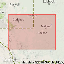
Pg. 262-270. Salado halite. In 1923 writer recognized that the salt section of Delaware basin is divisible into 2 major units, and orally introduced the terms "upper salt series" and "lower salt series," the basis for the separation at that time being that the upper series was shaly, pinkish, and by analysis showed more than 1 percent of potassium oxide, while the lower series has a dull-grayish appearance and on analysis yields less than 1 percent of potassium oxide. The upper salt series is dominantly rock salt with massive anhydrite beds, redbeds, shaly sands, and prominent beds and lenses of polyhalite that are characteristic of this formation only. Although this upper salt series underlies an area of over 60,000 sq mi it has no known outcrop, the nearest approach to an outcrop being in eastern Culberson County, where weathering has so deeply altered the anhydrite to gypsum that if the disrupted anhydrites of the upper series were present they would be difficult to recognize. The name Salado halite is given to this upper salt series, from Salado Wash, in northern Loving County, Texas, salado being the Spanish word for "salted." The formation has suffered pre-Rustler erosional truncation in Eddy County, New Mexico, and in Reeves, Culberson, and western Loving Counties, Texas, and has also been affected in those areas where the more prominent reef masses accumulated. In Means well (southeast corner sec. 23, Blk. C-26, PSL) it extends from 920 feet depth to 2,350 feet. The lower salt series outcrops in Eddy County, New Mexico, and Culberson County, Texas. It is the formation to which Richardson gave name Castile gypsum as including all rocks between Delaware Mountain and Rustler formations. Richardson was not then aware of what took place in subsurface. As the outcropping gypsum is the lower salt series and but a surficial alteration by weathering of the main mass of anhydrite in subsurface, it seems fitting to apply to the lower salt series the name Castile anhydrite. The Castile anhydrite extends downward from 2,350 feet depth to 4,990 feet, where it is unconformable on Delaware Mountain formation. The Castile in Delaware basin consists of massive beds of gray anhydrite, clean white rock salt, dolomitic and crystalline limestones that are chemical precipitates, and some sandstones. Age is Late Permian.
Source: US geologic names lexicon (USGS Bull. 896, p. 1887).
- Usage in publication:
-
- Salado halite*
- Modifications:
-
- Revised
- AAPG geologic province:
-
- Permian basin
Summary:
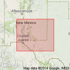
Discriminated Salado halite farther north in Pecos Valley of New Mexico, where it is overlain by Rustler formation and rests on Castile anhydrite. Age is Late Permian.
Source: US geologic names lexicon (USGS Bull. 896, p. 1887).
- Usage in publication:
-
- Salado formation
- Modifications:
-
- Contact revised
- AAPG geologic province:
-
- Permian basin
Summary:
Lower contact revised in that the Salado formation overlies the newly named Tansill formation, upper formation of the Whitehorse group at Vickers and Getty in Eddy Co. and at Halfway, Lea Co., NM, east of Carlsbad in the Permian basin. Cross sections. Of Ochoan, Permian age.
Source: GNU records (USGS DDS-6; Denver GNULEX).

- Usage in publication:
-
- Salado Formation*
- Modifications:
-
- Geochronologic dating
- AAPG geologic province:
-
- Permian basin
Summary:
Pg. 26, geologic time scale (inside front cover). Salado Formation (Permian). Lamprophyre dike intruding salt beds of Salado Formation. Sample from 466 m below surface at Kerr-McGee Mine, in sec. 31, T. 20 S., R. 32 E., Lat. 32 deg. 31 min. 47 sec. N., Long. 103 deg. 48 min. 06 sec. W., Clayton Basin quadrangle, Lea County, New Mexico, yielded a K-Ar age of 34.8 +/-0.8 Ma (whole-rock). Age calculated using decay constants of Steiger and Jager, 1977 (Earth Planet. Sci. Letters, v. 36, p. 359-362). [Oligocene, based on time scale of Berggren, 1972, Lethaia, v. 5, no. 2, p. 195-215.]
Source: Publication.
- Usage in publication:
-
- Salado Formation*
- Modifications:
-
- Revised
- AAPG geologic province:
-
- Permian basin
Summary:
Is a subsurface Upper Permian (Ochoan) marine evaporite unit whose contact with the underlying Castile is difficult to place because of facies changes from basin center to western edge. Near west edge Salado is predominately anhydrite and difficult to distinguish from laminated anhydrite of Castile. Major mineralogical and textural differences between these formations recognized in this report. Castile is primarily anhydrite with calcite and dolomite; Salado is primarily anhydrite with abundant layers of magnesite. The breccia zone at the top of Castile shows massive recrystallization that indicates a break in sedimentation, possible subaerial erosion, and may represent an unconformity between Castile and Salado.
Source: GNU records (USGS DDS-6; Denver GNULEX).
For more information, please contact Nancy Stamm, Geologic Names Committee Secretary.
Asterisk (*) indicates published by U.S. Geological Survey authors.
"No current usage" (†) implies that a name has been abandoned or has fallen into disuse. Former usage and, if known, replacement name given in parentheses ( ).
Slash (/) indicates name conflicts with nomenclatural guidelines (CSN, 1933; ACSN, 1961, 1970; NACSN, 1983, 2005, 2021). May be explained within brackets ([ ]).