

- Usage in publication:
-
- Rustler formation
- Modifications:
-
- Original reference
- Dominant lithology:
-
- Limestone
- Sandstone
- AAPG geologic province:
-
- Permian basin
Summary:
Pg. 44, geol. map. Rustler formation. Fine-textured white magnesium limestone and less abundant sandstone. Thickness 200 feet. In southern outcrops there is no sandstone and hills are capped by 150 feet of massive gray limestone. In Horseshoe Draw the formation consists of 100 feet of calcareous buff sandstone overlain by 50 feet of limestone. Overlies Castile gypsum and is clearly older than "Red Beds" but may be contemporary with part of Capitan limestone. [Now (ca. 1938) considered to be much younger than Capitan. See 1931 entry under Castile gypsum.] Age is Permian.
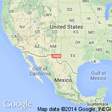
Named from exposures in Rustler Hills, [Lat. 31 deg. 40 min. 39 sec. N., Long. 104 deg. 10 min. 54 sec. W., Rustler Hills 7.5-min quadrangle], Culberson Co., western TX.
Source: US geologic names lexicon (USGS Bull. 896, p. 1858).
- Usage in publication:
-
- Rustler formation*
- Modifications:
-
- Revised
- AAPG geologic province:
-
- Permian basin
Summary:
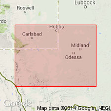
Underlies the newly named Pierce Canyon redbeds unconformably (both surface and subsurface) in Eddy Co, NM and adjoining parts of TX in the Permian basin. Varies lithologically. Two tongues of dolomitic, cellular and, locally ovlitic, limestone recognized in the subsurface. These tongues feather out in the east-central part of the Permian basin. The upper tongue thickens to west in Culbertson Co, TX [other lithologies, if present, in the subsurface not discussed.] Maintains a thickness of 300 to 400 ft. Locally may be 1,000 ft thick. Separated from the underlying upper salt series named Salado halite in this report by an unconformity. Permian age. Cross section.
Source: GNU records (USGS DDS-6; Denver GNULEX).
- Usage in publication:
-
- Rustler formation*
- Modifications:
-
- Revised
- Overview
- AAPG geologic province:
-
- Permian basin
Summary:
Divided into a lower unnamed part (not recognized on outcrop), Culebra dolomite member, Tamarisk member (new), Magenta member, and Forty-niner member (new). Overlies Salado formation; underlies Pierce Canyon redbeds. Separated from the Salado by a leached zone, 50 to 200 ft thick at the top of the Salado. Upper contact obscured by swelling and deformation of gypsum at top of Rustler. Members above the lower part were not originally included in Rustler. Ranges between 200 to 400 ft thick in quad. The four members mapped (geologic map) in west-central and southwest part of quad., Eddy Co., NM in the Permian basin. Description of well cuttings. Stratigraphic chart. Of Late Permian age.
Source: GNU records (USGS DDS-6; Denver GNULEX).
- Usage in publication:
-
- Rustler Formation
- Modifications:
-
- Mapped 1:250k
- Dominant lithology:
-
- Limestone
- Siltstone
- Sandstone
- Gypsum
- Marl
- Clay
- AAPG geologic province:
-
- Permian basin
Summary:
Pamphlet [p. 4]. Rustler Formation. Limestone, siltstone, sandstone, gypsum, marl, and clay. Upper part-- limestone and dolomitic limestone; thickness 50+ feet. Middle part-- siltstone and sandstone, yellowish gray; thickness 50 to 70 feet. Lower part-- siltstone and fine-grained sandstone, thin- to medium-bedded, red, interbeds of earthy to sparry red gypsum, a few beds of red and greenish-gray marl and clay; thickness 50+ feet. Is oldest bedrock unit. Lies below Dewey Lake Redbeds (Upper Permian). Age is Late Permian (Ochoan).
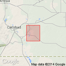
[Notable exposures along western edge of map sheet, Eddy Co., NM.]
Source: Publication.
For more information, please contact Nancy Stamm, Geologic Names Committee Secretary.
Asterisk (*) indicates published by U.S. Geological Survey authors.
"No current usage" (†) implies that a name has been abandoned or has fallen into disuse. Former usage and, if known, replacement name given in parentheses ( ).
Slash (/) indicates name conflicts with nomenclatural guidelines (CSN, 1933; ACSN, 1961, 1970; NACSN, 1983, 2005, 2021). May be explained within brackets ([ ]).