

- Usage in publication:
-
- Rockland Valley basalt*
- Modifications:
-
- Named
- Dominant lithology:
-
- Basalt
- AAPG geologic province:
-
- Snake River basin
Summary:
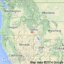
Type locality designated as exposures on north side of Rockland Valley, for which unit is probably named, [presumably in area of Rock Creek, Power Co, ID, Snake River basin]. Consists of about 250 ft of even-bedded blue and black, partly weathered basalt; contains at least one bed of clay 15 ft thick in Rock Creek Canyon. Overlies Massacre volcanics (new); underlies Raft lake beds (new). Assigned middle? Pliocene age.
Source: GNU records (USGS DDS-6; Denver GNULEX).
- Usage in publication:
-
- Rockland Valley basalt*
- Modifications:
-
- Overview
- AAPG geologic province:
-
- Snake River basin
Summary:
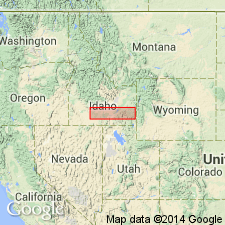
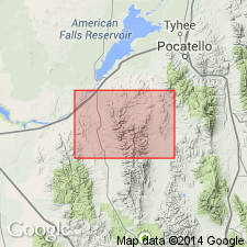
Consists of weathered even-bedded basalt flows that are easily distinguished from adjacent younger basalts due to state of decomposition of Rockland Valley. Intercalated light-colored clay bed 15 ft thick occurs near mouth of Rock Creek. Flows exhibit columnar jointing and are of pahoehoe type. From north end of Rockland Valley (geographic), lavas extend southward toward Table Mountain where vents may be located. Thickness is variable; about 250 ft is exposed in canyon of Rock Creek, in sec 8, T9S, R30E, Power Co, ID, Snake River basin; in Burley city well 5, about 40 mi west of mouth of Rock Creek, Cassia Co, ID, Great Basin province, 647 ft of basalt was reported at same stratigraphic position as Rockland Valley. Overlies Massacre volcanics; underlies Raft lake beds. Geologic map; stratigraphic chart. Assigned middle? Pliocene age.
Source: GNU records (USGS DDS-6; Denver GNULEX).
- Usage in publication:
-
- Rockland Valley Basalt†
- Modifications:
-
- Abandoned
Summary:
Abandoned. A thin basalt flow underlying much of northern part of Rockland quad north of Rocky Hollow, east of Rock Creek and basalt at Table Mountain, both in Power Co, Snake River basin, previously assigned to Rockland Valley are here reassigned to Massacre Volcanics.
Source: GNU records (USGS DDS-6; Denver GNULEX).
For more information, please contact Nancy Stamm, Geologic Names Committee Secretary.
Asterisk (*) indicates published by U.S. Geological Survey authors.
"No current usage" (†) implies that a name has been abandoned or has fallen into disuse. Former usage and, if known, replacement name given in parentheses ( ).
Slash (/) indicates name conflicts with nomenclatural guidelines (CSN, 1933; ACSN, 1961, 1970; NACSN, 1983, 2005, 2021). May be explained within brackets ([ ]).