

- Usage in publication:
-
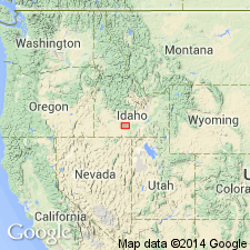
- Raft lake beds*
- Modifications:
-
- Original reference
- Dominant lithology:
-
- Clay
- Silt
- Sand
- AAPG geologic province:
-
- Great Basin province
Summary:
Pg. 434-439; H.T. Stearns, 1932 (Corr. chart of Idaho compiled by M.G. Wilmarth, dated Sept. 1, 1932). Raft lake beds. Buff-colored clay, silt, sand, often in lenticular form and in places filled with concretions; partly consolidated; weathers to brown sandy loam, forming rounded hills except along Snake River, where it forms a terrace. Thickness 200+/- feet. Exposed along south shore of Lake Walcott as far as mouth of Raft River Cassia County, southern Idaho [type section]. Form bluff along Lake Walcott Reservoir. Basal conglomerate is exposed at head of Fall Creek. Older than Banbury volcanics and younger than Rockland Valley basalt. In places rest unconformably on Paleozoic limestone. Age is middle(?) Pliocene.
Source: US geologic names lexicons (USGS Bull. 896, p. 1764; USGS Bull. 1200, p. 3187).
- Usage in publication:
-
- Raft lake beds*
- Modifications:
-
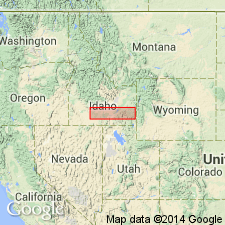
- Areal extent
- AAPG geologic province:
-
- Great Basin province
- Snake River basin
Summary:
Pg. 31, 48-50, pl. 4. Raft lake beds. Thickness about 200 feet. Overlie Rockland Valley basalt and, locally, Massacre volcanics. Age is middle(?) Pliocene. Geographical extent indicated.
Source: US geologic names lexicon (USGS Bull. 1200, p. 3187).
- Usage in publication:
-
- Raft lake beds*
- Modifications:
-
- Areal extent
- AAPG geologic province:
-
- Snake River basin
Summary:
Pg. 27. Raft lake beds. In Eagle rock area, Raft lake beds extend under most of older alluvium on west side of Snake River and probably also for some distance under Cedar basalt. Age is Late Pliocene(?).
Source: US geologic names lexicon (USGS Bull. 1200, p. 3187).

- Usage in publication:
-
- Raft formation*
- Modifications:
-
- Revised
- Age modified
- AAPG geologic province:
-
- Great Basin province
- Snake River basin
Summary:
The USGS has amended the name to Raft formation and designates the age as middle or late Pleistocene on basis of a study now [ca. 1960] in progress.
Source: US geologic names lexicon (USGS Bull. 1200, p. 3187).
- Usage in publication:
-
- Raft Formation*
- Modifications:
-
- Age modified
- Revised
- Redescribed
- Dominant lithology:
-
- Silt
- Sand
- AAPG geologic province:
-
- Snake River basin
Summary:
Redescribed from Raft Lake Beds to Raft Formation because formation is of fluviatile rather than lacustrine origin. Is limited stratigraphically to beds older than the basalt (Snake River Basalt) which dammed the Snake River and created the lake in which American Falls Lake Beds were formed. As redescribed, Raft is a light-colored, poorly bedded to massive silt in upper part, and a tan and gray clay, silt, and fine sand in lower part. Includes a few gravel lenses, and a few local basaltic and rhyolitic tuff layers. Ranges from a few ft to more than 200 ft. Age changed from Pliocene? to Pleistocene on basis of mollusk fossils.
Source: GNU records (USGS DDS-6; Denver GNULEX).
- Usage in publication:
-
- Raft formation*
- Modifications:
-
- Revised
- AAPG geologic province:
-
- Snake River basin
Summary:
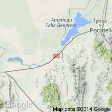
G21-G25, G28, pl. 1. Raft formation. Stearns and others' (1938) American Falls lake beds are restricted to beds younger than the Cedar Butte basalt (not present in quadrangle) that dammed the Snake River creating the lake in which the American Falls lake beds were deposited. Beds older than the Cedar Butte, beneath the persistent gravel layer at about 4,320 feet elevation, are transferred to the Raft formation. Thickness up to about 150 feet. Unconformably overlies Little Creek formation, Walcott tuff, or Neeley formation. Unconformably underlies Big Hole basalt and American Falls lake beds (restricted). Age is considered middle or late Pleistocene, probably late Pleistocene, based on fossils (identified by D.W. Taylor, written commun., 1959).
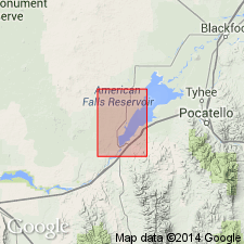
Exposed at southern edge of American Falls quadrangle, along Snake River and in lower Ferry Hollow. Measured section: on west bank of Snake River opposite Neeley, in SE/4 SW/4 sec. 10, T. 8 S., R. 30 E., about 1 mi south of margin of American Falls quadrangle, in Rockland quadrangle, ID.
Source: Publication.
- Usage in publication:
-
- Raft Formation*
- Modifications:
-
- Age modified
- Revised
- AAPG geologic province:
-
- Great Basin province
Summary:
Raft Formation. Silt, sand and clay, and minor gravel; includes buried soils and tephra layers. Exposed thickness up to 45 m; total thickness may be 360 m. Recognized in bluffs along Snake River from American Falls to Raft River and in tributaries to Snake River near Lake Walcott. Age is considered early(?) and middle Pleistocene, based on regional stratigraphic relations.
Source: Publication.
- Usage in publication:
-
- Raft Formation*
- Modifications:
-
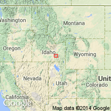
- Areal extent
- AAPG geologic province:
-
- Snake River basin
Summary:
Northern limit of unit in subsurface shown to be about 2 km north of American Falls Reservoir under various Quaternary sedimentary deposits, Bingham Co, ID, Snake River basin. Cross sections.
Source: GNU records (USGS DDS-6; Denver GNULEX).
- Usage in publication:
-
- Raft Formation*
- Modifications:
-
- Mapped
- AAPG geologic province:
-
- Snake River basin
Summary:
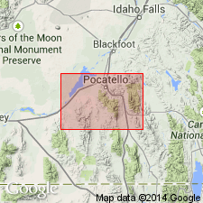
Raft Formation. Massive lacustrine silt and clay beds with local basal gravel; crops out above Massacre Volcanics and to west. Thickness <230 feet (70 m). Recognized in Power County, southeastern Idaho. Age is considered middle or late Pleistocene. (Follows Carr and Trimble, 1963, and Trimble and Carr, 1976.)
Source: Publication.
For more information, please contact Nancy Stamm, Geologic Names Committee Secretary.
Asterisk (*) indicates published by U.S. Geological Survey authors.
"No current usage" (†) implies that a name has been abandoned or has fallen into disuse. Former usage and, if known, replacement name given in parentheses ( ).
Slash (/) indicates name conflicts with nomenclatural guidelines (CSN, 1933; ACSN, 1961, 1970; NACSN, 1983, 2005, 2021). May be explained within brackets ([ ]).