

- Usage in publication:
-
- Plateau Rhyolite*
- Modifications:
-
- Named
- Dominant lithology:
-
- Rhyolite
- AAPG geologic province:
-
- Yellowstone province
Summary:
Name applied to rocks younger than Yellowstone Tuff (raised to group rank) called Plateau flows by Boyd (1961). Includes rhyolitic lavas, small rhyolitic domes, and mixed-lava complexes. Younger than Lava Creek Tuff (new) of Yellowstone Group. Divided into Mallard Lake, Upper Basin, Obsidian Creek, Central Plateau, Shoshone Lake Tuff, and Roaring Mountain Members. Ranges in age from 70,000 to 600,000 years. Belongs to the third volcanic cycle of the Yellowstone Plateau. Stratigraphic table; cross section.
Source: GNU records (USGS DDS-6; Denver GNULEX).
- Usage in publication:
-
- Plateau Rhyolite*
- Modifications:
-
- Revised
- AAPG geologic province:
-
- Yellowstone province
Summary:
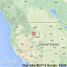
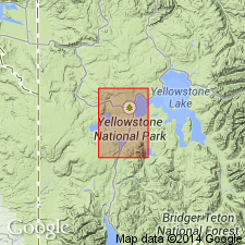
Plateau Rhyolite. †Shoshone Lake Tuff Member of Plateau Rhyolite abandoned; its rocks now included in unnamed tuffs of Cold Mountain Creek (Old Faithful quadrangle) and Bluff Point (Norris Junction quadrangle). Mallard Lake Member of Plateau Rhyolite now known to be younger than Upper Basin Member of Plateau Rhyolite. Plateau Rhyolite now divided into (ascending): Obsidian Creek, Roaring Mountain, Upper Basin, Mallard Lake, and Central Plateau Members (and its unnamed tuffs of Cold Mountain Creek and Bluff Point). Age is Pleistocene. Study area in Yellowstone National Park, Wyoming.
See also R.L. Christiansen and H.R. Blank, Jr., 1974, Geol. map Old Faithful quad., Yellowstone Natl. Park, WY, USGS Geol. Quad. Map GQ-1189; R.L. Christiansen and H.R. Blank, Jr., 1974, Geol. map Madison Junction quad., Yellowstone Natl. Park, WY, USGS Geol. Quad. Map GQ-1190; R.L. Christiansen, 1975, Geol. map Norris Junction quad., Yellowstone Natl. Park, WY, USGS Geol. Quad. Map GQ-1193.
Source: Changes in stratigraphic nomenclature, 1975 (USGS Bull. 1422-A, p. A30-A31).
For more information, please contact Nancy Stamm, Geologic Names Committee Secretary.
Asterisk (*) indicates published by U.S. Geological Survey authors.
"No current usage" (†) implies that a name has been abandoned or has fallen into disuse. Former usage and, if known, replacement name given in parentheses ( ).
Slash (/) indicates name conflicts with nomenclatural guidelines (CSN, 1933; ACSN, 1961, 1970; NACSN, 1983, 2005, 2021). May be explained within brackets ([ ]).