- Usage in publication:
-
- Parkers Ferry Member*
- Modifications:
-
- Named
- Dominant lithology:
-
- Limestone
- AAPG geologic province:
-
- Atlantic Coast basin
Summary:
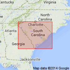
Cooper Formation divided into (ascending) Harleyville (new name), Parkers Ferry (new name), and Ashley Members. Parkers Ferry is a grayish-yellow-green, yellowish-gray, or pale-olive fine-grained, fossiliferous glauconitic, clayey limestone. At type section, unit is 2.5 m thick. Ranges to 40 m. Occurs only in the subsurface and contact with other members is unconformable.
Source: GNU records (USGS DDS-6; Reston GNULEX).

- Usage in publication:
-
- Parkers Ferry Formation*
- Modifications:
-
- Revised
- AAPG geologic province:
-
- Atlantic Coast basin
Summary:
Cooper Formation raised to group rank in SC and its Harleyville, Parkers Ferry, and Ashley Members raised to formations. Only the Ashley Formation forms natural outcrops in this quadrangle.
Source: GNU records (USGS DDS-6; Reston GNULEX).

- Usage in publication:
-
- Parkers Ferry Member*
- Modifications:
-
- Revised
- AAPG geologic province:
-
- Atlantic Coast basin
Summary:
In this discussion of the Clubhouse Crossroads Corehole #1, Cooper Formation and its Harleyville, Parkers Ferry, and Ashley Members are used to conform with previous usage. Age of Parkers Ferry is late Eocene.
Source: GNU records (USGS DDS-6; Reston GNULEX).
- Usage in publication:
-
- Parkers Ferry Formation
- Modifications:
-
- Areal extent
- Dominant lithology:
-
- Calcilutite
- AAPG geologic province:
-
- Atlantic Coast basin
Weems, R.E., Albright, L.B., III, Bybell, L.M., Cicimurri, D.J., Edwards, L.E., Harris, W.B., Lewis, W.C., Osborne, J.E., Sanders, A.E., and Self-Trail, J.M., 2016, Stratigraphic revision of the Cooper Group and the Chandler Bridge and Edisto Formations in the Coastal Plain of South Carolina: South Carolina Geology, v. 49, p. 1-24.
Summary:
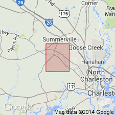
Pg. 3 (fig. 2), 4, 5-6, 7 (fig. 4), 21 (tbl. 6, fig. 13). Parkers Ferry Formation of Cooper Group. Is basal formation. Considered older than Harleyville Formation of Cooper Group, not younger, as previously thought. In quarry pit near type section of Harleyville Formation, the Parkers Ferry is identified as bluish-gray, very light gray weathering calcilutite, about 1 foot thick, lying below the Harleyville, and above /Pregnall Member of Tupelo Bay Formation (beds previously assigned to Cross Member of Santee Limestone). Parkers Ferry is absent from type section of Harleyville.
In subsurface, at type section of Parkers Ferry Formation (Clubhouse Crossroads no. 1 corehole, Dorchester County, southern South Carolina), the Harleyville is absent. Beds below the Parkers Ferry, that were previously assigned to the Harleyville, are reallocated to /Pregnall Member of Tupelo Bay Formation. Beds above the Parkers Ferry are assigned to Gettysville Member (new) of Ashley Formation of Cooper Group.
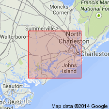
In USGS OS-1 core (Ravenel area, Osborn 7.5-min quadrangle, Charleston County, southern South Carolina), beds above the Parkers Ferry, that were previously informally called Drayton limestone by Weems and others, 1987 (USGS Open-file Rpt. 87-661, p. 84) and Drayton limestone beds by Weems and Lemon, 1996 (USGS Misc. Inv. Ser. Map I-2491, sheet 2), are assigned to Harleyville Formation. Beds below the Parkers Ferry, that were previously assigned to the Harleyville, are reallocated to /Pregnall Member of Tupelo Bay Formation.
Age is considered late Eocene (middle Priabonian) based on fossils; calcareous nannofossil zones NP 19/20, planktic foraminifer zones P 16/17.
Source: Publication.
For more information, please contact Nancy Stamm, Geologic Names Committee Secretary.
Asterisk (*) indicates published by U.S. Geological Survey authors.
"No current usage" (†) implies that a name has been abandoned or has fallen into disuse. Former usage and, if known, replacement name given in parentheses ( ).
Slash (/) indicates name conflicts with nomenclatural guidelines (CSN, 1933; ACSN, 1961, 1970; NACSN, 1983, 2005, 2021). May be explained within brackets ([ ]).

