

- Usage in publication:
-
- Ox Valley tuff
- Modifications:
-
- First used
- Dominant lithology:
-
- Tuff
- AAPG geologic province:
-
- Great Basin province
Summary:
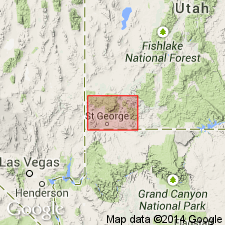
First published use of name attributed to an unpublished thesis (Blank, 1959). Source of name and type locality not stated. Consists of lightly to moderately or highly welded, rhyolitic vitric crystal gray-blue, pink or purple tuff 400 ft thick. Mapped (geologic map) in Ox Valley area (T38S, R17W) and west into Ts18 and 19W, Washington Co., UT in the Great Basin province where it is in contact with the older Cove Mountain formation (first used), and the younger "Muddy Creek" formation. Characterized by presence of clear phenocrysts of sanidine. Quartz, sanidine, and plagioclase are the main visible minerals. Tertiary age. Stratigraphic chert.
Source: GNU records (USGS DDS-6; Denver GNULEX).

- Usage in publication:
-
- Ox Valley Tuff*
- Modifications:
-
- Geochronologic dating
- AAPG geologic province:
-
- Great Basin province
Summary:
K-Ar age of 12.3 Ma reported on whole rock from a basalt that directly underlies Ox Valley Tuff north-northwest of Veyo, Washington Co., UT, Great Basin province. A K-Ar age of 11.4 Ma reported on biotite from a rhyolite flow that overlies Ox Valley Tuff near Enterprise Reservoir in Washington Co., UT. These determinations bracket the Ox Valley as Miocene age.
Source: GNU records (USGS DDS-6; Denver GNULEX).
For more information, please contact Nancy Stamm, Geologic Names Committee Secretary.
Asterisk (*) indicates published by U.S. Geological Survey authors.
"No current usage" (†) implies that a name has been abandoned or has fallen into disuse. Former usage and, if known, replacement name given in parentheses ( ).
Slash (/) indicates name conflicts with nomenclatural guidelines (CSN, 1933; ACSN, 1961, 1970; NACSN, 1983, 2005, 2021). May be explained within brackets ([ ]).