

- Usage in publication:
-
- Neeley lake beds*
- Modifications:
-
- Named
- Dominant lithology:
-
- Tuff
- AAPG geologic province:
-
- Snake River basin
Summary:
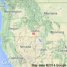
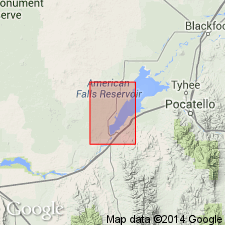
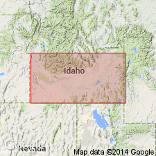
Type locality designated as bluffs of Snake River in vicinity of village of Neeley, probably for which unit is named, located 5 mi southwest of American Falls, Power Co, ID, Snake River basin. Consists of about 100 ft of flesh-colored to brown sandy lacustrine deposits and partly reworked tuffs. Overlies Pillar Falls mud flow (new); underlies Eagle Rock tuff (new). Assigned Pliocene? or early? Pliocene age.
Source: GNU records (USGS DDS-6; Denver GNULEX).
- Usage in publication:
-
- Neeley formation*
- Modifications:
-
- Redescribed
- Dominant lithology:
-
- Sandstone
- Gravel
- AAPG geologic province:
-
- Snake River basin
Summary:
Redescribed from Neeley lake beds to Neeley formation because gross lithologic character of Neeley is not of a lacustrine deposit. Lower part is a gravel containing pebbles and cobbles of Paleozoic rocks and of vitric-crystal tuff from the Starlight formation which unconformably underlies it. The upper part is a light tan to orange-brown, fine- to coarse-grained rhyolitic tuff, commonly poorly bedded, and a few beds of white marl. Ranges from 30 to 150 ft thick. Mollusk fossils. Underlies Walcott tuff. Assigned a middle Pliocene age. Mapped near American Falls, Power Co, ID, Snake River basin. Geologic map.
Source: GNU records (USGS DDS-6; Denver GNULEX).
- Usage in publication:
-
- Neeley Formation*
- Modifications:
-
- Age modified
- AAPG geologic province:
-
- Snake River basin
Summary:
Pg. 241. Neeley Formation. A massive impure rhyolitic tuff near American Falls, Power Co., eastern Snake River Plain, southern ID. [Based on stratigraphic position, age is considered North American land mammal age Hemphillian; =Pliocene (Evernden and others, 1964, Amer. Jour. Sci., v. 262, p. 145-198), =Miocene (Berggren, 1972, Lethaia, v. 5, no. 2, p. 195-215).] Lies above Starlight Formation, K-Ar ages 6.5 and 7.7 Ma, and below Walcott Tuff, K-Ar age about 6.2 Ma. Report includes sample locality map, schematic stratigraphic-chronologic diagram, table of K-Ar ages.
Source: Publication.
For more information, please contact Nancy Stamm, Geologic Names Committee Secretary.
Asterisk (*) indicates published by U.S. Geological Survey authors.
"No current usage" (†) implies that a name has been abandoned or has fallen into disuse. Former usage and, if known, replacement name given in parentheses ( ).
Slash (/) indicates name conflicts with nomenclatural guidelines (CSN, 1933; ACSN, 1961, 1970; NACSN, 1983, 2005, 2021). May be explained within brackets ([ ]).