

- Usage in publication:
-
- Muddy Peaks limestone*
- Modifications:
-
- Named
- Dominant lithology:
-
- Limestone
- AAPG geologic province:
-
- Great Basin province
Summary:
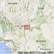
Named for exposures at Muddy Peaks on west side of White basin, Clark Co, NV in the Great Basin province. Geologic map. Nomenclature table. No type locality designated. The limestone is dense, hard in beds 2 to 20 ft thick; dark color attributed to carbonaceous matter included. Brecciated at base. Several lenses and thin layers of sandstone. Fossiliferous (fossils listed). Assigned to the Devonian. Next older unit is some unnamed sedimentary rocks. Disconformably overlain by Rogers Spring formation (new).
Source: GNU records (USGS DDS-6; Denver GNULEX).
- Usage in publication:
-
- Muddy Peak limestone*
- Modifications:
-
- Overview
- Dominant lithology:
-
- Limestone
- Dolomite
- AAPG geologic province:
-
- Great Basin province
Summary:
Spelled Muddy Peak in this paper. Mapped around the west, north, and east side of White basin, Clark Co, NV in the Great Basin province where it overlies Muav? limestone and unconformably underlies Rogers Spring limestone. Is 1,200+ ft thick. Consists of dense, hard, siliceous-appearing beds of limestone and dolomite that are banded alternately light and dark. Forms steep cliffs. Includes a few lenses and layers of fine-grained sandstone. Some carbonaceous beds with a fetid odor. Chert pebbles at many horizons. Fossiliferous (fossils listed). Section 986 ft thick measured 2 mi west of Basin fault. Devonian, tentatively Middle Devonian age. Geologic map.
Source: GNU records (USGS DDS-6; Denver GNULEX).
- Usage in publication:
-
- Muddy Peak limestone
- Modifications:
-
- Overview
- Areal extent
- AAPG geologic province:
-
- Plateau sedimentary province
- Great Basin province
Summary:
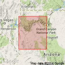
Is the western equivalent of the Martin limestone. Areal limits extended: name used in Virgin Mountains of AZ-NV and at North Grand Wash Cliffs, AZ. These areas are in the Great Basin and Plateau sedimentary provinces. Cross section. Measured section. Underlies Rogers Spring limestone. Overlies Ordovician limestone (Pogonip?). Recognized as far as the Jerome area, AZ. Is 552+ ft thick in the North Virgin Mountains where it consists of a basal dolomitic brown sandstone that is overlain by tan, red, dolomitic, coarse-grained to sandy limestone succeeded by upper fossiliferous gray (light to dark), fine- to coarse-grained, thin (base) to massive (top) dolomitic limestone. Devonian age.
Source: GNU records (USGS DDS-6; Denver GNULEX).
- Usage in publication:
-
- Muddy Peak Dolomite*
- Modifications:
-
- Areal extent
- Overview
- AAPG geologic province:
-
- Great Basin province
Summary:
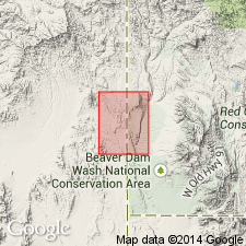
Extended into Lincoln Co, NV, Great Basin province. Consists of dark gray thick-bedded dolomite and limestone with few thin sandstone interbeds near top. Only 30 m is exposed on west edge of quad, however, unit was reported to be 240 m thick in adjacent part of Lime Mountain quad by Biller (1976, USGS Open-File Report 76-343). Younger than undivided Upper Ordovician and Silurian dolomites; conformably underlies Monte Cristo Limestone. Devonian age.
Source: GNU records (USGS DDS-6; Denver GNULEX).
For more information, please contact Nancy Stamm, Geologic Names Committee Secretary.
Asterisk (*) indicates published by U.S. Geological Survey authors.
"No current usage" (†) implies that a name has been abandoned or has fallen into disuse. Former usage and, if known, replacement name given in parentheses ( ).
Slash (/) indicates name conflicts with nomenclatural guidelines (CSN, 1933; ACSN, 1961, 1970; NACSN, 1983, 2005, 2021). May be explained within brackets ([ ]).