

- Usage in publication:
-
- Moody Canyon Member
- Modifications:
-
- Original reference
- Dominant lithology:
-
- Siltstone
- Mudstone
- AAPG geologic province:
-
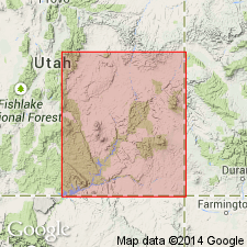
- Paradox basin
Summary:
Pg. 46-51. Moody Canyon Member of Moenkopi Formation. Chiefly intercalated siltstone and mudstone. Includes beds of gypsum and dolomite in upper part, and a massive cliff-forming sandstone called Steer Mesa facies. Thickness about 110 to 425 feet; is 276+ feet at type. Overlies Torrey Member (new) of Moenkopi; contact placed at highest ledgy sandstone. Unconformably underlies Chinle Formation (Shinarump Member in northeast and southeast Circle Cliffs). No fossils. Age is considered Early Triassic although upper part may be Middle Triassic.
Type section: Moody Canyon, along southwest side of Circle Cliffs, about 1 mi north of where Moody Creek enters the canyon, in T. 34 S., R. 7 E., Garfield Co., UT.
[Type section: measured along an east-west line exactly 2.16 mi (3.5 km) due south of the 5728 BM on Horse Pasture Mesa, Circle Cliffs, Garfield Co., Utah. The section continues up prominent rounded point to west of road (Ron Blakey, personal commun., June 9, 2000, via Thomas J. Messenger, NSSC).]
Source: Publication.
For more information, please contact Nancy Stamm, Geologic Names Committee Secretary.
Asterisk (*) indicates published by U.S. Geological Survey authors.
"No current usage" (†) implies that a name has been abandoned or has fallen into disuse. Former usage and, if known, replacement name given in parentheses ( ).
Slash (/) indicates name conflicts with nomenclatural guidelines (CSN, 1933; ACSN, 1961, 1970; NACSN, 1983, 2005, 2021). May be explained within brackets ([ ]).