

- Usage in publication:
-
- Mescalero caliche*
- Modifications:
-
- First used
- Dominant lithology:
-
- Caliche
- AAPG geologic province:
-
- Permian basin
Summary:
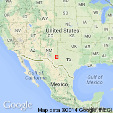
First used as an informal stratigraphic unit observed to underlie the Mescalero plain at many places in southeastern NM. Is mapped (fig 2) in Eddy and Lea Cos, NM in Permian basin. Type locality not designated; derivation of name not stated. Consists of two parts: a basal, earthy to firm, nodular calcareous deposit; and an upper well-cemented laminar caprock. Commonly weathers to a ledge in which caprock overhangs nodular base. Total thickness about 1-4 m; cap-rock usually comprising about one-third to more than one-half of the total. Prominent laminations in the caprock characterize the Mescalero; laminae consists of alternating dark and light layers generally less than 5 mm thick, parallel to the land surface, and may be weakly crenulated or disrupted by pisoliths. Pisoliths are common only locally and are less common and less well developed than in the caliche of the Ogallala Formation along Mescalero Ridge. Brecciation is rare in the Mescalero. Was formed during an interval of climatic (more dry than present and probably warmer) and tectonic stability that followed deposition of the Gatuna Formation (early or middle Pleistocene). Caps the Gatuna almost everywhere the Gatuna is exposed. Is analogous in maturity and extent to caliche that caps the La Mesa surface along the Rio Grande valley in southern NM. Is considered to be middle Pleistocene in age.
Source: GNU records (USGS DDS-6; Denver GNULEX).
For more information, please contact Nancy Stamm, Geologic Names Committee Secretary.
Asterisk (*) indicates published by U.S. Geological Survey authors.
"No current usage" (†) implies that a name has been abandoned or has fallen into disuse. Former usage and, if known, replacement name given in parentheses ( ).
Slash (/) indicates name conflicts with nomenclatural guidelines (CSN, 1933; ACSN, 1961, 1970; NACSN, 1983, 2005, 2021). May be explained within brackets ([ ]).